State highway in Tamil Nadu
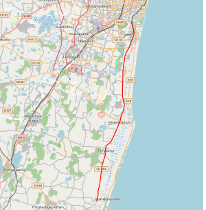
State Highway 49A (SH-49A),[1] also known as Rajiv Gandhi Salai[2] and Rajiv Gandhi IT Expressway or just IT Expressway, is a major road connecting Chennai, Tamil Nadu state with Mahabalipuram in Chengalpattu district, in the same state. It is 45 km long and was earlier known as the Old Mahabalipuram Road (OMR). The road starts from Madhya Kailash Temple on Sardar Patel Road in South-East Chennai and terminates on East Coast Road near Mahabalipuram.
The prestigious TIDEL Park, home to a number of BPO and IT/ITES companies and many other major IT/ITES Companies in the country, is situated along the Rajiv Gandhi Salai. Prominent technical and educational Institutions, national research laboratories are also located along the Corridor.
Besides, State Industries Promotion Corporation of Tamil Nadu Ltd (SIPCOT) has developed a Cyber City, spread over 2000 acres in Siruseri, abutting the IT Corridor. Many IT/ITES Companies have set up their facilities in the Cyber City.[2]
Based on development and growth of OMR road, it was categorized as 2 major zones. Zone-1 is from Madhya Kailash to Sholinganallur and Zone-2 is from Sholinganallur to Kelambakkam.
Toll plazas
There are two toll plazas on OMR and three on the roads leading to OMR.
- Entrance toll plaza at Seevaram (Perungudi)
- Exit plaza at Egattur
- Satellite toll plaza on 200 feet Thoraipakkam-Pallavaram radial road
- Satellite toll plaza on Sholinganallur-Medavakkam link road
- Satellite toll plaza on Sholinganallur-ECR link road (Kalaignar Karunanidhi Salai)
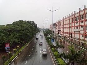
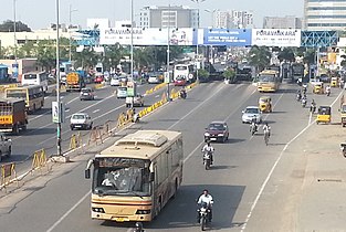
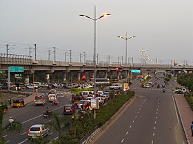
Gallery
-
Seen from CIT Campus -
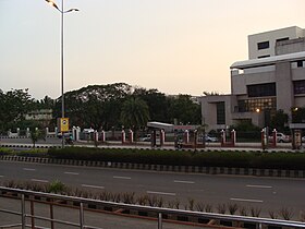
Perungudi Toll Plaza -
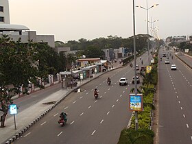
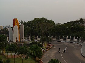
Traffic near TIDEL Park Junction -
Tecci Park -
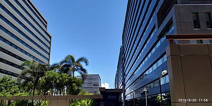
Ascendas IT Park Chennai -
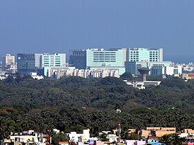
TIDEL Park -
TIDEL Park bus stop -
TIDEL Park bus stop (alternate view) -
Ramanujan IT City at Taramani, Chennai -
Service road to TIDEL Park -
Service road and IT corridor with MRTS line in the background -
Siruseri SIPCOT |
See also
 India portal
References
- ^ a b State Highways of Tamil Nadu
- ^ a b IT Expressway
External links
Wikimedia Commons has media related to Old Mahabalipuram Road.
- The Federation of OMR Residents Associations
- "the Road to The future" - IT Corridor (home page)
- Newindpress - One for the Road
- SIPCOT IT Park map
| National Highways | - NH 16
- NH 716
- NH 716A
- NH 32
- NH 132
- NH 132B
- NH 332
- NH 332A
- NH 532
- NH 36
- NH 136
- NH 136B
- NH 336
- NH 536
- NH 38
- NH 138
- NH 338
- NH 40
- NH 42
- NH 44
- NH 544
- NH 544H
- NH 744
- NH 844
- NH 944
- NH 48
- NH 648
- NH 948
- NH 66
- NH 75
- NH 77
- NH 79
- NH 179A
- NH 179D
- NH 81
- NH 181
- NH 381
- NH 381A
- NH 381B
- NH 83
- NH 183
- NH 383
- NH 85
- NH 785
- NH 87
| |
|---|
| State Highways | - SH 2
- SH 4
- SH 6
- SH 9
- SH 10
- SH 15
- SH 19
- SH 20
- SH 22
- SH 25
- SH 26
- SH 30
- SH 49
- SH 49A
- SH 58
- SH 60
- SH 62
- SH 68
- SH 71
- SH 71A
- SH 81
- SH 83A
- SH 84
- SH 84A
- SH 96
- SH 109
- SH 113
- SH 115
- SH 134
- SH 142
- SH 156
- SH 161
- SH 173
- SH 190
- SH 234
|
|---|
| See also | |
|---|
|
|
|---|
|
|---|
| Early history (pre-1500) | |
|---|
| Colonial period (1500–1900) | |
|---|
| Modern period (1900–present) | |
|---|
| Writers and historians | |
|---|
|
|
|
|---|
| Regions | |
|---|
| Waterways | |
|---|
| Lakes | |
|---|
| Islands | |
|---|
| Zoological parks | |
|---|
| Reserve Forests | |
|---|
| Marshlands | |
|---|
Heritage
monuments | |
|---|
| Statues | |
|---|
| Memorials | |
|---|
|
|
|
|---|
| Districts | |
|---|
| Taluks | |
|---|
| Constituencies | | Parliamentary | - Chennai Central
- Chennai North
- Chennai South
- Sriperumbudur
- Thiruvallur
|
|---|
| Assembly | - Alandur
- Ambattur
- Anna Nagar
- Avadi
- Chengalpattu
- Chepauk
- Egmore
- Harbour
- Kolathur
- Madhavaram
- Maduravoyal
- Mylapore
- Pallavaram
- Perambur
- Ponneri
- Poonamallee
- RK Nagar
- Royapuram
- Saidapet
- Sholinganallur
- Sriperumbudur
- T.Nagar
- Tambaram
- Thiru. Vi. Ka. Nagar
- Thiruvottiyur
- Thousand Lights
- Tiruvallur
- Villivakkam
- Virugambakkam
- Velachery
|
|---|
|
|---|
| Nodal agencies | |
|---|
|
|
|
|---|
Business
districts | |
|---|
| SEZ | |
|---|
Companies and
institutions | |
|---|
| Industry | |
|---|
|
|
|
|
|
|---|
| Air | |
|---|
| Sea | |
|---|
| Rail | |
|---|
| Road | Roads and
expressways | |
|---|
Grade separators
and flyovers | |
|---|
| Others | |
|---|
|
|---|
|
|
|
|---|
| Venues | |
|---|
| Teams | | Badminton | |
|---|
| Cricket | |
|---|
| Field hockey | |
|---|
| Football | |
|---|
| Kabaddi | |
|---|
| Tennis | |
|---|
| Table tennis | |
|---|
| Volleyball | |
|---|
|
|---|
| Others | |
|---|
|
|
|
|
 Category Category- India portal
 WikiProject WikiProject
|
|
|---|
| Organisations | | Planning and administration | |
|---|
| Air | |
|---|
| Rail | |
|---|
| Road | |
|---|
| Water | |
|---|
|
|---|
| Air | |
|---|
| Rail | |
|---|
| Road | | Major terminus | |
|---|
| Motorways | |
|---|
| Ring roads | |
|---|
Flyovers/
Grade separators | |
|---|
|
|---|
| Water | |
|---|
- Category
 Commons Commons- WikiProject
|
|
|---|
| Transport by cities | | |
|---|
| Road | | National Highways | |
|---|
| State Highways | - SH 4
- SH 6
- SH 9
- SH 10
- SH 15
- SH 22
- SH 49
- SH 49A
- SH 58
- SH 68
- SH 81
- SH 134
- SH 156
|
|---|
| Other Roads | |
|---|
| Public Transport | |
|---|
|
|---|
| Rail | | Rail Networks | |
|---|
| Rail Stations | |
|---|
|
|---|
| Air | | International Airports | |
|---|
| Customs Airports | |
|---|
| Domestic Airports | |
|---|
| Military Bases | |
|---|
|
|---|
| Water | |
|---|
| Space | |
|---|
12°58′33″N 80°15′04″E / 12.975897°N 80.251018°E / 12.975897; 80.251018


 List
List


