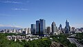
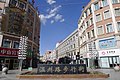
Wujiaqu
County-level city in Xinjiang, China
Wujiaqu 44°10′01″N 87°32′35″E / 44.167°N 87.543°E / 44.167; 87.543 | |
|---|---|
| Country | China |
| Autonomous region | Xinjiang |
| Municipal seat | Renmin Road Subdistrict |
| Government | |
| • CCP Secretary | Song Hongli (Political Commissar of the 6th Division) |
| • Mayor | Jing Dawei (Commander of the 6th Division) |
| Area | |
| • Total | 742 km2 (286 sq mi) |
| Population (2022)[1] | |
| • Total | 154,400 |
| • Density | 210/km2 (540/sq mi) |
| Time zone | UTC+8 (China Standard[a]) |
| Website | www |
| Wujiaqu | |||||||||||
|---|---|---|---|---|---|---|---|---|---|---|---|
| Chinese name | |||||||||||
| Chinese | 五家渠 | ||||||||||
| |||||||||||
| Uyghur name | |||||||||||
| Uyghur | ۋۇجياچۈ | ||||||||||
| |||||||||||
Wujiaqu is a county-level city in the northern part of Xinjiang Uyghur Autonomous Region, China, about 40 kilometres (25 mi) north of Ürümqi.
Wujiaqu is the headquarter of the 6th Division of Xinjiang Production and Construction Corps and currently administered by the 6th Division. The city implemented the "division and city integration" (师市合一, shī shì héyī) management system, it shares the same leader group with the 6th Division.
Administrative divisions
Wujiaqu contains 3 subdistricts, 3 towns, and 1 township-equivalent region.
| Name | Simplified Chinese | Hanyu Pinyin | Uyghur (UEY) | Uyghur Latin (ULY) | Administrative division code | |
|---|---|---|---|---|---|---|
| Subdistricts | ||||||
| Junken Road Subdistrict | 军垦路街道 | Jūnkěnlù Jiēdào | جۈنكېن يولى كوچا باشقارمىسى | Jünkën yoli kocha bashqarmisi | 659004001 | |
| Qinghu Road Subdistrict | 青湖路街道 | Qīnghúlù Jiēdào | چىڭخۇ يولى كوچا باشقارمىسى | Chingxu yoli kocha bashqarmisi | 659004002 | |
| Renmin Road Subdistrict | 人民路街道 | Rénmínlù Jiēdào | خەلق يولى كوچا باشقارمىسى | Xelq yoli kocha bashqarmisi | 659004003 | |
| Towns | ||||||
| Wutong Town (102nd Regiment Farm)* | 梧桐镇 (一〇二团) | Wútóng Zhèn | ۋۇتۇڭ بازىرى | Wutung baziri | 659004100 | |
| Caijiahu Town (103rd Regiment Farm)* | 蔡家湖镇 (一〇三团) | Càijiāhú Zhèn | سەيجياخۇ بازىرى | Seyjyaxu baziri | 659004101 | |
| Qinghu Town (101st Regiment Farm)* | 青湖镇 (一〇一团) | Qīnghú Zhèn | 659004102 | |||
| township-equivalent region | ||||||
| Wujiaqu Economic and Technological Development Zone | 五家渠经济技术开发区 | Wǔjiāqú Jīngjì Jìshù Kāifāqū | 659004501 | |||
Demographics
As of 2015, 89,695 (96.4%) of the 93,058 residents of the city were Han Chinese, 1,926 (2.1%) were Hui and 1,437 were from other ethnic groups.[2]
Wujiaqu's population is around 96,000 and predominantly Han Chinese according to the 2010 census. There are also Hui and various other minorities.
- Population by ethnicity – 2010 census[3]
| Ethnicity | Population | % |
|---|---|---|
| Han | 92,372 | 95.79% |
| Hui | 2,541 | 2.63% |
| Mongols | 319 | 0.33% |
| Kazakhs | 232 | 0.24% |
| Uyghur | 223 | 0.23% |
| Tujia | 167 | 0.17% |
| Manchu | 128 | 0.13% |
| others | 454 | 0.47% |
| Total | 96,436 | 100% |
- Population by ethnicity – 2018 census
| |||||||||||||||||||||||||||||||||||||||||||||
Climate
| Climate data for Caijiahu, Wujiaqu (1991–2020 normals) | |||||||||||||
|---|---|---|---|---|---|---|---|---|---|---|---|---|---|
| Month | Jan | Feb | Mar | Apr | May | Jun | Jul | Aug | Sep | Oct | Nov | Dec | Year |
| Mean daily maximum °C (°F) | −13.3 (8.1) | −7.7 (18.1) | 6.2 (43.2) | 21.2 (70.2) | 27.7 (81.9) | 32.8 (91.0) | 34.3 (93.7) | 33.1 (91.6) | 26.8 (80.2) | 17.0 (62.6) | 3.5 (38.3) | −9.7 (14.5) | 14.3 (57.8) |
| Daily mean °C (°F) | −18.8 (−1.8) | −13.8 (7.2) | −0.3 (31.5) | 12.7 (54.9) | 19.3 (66.7) | 24.5 (76.1) | 25.9 (78.6) | 23.9 (75.0) | 17.4 (63.3) | 8.2 (46.8) | −2.4 (27.7) | −14.4 (6.1) | 6.9 (44.3) |
| Mean daily minimum °C (°F) | −23.6 (−10.5) | −19.3 (−2.7) | −6.2 (20.8) | 4.9 (40.8) | 11.1 (52.0) | 16.3 (61.3) | 18.0 (64.4) | 15.5 (59.9) | 8.9 (48.0) | 1.1 (34.0) | −7.1 (19.2) | −18.5 (−1.3) | 0.1 (32.2) |
| Average precipitation mm (inches) | 6.6 (0.26) | 6.5 (0.26) | 8.0 (0.31) | 17.4 (0.69) | 16.2 (0.64) | 17.4 (0.69) | 19.7 (0.78) | 14.5 (0.57) | 9.8 (0.39) | 11.6 (0.46) | 12.1 (0.48) | 10.2 (0.40) | 150 (5.93) |
| Average precipitation days (≥ 0.1 mm) | 7.8 | 6.6 | 4.0 | 4.8 | 5.8 | 6.0 | 6.3 | 5.2 | 3.9 | 4.3 | 5.4 | 8.1 | 68.2 |
| Average snowy days | 15.9 | 13.5 | 5.5 | 1.1 | 0 | 0 | 0 | 0 | 0 | 0.6 | 5.9 | 15.1 | 57.6 |
| Average relative humidity (%) | 80 | 81 | 71 | 46 | 41 | 44 | 48 | 48 | 48 | 59 | 77 | 83 | 61 |
| Mean monthly sunshine hours | 111.7 | 143.9 | 226.2 | 271.5 | 312.5 | 312.6 | 315.4 | 313.2 | 282.1 | 241.7 | 148.2 | 93.5 | 2,772.5 |
| Percent possible sunshine | 38 | 48 | 60 | 66 | 68 | 68 | 68 | 74 | 77 | 73 | 52 | 34 | 61 |
| Source: China Meteorological Administration[5][6] | |||||||||||||
See also
Notes
- ^ Locals in Xinjiang frequently observe UTC+6 (Xinjiang Time), 2 hours behind Beijing.
References
Wikimedia Commons has media related to Wujiaqu.
Look up Wujiaqu in Wiktionary, the free dictionary.
- ^ "五家渠市2022年国民经济和社会发展统计公报" (in Chinese). 2023-03-28.
- ^ 3-7 各地、州、市、县(市)分民族人口数 (in Simplified Chinese). شىنجاڭ ئۇيغۇر ئاپتونوم رايونى 新疆维吾尔自治区统计局 Statistic Bureau of Xinjiang Uygur Autonomous Region. 15 March 2017. Archived from the original on 11 October 2017. Retrieved 3 September 2017.
- ^ Stanley W. Toops (August 2012). Susan M. Walcott; Corey Johnson (eds.). Eurasian Corridors of Interconnection: From the South China to the Caspian Sea. Routledge. pp. 65–66. ISBN 978-1135078751.
- ^ 3-7 各地、州、市、县(市)分民族人口数 [3-7 Population by Nationality by Prefecture, State, City and County (City)]. tjj.xinjiang.gov.cn (in Chinese). Statistical Bureau of Xinjiang Uyghur Autonomous Region. 2020-06-10. Archived from the original on 2020-11-01. Retrieved 2021-06-11.
- ^ 中国气象数据网 – WeatherBk Data (in Simplified Chinese). China Meteorological Administration. Retrieved 10 October 2023.
- ^ "Experience Template" 中国气象数据网 (in Simplified Chinese). China Meteorological Administration. Retrieved 10 October 2023.

Largest cities in Xinjiang Source: China Urban Construction Statistical Yearbook 2018 Urban Population and Urban Temporary Population | |||||||||||||||||||||||||||||||||||||||||||||||||||||||||||||||||||||||
|---|---|---|---|---|---|---|---|---|---|---|---|---|---|---|---|---|---|---|---|---|---|---|---|---|---|---|---|---|---|---|---|---|---|---|---|---|---|---|---|---|---|---|---|---|---|---|---|---|---|---|---|---|---|---|---|---|---|---|---|---|---|---|---|---|---|---|---|---|---|---|---|
| |||||||||||||||||||||||||||||||||||||||||||||||||||||||||||||||||||||||


 | This Xinjiang location article is a stub. You can help Wikipedia by expanding it. |
- v
- t
- e


