Baïse
River in France
| Baïse | |
|---|---|
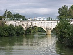 Canal bridge over the river | |
 | |
| Native name | La Baïse (French) |
| Location | |
| Country | France |
| Physical characteristics | |
| Source | |
| • location | Plateau de Lannemezan |
| Mouth | |
• location | Garonne |
• coordinates | 44°17′5″N 0°19′17″E / 44.28472°N 0.32139°E / 44.28472; 0.32139 |
| Length | 188 km (117 mi) |
| Basin size | 2,910 km2 (1,120 sq mi) |
| Discharge | |
| • average | 5 m3/s (180 cu ft/s) |
| Basin features | |
| Progression | Garonne→ Gironde estuary→ Atlantic Ocean |
The Baïse (pronounced [baiːz]) (Occitan: Baïsa) is a 188-kilometre (117 mi) long river in south-western France, left tributary of the Garonne.[1] Its source is in the foothills of the Pyrenees, near Lannemezan. It flows north through the following départements and towns:
- Hautes-Pyrénées: Lannemezan, Trie-sur-Baïse
- Gers: Mirande, Castéra-Verduzan, Valence-sur-Baïse, Condom
- Lot-et-Garonne: Nérac, Lavardac
It flows into the Garonne near Aiguillon.
Tributaries
- Gélise (in Lavardac)
- Petite Baïse (in L'Isle-de-Noé)
References
External links
- River Baise guide Places, ports and moorings on the River Baise - french-waterways.com
Wikimedia Commons has media related to Baïse.
Authority control databases | |
|---|---|
| International |
|
| National |
|
| Other |
|
- v
- t
- e
 | This Occitania geographical article is a stub. You can help Wikipedia by expanding it. |
- v
- t
- e
This article related to a river in France is a stub. You can help Wikipedia by expanding it. |
- v
- t
- e


