Mila Province
Province of Algeria
Province in Algeria
Mila Province ولاية ميلة | |
|---|---|
Province | |
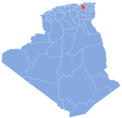 Map of Algeria highlighting Mila | |
| Coordinates: 36°27′N 06°16′E / 36.450°N 6.267°E / 36.450; 6.267 | |
| Country |  Algeria Algeria |
| Capital | Mila |
| Area | |
| • Total | 9,375 km2 (3,620 sq mi) |
| Population (2008)[1] | |
| • Total | 768,419 |
| • Density | 82/km2 (210/sq mi) |
| Time zone | UTC+01 (CET) |
| Area Code | +213 43, +213 31 |
| ISO 3166 code | DZ-43 |
| Districts | 13 |
| Municipalities | 32 |
Mila (Arabic: ولاية ميلة, wilāya mīla) is a province (wilayah) of Algeria, whose capital is Mila. Other localities include Teleghma, Grarem Gouga, Hamala and Rouached.
History
The province was created from parts of Constantine Province, Jijel Province, Oum el Bouaghi Province and Sétif Province in 1984.
Administrative divisions
The province is divided into 13 districts (daïras), which are further divided into 32 communes or municipalities.
Districts
Communes
- Ahmed Rachedi
- Aïn Beida Harriche
- Aïn Mellouk
- Aïn Tine
- Amira Arras
- Benyahia Abderrahmane
- Bouhatem
- Chelghoum Laïd
- Chigara
- Derradji Bousselah
- El Mechira
- Elayadi Barbes
- Ferdjioua
- Grarem Gouga
- Hamala
- Mila
- Minar Zarza
- Oued Athmania
- Oued Endja
- Oued Seguen
- Ouled Khalouf
- Rouached
- Sidi Khelifa
- Sidi Merouane
- Tadjenanet
- Tassadane Haddada
- Teleghma
- Terrai Bainen
- Tessala Ldematai
- Tiberguent
- Yahia Beniguecha
- Zeghaia
References
 Algeria portal

- ^ Office National des Statistiques, Recensement General de la Population et de l’Habitat 2008 Archived 2008-07-24 at the Wayback Machine Preliminary results of the 2008 population census. Accessed on 2008-07-02.
- v
- t
- e
Mila ProvinceCapital: Mila

- Ahmed Rachedi
- Aïn Beida Harriche
- Aïn Mellouk
- Aïn Tine
- Amira Arras
- Benyahia Abderrahmane
- Bouhatem
- Chelghoum Laid
- Chigara
- Derradji Bousselah
- El Mechira
- Elayadi Barbes
- Ferdjioua
- Grarem Gouga
- Hamala
- Mila
- Minar Zarza
- Oued Athmania
- Oued Endja
- Oued Seguen
- Ouled Khalouf
- Rouached
- Sidi Khelifa
- Sidi Merouane
- Tadjenanet
- Tassadane Haddada
- Teleghma
- Terrai Bainen
- Tessala Lemtai
- Tiberguent
- Yahia Beniguecha
- Zeghaia
| ||
|---|---|---|
|  | |
Authority control databases | |
|---|---|
| International |
|
| National |
|
| Geographic |
|
| Other |
|
 | This article about a location in Mila Province is a stub. You can help Wikipedia by expanding it. |
- v
- t
- e


