Béjaïa Province
Province of Algeria
You can help expand this article with text translated from the corresponding article in Arabic. (March 2024) Click [show] for important translation instructions.
- Machine translation, like DeepL or Google Translate, is a useful starting point for translations, but translators must revise errors as necessary and confirm that the translation is accurate, rather than simply copy-pasting machine-translated text into the English Wikipedia.
- Do not translate text that appears unreliable or low-quality. If possible, verify the text with references provided in the foreign-language article.
- You must provide copyright attribution in the edit summary accompanying your translation by providing an interlanguage link to the source of your translation. A model attribution edit summary is
Content in this edit is translated from the existing Arabic Wikipedia article at [[:ar:ولاية بجاية]]; see its history for attribution. - You may also add the template
{{Translated|ar|ولاية بجاية}}to the talk page. - For more guidance, see Wikipedia:Translation.
Province in Algeria
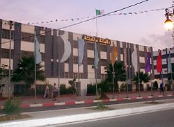
Béjaïa Province Tawilayt n Bgayet ولاية بجاية Wilaya de Béjaïa | |
|---|---|
Province | |
 | |
 Map of Algeria highlighting Béjaïa | |
| Coordinates: 36°45′N 5°04′E / 36.750°N 5.067°E / 36.750; 5.067 | |
| Country |  Algeria Algeria |
| Capital | Béjaïa |
| Government | |
| • PPA president | Mohamed Bettache (FLN) |
| • Wāli | Ali Bedrici |
| Area | |
| • Total | 3,268 km2 (1,262 sq mi) |
| Population (2008)[1] | |
| • Total | 915,835 |
| • Density | 280/km2 (730/sq mi) |
| Time zone | UTC+01 (CET) |
| Area Code | +213 (0) 34 |
| ISO 3166 code | DZ-06 |
| Districts | 19 |
| Municipalities | 52 |
The Béjaïa Province (Kabyle: Tawilayt n Bgayet; Arabic: ولاية بجاية, Wilāyat Bijāyah; French: wilaya de Béjaïa or province de Béjaïa) is a province of Algeria in the Kabylie region. The province's capital city is Béjaïa, the terminus of the Béni Mansour-Bejaïa line.

Gouraya National Park is located in Béjaïa Province. A population of an endangered primate species, the Barbary macaque, is found within the park; this primate has a severely restricted and disjunctive range.[2]
History
The province was created from the Sétif (département) in 1974.
Administrative divisions
The province is divided into 19 districts (daïras), which are further divided into 52 communes or municipalities.
Districts
Communes
- Adekar
- Aït-Rizine
- Aït-Smail
- Akbou
- Akfadou
- Amalou
- Amizour
- Aokas
- Barbacha
- Béjaïa
- Beni Djellil
- Beni Ksila
- Beni Maouche
- Beni Mellikeche
- Boudjellil
- Bouhamza
- Boukhelifa
- Chelata
- Chemini
- Darguina
- Draâ El-Kaïd
- El-Flaye
- El-Kseur
- Feraoun
- Ifenain Ilmathen
- Ighil Ali
- Ighram
- Kendira
- Kherrata
- Melbou
- Msisna
- Oued Ghir
- Ouzellaguen
- Seddouk
- Semaoune
- Sidi-Aïch
- Sidi-Ayad
- Sidi-Saïd
- Souk El-Thenine
- Souk-Oufella
- Tala Hamza
- Tamokra
- Tamridjet
- Taourit Ighil
- Taskriout
- Tazmalt
- Tinabdher
- Tibane
- Tichy
- Tifra
- Timezrit
- Tizi N'Berber
- Toudja
References
 Algeria portal

- ^ Office National des Statistiques, Recensement General de la Population et de l’Habitat 2008 Archived July 24, 2008, at the Wayback Machine Preliminary results of the 2008 population census. Accessed on 2008-07-02.
- ^ C. Michael Hogan. 2008. Barbary Macaque: Macaca sylvanus, Globaltwitcher.com, ed. Nicklas Stromberg Archived April 19, 2012, at the Wayback Machine
External links
- (in French, Arabic, Berber languages, and Kabyle) The first website of Bgayet Béjaïa Bougie and his region
- (in French and Arabic) Official website of Béjaïa Province
- v
- t
- e
- Adrar (01)
- Chlef (02)
- Laghouat (03)
- Oum El Bouaghi (04)
- Batna (05)
- Béjaïa (06)
- Biskra (07)
- Béchar (08)
- Blida (09)
- Bouira (10)
- Tamanrasset (11)
- Tébessa (12)
- Tlemcen (13)
- Tiaret (14)
- Tizi Ouzou (15)
- Algiers (16)
- Djelfa (17)
- Jijel (18)
- Sétif (19)
- Saïda (20)
- Skikda (21)
- Sidi Bel Abbès (22)
- Annaba (23)
- Guelma (24)
- Constantine (25)
- Médéa (26)
- Mostaganem (27)
- M'Sila (28)
- Mascara (29)
- Ouargla (30)
- Oran (31)
- El Bayadh (32)
- Illizi (33)
- Bordj Bou Arréridj (34)
- Boumerdès (35)
- El Taref (36)
- Tindouf (37)
- Tissemsilt (38)
- El Oued (39)
- Khenchela (40)
- Souk Ahras (41)
- Tipaza (42)
- Mila (43)
- Aïn Defla (44)
- Naâma (45)
- Aïn Témouchent (46)
- Ghardaïa (47)
- Relizane (48)
- Bordj Baji Mokhtar (49)
- In Salah (50)
- Djanet (51)
- In Guezzam (52)
- El M'Ghair (53)
- Touggourt (54)
- Béni Abbès (55)
- Timimoun (56)
- Ouled Djellal (57)
- El Menia (58)

Authority control databases | |
|---|---|
| International |
|
| National |
|
| Geographic |
|


