Gouger Street, Adelaide


- 34°55′51″S 138°35′17″E / 34.930707°S 138.587942°E / -34.930707; 138.587942 (West end)
- 34°55′48″S 138°36′00″E / 34.930117°S 138.600059°E / -34.930117; 138.600059 (East end)
Adelaide
- Morphett Street
- Victoria Square
Adelaide


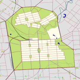
Gouger Street (/ˈɡʊdʒər/ GUUJ-ər) is a major street in the centre of Adelaide, South Australia.[2][3] It was named after Robert Gouger, the first Colonial Secretary of South Australia.[4]
Restaurant district
Gouger Street is known for its high-end international restaurants and cafes. Cuisines found along Gouger Street include Italian, French, Argentinian, Malaysian, Vietnamese, Chinese and Thai. Many of the restaurants on Gouger Street have won awards. Some of the better known ones are Star of Siam (which specializes in Thai cuisine), La Porchetta (Italian) and Chi on Gouger.
The southern entrance of the Adelaide Central Market is on Gouger street. A paifang, comprising an archway erected by the city council and two lions donated by the People's Republic of China, marks the southern entrance to the Moonta Street Chinatown.
See also
 Australian Roads portal
References
- ^ Google (1 June 2022). "Gouger Street" (Map). Google Maps. Google. Retrieved 1 June 2022.
- ^ 2003 Adelaide Street Directory, 41st Edition. UBD (A Division of Universal Press Pty Ltd). 2003. ISBN 0-7319-1441-4.
- ^ Map Archived 25 March 2017 at the Wayback Machine of the Adelaide CBD, North Adelaide and the Adelaide Parklands.
- ^ Gouger Street Archived 19 February 2009 at the Wayback Machine, History of Adelaide Through Street Names, Streets Named on 23 May 1837, historysouthaustralia.net
- v
- t
- e
|
| ||||||||||
34°55′50″S 138°35′38″E / 34.93045°S 138.5940°E / -34.93045; 138.5940
 | This article about Adelaide is a stub. You can help Wikipedia by expanding it. |
- v
- t
- e


