Reed, Kentucky
Unincorporated community in Kentucky, United States
Unincorporated community in Kentucky, United States
37°51′4″N 87°21′15″W / 37.85111°N 87.35417°W / 37.85111; -87.3541742451
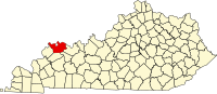
Reed is an unincorporated community in Henderson County, Kentucky, United States.
References
- ^ U.S. Geological Survey Geographic Names Information System: Reed, Kentucky
- v
- t
- e
Municipalities and communities of Henderson County, Kentucky, United States
County seat: Henderson
- Corydon
- Henderson
- Robards
communities
‡This populated place also has portions in an adjacent county or counties
- Kentucky portal
- United States portal
 | This Henderson County, Kentucky state location article is a stub. You can help Wikipedia by expanding it. |
- v
- t
- e


