Poole, Kentucky
Census-designated place in Kentucky, United States
37°38′25″N 87°38′39″W / 37.64028°N 87.64417°W / 37.64028; -87.64417 (2020)
42444
Poole is an unincorporated community and census-designated place (CDP) in Webster and Henderson counties, Kentucky, United States. The community is on U.S. Route 41A, 15 miles (24 km) south of Henderson and 20 miles (32 km) north of Providence. The center of Poole is in northern Webster County, and the community extends north into southern Henderson County.
Demographics
| Census | Pop. | Note | %± |
|---|---|---|---|
| 2020 | 354 | — | |
| U.S. Decennial Census[3] | |||
References
- v
- t
- e
Municipalities and communities of Webster County, Kentucky, United States
County seat: Dixon

- Onton
- Poole‡
unincorporated
communities
‡This populated place also has portions in an adjacent county or counties
- Kentucky portal
- United States portal
Municipalities and communities of Henderson County, Kentucky, United States | ||
|---|---|---|
County seat: Henderson | ||
| Cities | 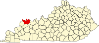 | |
| CDPs |
| |
| Other communities | ||
| Ghost town | ||
| Footnotes | ‡This populated place also has portions in an adjacent county or counties | |
| ||
 | This Webster County, Kentucky state location article is a stub. You can help Wikipedia by expanding it. |
- v
- t
- e


