Petőfiszállás
Place in Bács-Kiskun, Hungary
Petőfiszállás | |
|---|---|
| Country |  Hungary Hungary |
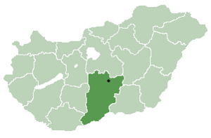
| County | Bács-Kiskun |
| Area | |
| • Total | 67.78 km2 (26.17 sq mi) |
| Population (2015) | |
| • Total | 1,453[1] |
| • Density | 21.4/km2 (55/sq mi) |
| Time zone | UTC+1 (CET) |
| • Summer (DST) | UTC+2 (CEST) |
| Postal code | 6113 |
| Area code | 76 |
Petőfiszállás is a village in Bács-Kiskun county, in the Southern Great Plain region of southern Hungary.
Geography
It covers an area of 67.78 km2 (26 sq mi) and has a population of 1453 people (2015).[1]
References
- ^ a b Gazetteer of Hungary, 1 January 2015. Hungarian Central Statistical Office. 3 September 2015
- v
- t
- e
- Kecskemét (county seat)


- Ágasegyháza
- Akasztó
- Apostag
- Bácsborsód
- Bácsszentgyörgy
- Bácsszőlős
- Ballószög
- Balotaszállás
- Bátmonostor
- Bátya
- Bócsa
- Borota
- Bugacpusztaháza
- Császártöltés
- Csátalja
- Csávoly
- Csengőd
- Csikéria
- Csólyospálos
- Dávod
- Drágszél
- Dunaegyháza
- Dunafalva
- Dunaszentbenedek
- Dunatetétlen
- Dusnok
- Érsekcsanád
- Érsekhalma
- Fajsz
- Felsőlajos
- Felsőszentiván
- Foktő
- Fülöpháza
- Fülöpjakab
- Fülöpszállás
- Gara
- Gátér
- Géderlak
- Harkakötöny
- Helvécia
- Hercegszántó
- Homokmégy
- Imrehegy
- Jakabszállás
- Jászszentlászló
- Kaskantyú
- Katymár
- Kelebia
- Kéleshalom
- Kisszállás
- Kömpöc
- Kunadacs
- Kunbaja
- Kunbaracs
- Kunfehértó
- Kunpeszér
- Kunszállás
- Ladánybene
- Madaras
- Mátételke
- Miske
- Móricgát
- Nagybaracska
- Nemesnádudvar
- Nyárlőrinc
- Ordas
- Öregcsertő
- Orgovány
- Páhi
- Pálmonostora
- Petőfiszállás
- Pirtó
- Rém
- Soltszentimre
- Szakmár
- Szalkszentmárton
- Szank
- Szentkirály
- Szeremle
- Tabdi
- Tass
- Tataháza
- Tázlár
- Tiszaug
- Újsolt
- Újtelek
- Uszód
- Városföld
- Vaskút
- Zsana
46°37′N 19°50′E / 46.617°N 19.833°E / 46.617; 19.833
 | This Bács-Kiskun location article is a stub. You can help Wikipedia by expanding it. |
- v
- t
- e


