Kowloon City District
District in Hong Kong, Kowloon and New Kowloon
Kowloon City 九龍城區 | |
|---|---|
| Kowloon City District | |
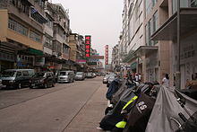
     Left-right from top: Kowloon City District skyline, Kowloon Walled City Park, Osborn Barracks, Hong Kong Baptist University, Kai Tak Cruise Terminal | |
 | |
 Location of Kowloon City District within Hong Kong | |
| Coordinates: 22°19′42″N 114°11′30″E / 22.32820°N 114.19155°E / 22.32820; 114.19155 | |
| Statutorily-defined area | Kowloon (south of Boundary Street) and New Kowloon |
| Country | Hong Kong (special administrative region) |
| Sovereign state | People's Republic of China |
| Constituencies | 25 |
| Government | |
| • District Officer | Tso Man Kwan[1] |
| • District Council Chairman | Ho Hin-ming[needs update] |
| • District Council Vice-Chairman | Ng Po-Keung |
| Area | |
| • Total | 9.97 km2 (3.85 sq mi) |
| Population (2016[2]) | |
| • Total | 418,732 |
| • Density | 42,000/km2 (110,000/sq mi) |
| Time zone | UTC+8 (Hong Kong Time) |
| Largest neighbourhood by population | Ma Tau Kok (53,800 – 2016 est)[3] |
| Website | Kowloon City District Council |
| Kowloon City District | |||||||||||||||||||
|---|---|---|---|---|---|---|---|---|---|---|---|---|---|---|---|---|---|---|---|
| Traditional Chinese | 九龍城區 | ||||||||||||||||||
| Simplified Chinese | 九龙城区 | ||||||||||||||||||
| Jyutping | Gau2lung4 sing4 keoi1 | ||||||||||||||||||
| |||||||||||||||||||
Kowloon City District is one of the 18 districts of Hong Kong. It is located in the city of Kowloon and cut through by Boundary Street. It had a population of 381,352 in 2001, and increased to 418,732 in 2016.[4] The district has the third most educated residents while its residents enjoy the highest income in Kowloon. It borders all the other districts in Kowloon, with Kwun Tong district to the east, Wong Tai Sin district to its northeast, Sham Shui Po district to its northwest, and Yau Tsim Mong district to its southwest.
Kowloon City district covers about 1,000 hectares, and is mainly a residential area; most of its people live in private sector housing, including old tenement buildings, private residential developments and low-rise villas; the rest of them mainly live in public rental housing and the Home Ownership Scheme estates.[5] It is the only district that incorporated into the land of Hong Kong in different stages (Convention of Peking, Convention for the Extension of Hong Kong Territory and the demolition of the Kowloon Walled City)
The district includes many notable areas of Kowloon, such as Ho Man Tin, Hung Hom, Kai Tak Airport, Kowloon Tong, Ma Tau Wai, To Kwa Wan, and Whampoa Garden, and the proper Kowloon City, from where it derives its namesake.
History
According to reliable historical records such as the History book of Song Dynasty (宋書), emperor Emperor Duanzong (Zhao Shi) and emperor Zhao Bing took refuge in nowadays Kowloon City District. Sung Wong Toi was a remarkable monument during that era.
Part of the district was the location of the original Kowloon Walled City, see Kowloon Walled City. This is now Walled City Park.
The former airport, Kai Tak International Airport was also located in the district; part of it will be re-developed to be Kai Tak Cruise Terminal. In 1982, the Hong Kong Government decided to divide Hong Kong into 18 administrative districts, and Kowloon City and its neighbouring areas such as Hung Hom now belongs to Kowloon City District.
Areas
Sights
Education
- Universities
- Hong Kong Baptist University (Kowloon Tong main campus)
- Open University of Hong Kong (Ho Man Tin main campus)
- The Hong Kong Polytechnic University (Hung Hom main campus)
See also
References
- ^ Welcome Message from Franco KWOK, JP, District Officer (Kowloon City) Retrieved 2018-05-24
- ^ "2016 Population Census: Summary Results" (in English and Chinese). Census and Statistics Department, Hong Kong Government. 2017. Retrieved 24 May 2018.
- ^ District Profiles, Hong Kong Government, 8 December 2017, retrieved 15 April 2020
- ^ 2016 HK Population by-Census Table A201a Population by District Council District and Year, Retrieved 2018-05-24
- ^ Kowloon City district highlights extracted from Council website, Retrieved 2018-05-24
External links
Wikimedia Commons has media related to Kowloon City District.
- Kowloon City District Council
- List and map of electoral constituencies (large PDF file)
Places adjacent to Kowloon City District | |
|---|---|


- v
- t
- e
Kowloon City District
- Kowloon (areas to the south of the Boundary Street)
- New Kowloon (areas to the north of the Boundary Street)
- 41 Cumberland Road (Bruce Lee home)
- Beacon Hill
- Broadcast Drive
- Cattle Depot Artist Village
- Celestial Heights
- Grand Waterfront
- Holy Trinity Cathedral, Hong Kong
- Hong Kong Baptist Hospital
- Hong Kong Children's Hospital
- Hong Kong Coliseum
- Hong Kong Housing Authority Exhibition Centre
- Kai Ching Estate
- Kai Tak Sports Park
- Kerry Hotel Hong Kong
- Kowloon City Plaza
- Kowloon East Barracks (formerly Osborn Barracks)
- Kowloon Hospital
- Kowloon Tsai Park
- Kowloon Walled City (demolished)
- Kowloon Walled City Park
- Laguna Verde
- No. 12 Hill
- Quarry Hill
- St. Teresa's Church
- Whampoa Garden
| Former airport | |
|---|---|
| Water | |
| Major roads |
|
| MTR stations |
| Tertiary | |||
|---|---|---|---|
| Primary and secondary |
|
This list is incomplete.
| |
|---|---|
District Officers, District councils | |
| Hong Kong Island | |
| Kowloon and New Kowloon |
|
| New Territories (excluding New Kowloon) | |

| Authority control databases: Geographic |
|
|---|


