Drechterland
Municipality in North Holland, Netherlands

Flag

Coat of arms
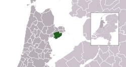
Location in North Holland
(January 2021)[4]
1606–1609, 1616–1617, 1696–1697
Drechterland (Dutch pronunciation: [ˈdrɛxtərlɑnt] ⓘ) is a municipality in the Netherlands, in the province of North Holland and the region of West-Frisia. The municipality was formed in 1979, in a merger of the former municipalities of Hoogkarspel, Westwoud and Oosterblokker. Its original name, Bangert, was changed to "Drechterland" in 1980. In 2006, the former municipality of Venhuizen was added to Drechterland.
Population centres
The municipality of Drechterland consists of the following towns, villages and districts:
- Hem
- Hoogkarspel
- Oosterblokker
- Oosterleek
- Oosterwijzend
- Schellinkhout
- Venhuizen
- Westerwijzend
- Westwoud
- Wijdenes
Topography

Dutch topographic map of the municipality of Drechterland, June 2015
Local government
The municipal council of Drechterland consists of 17 seats, which after the 2022 municipal election divided as follows:[5]
- Senior Party, Drechterland – 4 seats
- Christian Democratic Appeal (CDA) – 4 seats
- Progressive Drechterland – 3 seats
- People's Party for Freedom & Democracy (VVD) – 3 seats
- Municipal interests, Drechterland – 3 seats
Notable people

- Jan Jacobszoon May van Schellinkhout (17th c., born in Schellinkhout) a Dutch seafarer and explorer, eponym of Jan Mayen
- Cornelis Jacobsen Mey (17th c., born in Schellinkhout) a Dutch explorer, captain and fur trader
- Wilhelmus Nuyens (1823 in Avenhorn – 1894) a Dutch historian.[6]
- Vincent Mentzel (born 1945 Hoogkarspel) a Dutch newspaper photographer, embraces photorealism
Sport
- Hendrik Offerhaus (1875 in Venhuizen – 1953) a Dutch rower and bronze medallist in the 1900 Summer Olympics
- Mathieu Boots (born 1975 in Venhuizen) a Dutch retired football player with over 250 club caps
- Thomas Koenis (born 1989 in Hoogkarspel) a Dutch professional basketball player
- Erik Schouten (born 1991 in Westwoud) a Dutch professional footballer with 140 caps with FC Volendam
Gallery
-
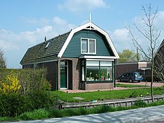
 Dorpsweg, Schellinkhout
 -
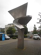 Sculpture on the Raadhuisplein, Hoogkarspel
 -
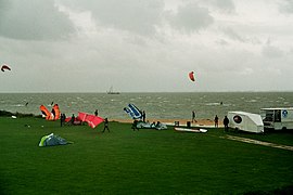 Schellinkhout, the beach
 -
 Saint Luke, Venhuizen
 -
 Zittend


References
- ^ "Samenstelling college van burgemeester en wethouders" [Members of the board of mayor and aldermen] (in Dutch). Gemeente Drechterland. Archived from the original on 28 February 2014. Retrieved 28 February 2014.
- ^ "Kerncijfers wijken en buurten 2020" [Key figures for neighbourhoods 2020]. StatLine (in Dutch). CBS. 24 July 2020. Retrieved 19 September 2020.
- ^ "Postcodetool for 1616AV". Actueel Hoogtebestand Nederland (in Dutch). Het Waterschapshuis. Retrieved 28 February 2014.
- ^ "Bevolkingsontwikkeling; regio per maand" [Population growth; regions per month]. CBS Statline (in Dutch). CBS. 1 January 2021. Retrieved 2 January 2022.
- ^ "Drechterland municipal election 2022". www.verkiezingsuitslagen.nl (in Dutch). 16 March 2022. Retrieved 8 February 2024.
- ^ Schlager, Patricius (1911). "Wilhelmus Nuyens" . Catholic Encyclopedia. Vol. 11.
External links
 Media related to Drechterland at Wikimedia Commons
- Official website
Places adjacent to Drechterland | ||||||||||||||||
|---|---|---|---|---|---|---|---|---|---|---|---|---|---|---|---|---|
| ||||||||||||||||


 | This North Holland location article is a stub. You can help Wikipedia by expanding it. |
- v
- t
- e


