Didsbury Village tram stop
Manchester Metrolink tram stop
| Preceding station | Following station | |||
|---|---|---|---|---|
| East Didsbury Terminus | East Didsbury–Rochdale | West Didsbury towards Rochdale Town Centre | ||
| East Didsbury–Shaw (peak only) | West Didsbury towards Shaw and Crompton | |||
Route map | |||||||||||||||||||||||||||||||||||||||||||||||||||||||||||||||||||||||||||||||||||||||||||||||
|---|---|---|---|---|---|---|---|---|---|---|---|---|---|---|---|---|---|---|---|---|---|---|---|---|---|---|---|---|---|---|---|---|---|---|---|---|---|---|---|---|---|---|---|---|---|---|---|---|---|---|---|---|---|---|---|---|---|---|---|---|---|---|---|---|---|---|---|---|---|---|---|---|---|---|---|---|---|---|---|---|---|---|---|---|---|---|---|---|---|---|---|---|---|---|---|
| |||||||||||||||||||||||||||||||||||||||||||||||||||||||||||||||||||||||||||||||||||||||||||||||


Location | |
|---|---|
 |
Didsbury Village is a tram stop on the South Manchester Line on the light-rail Metrolink network in Greater Manchester, England. It serves the South Manchester suburb of Didsbury.
History
The Manchester South District Line was opened by the Midland Railway in 1880. Originally, Didsbury was served by Didsbury railway station, which was located opposite Didsbury Library on Wilmslow Road, approximately 290 metres (0.18 mi) further north along the line from the present tram stop. The railway station was closed in 1967 as part of the Beeching cuts and was demolished in 1982, and the old railway line lay derelict for several decades.[1]
In 1984, Greater Manchester Council and GMPTE announced the Project Light Rail scheme to develop a new light rail/tram system by re-opening use of disused railway lines in the region, including the route through Didsbury.[2] The first phase of the Manchester Metrolink system opened in 1992, but it was not until 2013 that the network was expanded to reach Didsbury, as part of Phase 3b of the Metrolink expansion project. Tram tracks were laid along the former trackbed, but as Didsbury station had been demolished over 30 years earlier, a new tram stop was constructed further down the line on School Lane.[3][4]
There were plans to extend the line to Stockport, which were cancelled on grounds of cost.[5]
-
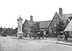 The tram stop replaced the old Didsbury Railway Station (closed 1967)
 -
 Map of Didsbury showing the locations of the old station and the tram stop


Service pattern
- 12 minute service to Shaw and Crompton with double trams in the peak
- 12 minute service to Rochdale Town Centre with double trams in the peak
- 6 minute service to East Didsbury with double trams in the peak
References
- ^ Suggitt 2004.
- ^ Ogden, Eric; Senior, John (1991). Metrolink: Official Handbook. Glossop, Derbyshire: Transport Publishing Company. pp. 26–27. ISBN 0-86317-164-8.
- ^ Kirby, Dean (23 May 2013). "First passengers travel on tram extension to East Didsbury". Manchester Evening News. Retrieved 18 June 2020.
- ^ "Didsbury Station". www.disused-stations.org.uk. Disused Stations. Archived from the original on 20 May 2020. Retrieved 18 June 2020.
- ^ "Council wants Darling resignation". 21 July 2004.
Sources
- Suggitt, Gordon (2004). Lost Railways of Merseyside and Greater Manchester. Countryside Books. ISBN 978-1-85306-869-0.
External links
Wikimedia Commons has media related to Didsbury Village Metrolink station.
- https://web.archive.org/web/20130226053951/http://www.lrta.org/Manchester/city_south.html
- Metrolink stop information
- Didsbury Village area map
- "Didsbury Village Metrolink station plans" (PDF). GMPTE. 21 September 2017. Archived from the original (PDF) on 21 September 2017. Retrieved 18 June 2020.
| ||||||||||||||||||||||||||
|---|---|---|---|---|---|---|---|---|---|---|---|---|---|---|---|---|---|---|---|---|---|---|---|---|---|---|
| Tram stops |
|   | ||||||||||||||||||||||||
| Operations |
| |||||||||||||||||||||||||
| History (Timeline) |
| |||||||||||||||||||||||||
| Proposed developments |
| |||||||||||||||||||||||||


