Crofton, London
Human settlement in England
- London
- Orpington
- Bexley and Bromley
Crofton is a suburb of Orpington in southeast London, England, located in the London Borough of Bromley in Greater London. Prior to 1965 it was within the historic county of Kent. It is about 13.6 miles (21.9 km) southeast of Charing Cross. It lies south of Petts Wood, west of Orpington and Broom Hill, north of Green Street Green and Farnborough, north-east of Locksbottom and east of Bromley Common.
History

A Roman settlement existed here from circa 140 ADs-400, with the ruins of a Roman villa forming a small museum just next to Orpington train station.[1]
The name Crofton comes from Old English and means 'farm on a rounded hill'.[1] Little is known of its subsequent history, though it remained a rural locality until well into the 19th century.[1] Some small-scale development occurred from 1868 following the opening of Orpington train station, and St Paul's Church, Crofton Road was built in 1887 (later rebuilt in 1958).[1] The inter-war years saw extensive development and the area is now effectively a suburban extension of Orpington.[1]
Amenities
The area contains two small shopping parades on Crofton Lane and Kelvin Parade. To the north-west lies Crofton Wood, which is designated a Site of Special Scientific Interest.[1][2]
Governance
Crofton falls within the London Borough of Bromley and is in the Orpington Parliament constituency.[3] For local council elections it forms a part of the Farnborough and Crofton ward along with Farnborough.[4]
Demography
Demographic data is produced by the Office for National Statistics for the Farnborough and Crofton ward. In the 2011 census, the population for the Farnborough and Crofton ward was 14,632.[5] The most common ethnic group was White British in the Farnborough and Crofton ward, measured at 90.5%, followed by Asian or British Asian (5.5%) and mixed-race (1.9%). The remaining percentage was made up of Black or Black British and other unspecified ethnic groups.[6]
Transport
Crofton has no railway station of its own, but east of Crofton is Orpington railway station which runs on the South Eastern Main Line.
There is good bus infrastructure in Crofton, having six daytime routes, one nighttime route and one school bus route. Buses in Crofton include bus routes 61, 208, 353, N199, R2, R3, R7 and school route 654 with connections to many towns, villages and suburbs such as Biggin Hill, Bromley town centre, Catford, Lewisham town centre, Petts Wood, St Mary Cray and several other areas.[7]
Gallery
-
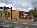
 Shops on Crofton Lane
 -
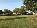 Oregon Square Open Space, with the Kelvin Parade shops at the far end
 -
![St Paul's Church, built in 1958 by AB Knapp-Fisher[8]](//upload.wikimedia.org/wikipedia/commons/thumb/d/d6/St_Paul%27s_Church%2C_Crofton.jpg/120px-St_Paul%27s_Church%2C_Crofton.jpg) St Paul's Church, built in 1958 by AB Knapp-Fisher[8]
St Paul's Church, built in 1958 by AB Knapp-Fisher[8] -
 Crofton village sign
 -
 Crofton War Memorial at St Paul's Church
 -
 Crofton Roman Villa Museum


![St Paul's Church, built in 1958 by AB Knapp-Fisher[8]](http://upload.wikimedia.org/wikipedia/commons/thumb/d/d6/St_Paul%27s_Church%2C_Crofton.jpg/120px-St_Paul%27s_Church%2C_Crofton.jpg)


References
- ^ a b c d e f Willey, Russ (2006). The London Gazetteer. Chambers Harrap Publishers Ltd. pp. 125–6.
- ^ "Map of Crofton Woods SSSI". Natural England.
- ^ "The Parliamentary Constituencies (England) Order 2007". www.legislation.gov.uk. Retrieved 6 May 2019.
- ^ "Map of ward boundaries | London Borough of Bromley". www.bromley.gov.uk. Retrieved 6 May 2019.
- ^ "2011 Census Ward Population Estimates | London DataStore". Archived from the original on 22 February 2014. Retrieved 4 May 2019.
- ^ "Ethnic group". NOMIS. Office for National Statistics. Retrieved 4 May 2019.
- ^ "Buses from Crofton (Orpington)" (PDF). Transport for London. Retrieved 7 May 2019.
- ^ "St Paul's Church, Crofton, Kent". London Churches in Photographs. London Church Buildings. 23 February 2017. Retrieved 12 September 2020.
- v
- t
- e
- Anerley
- Aperfield
- Beckenham
- Berry's Green
- Bickley
- Biggin Hill
- Bromley
- Bromley Common
- Chelsfield
- Chislehurst
- Coney Hall
- Crystal Palace
- Cudham
- Downe
- Eden Park
- Elmers End (including Upper Elmers End)
- Elmstead
- Farnborough
- Foxbury
- Goddington
- Green Street Green
- Hayes
- Hazelwood
- Hockenden
- Horns Green
- Keston
- Kevington
- Leaves Green
- Locksbottom
- Longlands
- Luxted
- Mottingham
- New Beckenham
- Orpington (including: Broom Hill, Crofton, Derry Downs and Ramsden)
- Park Langley
- Penge
- Petts Wood
- Plaistow
- Poverest
- Pratt's Bottom
- Ruxley
- St Mary Cray
- St Paul's Cray
- Shortlands
- Single Street
- Southborough
- South Street
- Sundridge
- Sydenham
- Upper Norwood
- West Wickham
- Widmore


- Betts Park
- Chislehurst Common
- Crofton Wood
- Croydon Road Recreation Ground
- Crystal Palace Park
- Cuckoo Wood
- Downe Bank
- Elmstead Wood
- Hayes Common
- High Elms Country Park
- Jubilee Country Park
- Kelsey Park
- Keston Common
- Norman Park
- Ruxley Gravel Pits
- Saltbox Hill
- Scadbury Park
- Sundridge Park
- The Warren
- West Kent Golf Course nature reserve
- Beckenham
- Bromley and Chislehurst
- Lewisham West and Penge
- Orpington
tram stops

 Anerley
 Avenue Road
- Beckenham Road
- Beckenham Junction
- Bickley
- Birkbeck
- Bromley North
- Bromley South
- Chelsfield
- Chislehurst
- Clock House
- Crystal Palace
- Eden Park
- Elmers End
- Elmstead Woods
- Hayes
- Kent House
- Knockholt
- Lower Sydenham
- New Beckenham
- Orpington
- Penge East
- Penge West
- Petts Wood
- Ravensbourne
- St Mary Cray
- Shortlands
- Sundridge Park
- West Wickham


 Category
 Commons


