Balichak
Census Town in West Bengal, India
22°22′N 87°33′E / 22.37°N 87.55°E / 22.37; 87.55 India
India (2011)
721124
Balichak is a census town in the Debra CD block in the Kharagpur subdivision of the Paschim Medinipur district in the state of West Bengal, India.
Geography


8km
5miles
5miles

Kangsabati River
Satyapur
H

Raj Ballabh
H
Loyada
H
Jalchak
H
Dhaneshwarpur
Madhyabar
Madhyabar
H
Chak Bajit
H
IIT, Kharagpur
F
Kharagpur
M
Hijli
R
Satkul
R
Salua
R
Pingla
R
Maligram
R
Madpur
R
Gangaram Chak
R
Debra
R
Changual
R
Kharagpur
Railway Settlement
Railway Settlement
CT
Balichak
CT
Kalaikunda
CT
Cities and towns in the northern part of Kharagpur subdivision (including Khararagpur I & II, Debra and Pingla CD blocks) of Paschim Medinipur district
M: municipal city/ town, CT: census town, R: rural/ urban centre, H: historical/ religious centre, F: facilities
Owing to space constraints in the small map, the actual locations in a larger map may vary slightly
M: municipal city/ town, CT: census town, R: rural/ urban centre, H: historical/ religious centre, F: facilities
Owing to space constraints in the small map, the actual locations in a larger map may vary slightly
Location
Balichak is located at 22°22′N 87°33′E / 22.37°N 87.55°E / 22.37; 87.55.[1] It has an average elevation of 12 metres (42 feet). It is located in the Debra CD Block in the Kharagpur subdivision of the Paschim Medinipur district.[2]
Area overview
Kharagpur subdivision, shown partly in the map alongside, mostly has alluvial soils, except in two CD blocks in the west – Kharagpur I and Keshiary, which mostly have lateritic soils. Around 74% of the total cultivated area is cropped more than once.[3] With a density of population of 787 per km2nearly half of the district’s population resides in this subdivision. 14.33% of the population lives in urban areas and the rest in the rural areas.[4]
Note: The map alongside presents some of the notable locations in the subdivision. All places marked in the map are linked in the larger full screen map.
Demographics
According to the 2011 Census of India, Balichak had a population of 13,784, of which 14,977(49%) were males and 15,834(51%) females. There were 3,261 persons in the age range of 0–6 years. The total number of literate persons in Balichak was 27,550(89.41% of the population over 6 years).[5]
.*For language details see Debra (community development block)#Language and religion
Civic administration
CD block HQ
The headquarters of Debra CD block are located at Balichak.[6]
Infrastructure
According to the District Census Handbook 2011, Paschim Medinipur, Balichak covered an area of 4.66 km2. Among the civic amenities, it had 3 km roads with open drains, the protected water supply involved tap water from untreated sources, borewell, tubewell. It had 2,500 domestic electric connections, 200 road lighting points. Among the medical facilities, it had 1 hospital, 1 dispensary/ health centre, 3 medicine shops. Among the educational facilities it had were 10 primary schools, 4 middle schools, 4 secondary schools, 2 senior secondary schools, the nearest general degree college at Debra, 3 km away. It had 4 recognised shorthand, typewriting and vocational training institutes. Among the social, recreational and cultural facilities, it had 1 cinema theatre, 2 public libraries, 3 reading rooms. Rice and wheat were two important commodities it produced. It had branch offices of 2 nationalised banks, 2 cooperative banks, 2 agricultural credit societies, 7 non-agricultural societies.[7]
Economy
There are few Banks and financial houses that serve the people living in Balichak and nearby areas. While State Bank of India is the busiest of all, other banks like Punjab National Bank, Vidyasagar Central Co-operative Bank Ltd also have their presence here. Bandhan Bank has a banking and a DSC branch at Balichak. Punjab National Bank has two branches here. SBI Branch is at station Road, PNB (Balichak Branch) near Balichak Bhajahari institution and PNB (Hamirpur Branch) is at Balichak station road, Vidyasagar Central Coop Bank is at Balichak daily bazar. State Bank of India also has e-corner with branch. Life Insurance Corporation has a satellite branch in Balichak. The Private institutions do business mainly in the investment area.
Transportation
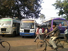
Balichak is well connected by roads/highways to other important towns of South Bengal. Locals use bicycles and motorbikes for transportation within the town. Rickshaws and cabs, autoes are also available.
Balichak railway station is on the Howrah-Kharagpur line. It is 90.5 km from Howrah station.[8]
Education
There are a number of schools in Balichak:
- Maa Sarada Vidyamandir
- Balichak Christopherday School
- Ramakrishna nursery school
- Aurobinda Vidyabhawan (English Medium, ICSE Board)
- Balichak Bhajahari Institution
- Balichak Girls High School
- Antala Sitala High School
- Duan Rudreswar High School
- Jhanjia Gopal Chandra Institution
- Brahmansasan Kamala Vidyapith
Culture
The regular Bengali festivals like Durga Puja, Saraswati Puja and Kali Puja are well attended. Other common pujas in the worship of Shitala, Jagaddhatri, Holi, Janmastami, Rath Yatra, Dussera (Ravan Pora) also take place.
References
- ^ Falling Rain Genomics, Inc - Balichak
- ^ "District Wise List of Statutory Towns (Municipal Corporation, Municipality, Notified Area and Cantonment Board), Census Towns and Outgrowths, West Bengal, 2001". Census of India, Directorate of Census Operations, West Bengal. Archived from the original on 30 September 2007. Retrieved 27 December 2008.
- ^ "District Human Development Report Paschim Medinipur, 2011". page 27-28. Department of Planning and Statistics, Government of West Bengal. Retrieved 10 September 2020.
- ^ "District Statistical Handbook Paschim Medinipur, 2013". Table 2.2, 2.4 (a). Department of Planning and Statistics. Retrieved 10 September 2020.
- ^ "CD block Wise Primary Census Abstract Data(PCA)". West Bengal – District-wise CD blocks. Registrar General and Census, India. Retrieved 5 September 2020.
- ^ "District Census Handbook: Paschim Medinipur" (PDF). Map of Paschim Medinipur with CD Block HQs and Police Stations (on the fifth page). Directorate of Census Operations, West Bengal, 2011. Retrieved 20 November 2016.
- ^ "District Census Handbook Paschim Medinipur, Census of India 2011, Series 20, Part XII A" (PDF). Section II Town Directory, Pages 2827-2833; Statement I: Status and Growth History, Page 2827; Statement II: Physical Aspects and Location of Towns, Page 2829; Statement III: Civic and other Amenities, Page 2830; Statement IV: Medical Facilities 2831, Page 2832; Statement V: Educational, Recreational and Cultural Facilities, Page 2832,2833; Statement VI:Industry and Banking,Page 2833. Directorate of census Operations V, West Bengal. Retrieved 5 September 2020.
- ^ [Publics reservation system is available in station. https://indiarailinfo.com/train/-train-howrah-kharagpur-local-38713/16860/1/167 "Howrah-Kharagpur Local"]. Time Table. IndiaRailInfo. Retrieved 13 September 2020.
{{cite web}}: Check|url=value (help)
- v
- t
- e
Cities, towns and locations in Paschim Medinipur District, Medinipur division
and census towns
| Kharagpur subdivision | |
|---|---|
| Medinipur Sadar subdivision | |
| Ghatal subdivision |

other than cities and towns
 Paschim Medinipur topics
 People from Paschim Medinipur district
- Villages in Paschim Medinipur district


 India portal


