Ampelokipoi-Menemeni
Municipality in Greece
Ampelokipoi-Menemeni Αμπελόκηποι-Μενεμένη | |
|---|---|
| 40°39′N 22°55′E / 40.650°N 22.917°E / 40.650; 22.917 | |
| Country | Greece |
| Administrative region | Central Macedonia |
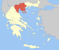
| Regional unit | Thessaloniki |
| Government | |
| • Mayor | Lazaros Kyrizoglou[1] (since 2011) |
| Area | |
| • Municipality | 8.82 km2 (3.41 sq mi) |
| Population (2021)[2] | |
| • Municipality | 50,143 |
| • Density | 5,700/km2 (15,000/sq mi) |
| Time zone | UTC+2 (EET) |
| • Summer (DST) | UTC+3 (EEST) |
| Website | www |
Ampelokipoi–Menemeni (Greek: Αμπελόκηποι-Μενεμένη) is a municipality of the Thessaloniki Urban Area in the regional unit of Thessaloniki, Central Macedonia, Greece. The seat of the municipality is in Ampelokipoi.[3]
Municipality
The municipality Ampelokipoi–Menemeni was formed at the 2011 local government reform by the merger of the following 2 former municipalities, that became municipal units:[3]
- Ampelokipoi
- Menemeni
Population
| Year | Population |
|---|---|
| 2011 | 52,127 |
| 2021 | 50,143 |
Neighborhoods
Municipal Unit of Ampelokipoi
- Eptalofos
- Akriton
- Kaistri
- Skeparni
- Filipou
Municipal Unit of Menemeni
- Nea Menemeni
- Vosporos
- Agios Nektarios
Monuments
Municipal Unit of Ampelokipoi
- Monument of the Greeks of Asia Minor.
- Monument of the National Resistance (Eleftherias Street).
- Statue of the Mother of the People (Eptalofos Square).
- "Zeitenlik" WW1 Allied Cemetery and Museum of the french quarter of the cemetery.
- Monument of the last Byzantine Emperor, Constantine XI Palaiologos (Dimokratias Square).
Municipal Unit of Menemeni
- Monument of Chrysostomos of Smyrna and of the Asia Minor Catastrophe (Tsompanoglou Square).
- "Harmankioi" Allied Cemetery. It is an Indian Allied Cemetery which was used for the burial of Indians who were drafted by the British to support the Entente Powers during World War I.
References
- ^ Municipality of Abelokipi – Menemeni, Municipal elections – October 2023, Ministry of Interior
- ^ "Αποτελέσματα Απογραφής Πληθυσμού - Κατοικιών 2021, Μόνιμος Πληθυσμός κατά οικισμό" [Results of the 2021 Population - Housing Census, Permanent population by settlement] (in Greek). Hellenic Statistical Authority. 29 March 2024.
- ^ a b "ΦΕΚ A 87/2010, Kallikratis reform law text" (in Greek). Government Gazette.
- v
- t
- e
Administrative division of the Central Macedonia Region
- Area
- 18,811 km2 (7,263 sq mi)
- Population
- 1,882,108 (as of 2011)
- Municipalities
- 38 (since 2011)
- Capital
- Thessaloniki
- Aristotelis
- Kassandra
- Nea Propontida
- Polygyros
- Sithonia
- Kilkis
- Paionia
- Amfipoli
- Emmanouil Pappas
- Irakleia
- Nea Zichni
- Serres
- Sintiki
- Visaltia
- Ampelokipoi-Menemeni
- Chalkidona
- Delta
- Kalamaria
- Kordelio-Evosmos
- Lagkadas
- Neapoli-Sykies
- Oraiokastro
- Pavlos Melas
- Pylaia-Chortiatis
- Thermaikos
- Thermi
- Thessaloniki
- Volvi
- Regional governor
- Apostolos Tzitzikostas (since 2013, elected 2014 & 2019)
- Decentralized Administration
- Macedonia and Thrace
 | This Central Macedonia location article is a stub. You can help Wikipedia by expanding it. |
- v
- t
- e


