Praias do Norte (Sydney)
Praias do Norte

Manly Praia em julho de 2004
| Nome local | Praias do Norte |
|---|
| País | |
|---|---|
| Estado | |
| Coordenadas | 33° 36′ 32″ S, 151° 19′ 41″ L  |

| Estatuto |
|---|

editar - editar código-fonte - editar Wikidata
Leste
Subúrbios
Subúrbios
Colinas
Distrito
Distrito
Parramatta
Blacktown
Penrith
Berowra
Greater
Western
Sydney
Western
Sydney
Hawkesbury
Inner West
Norte
Subúrbios
Subúrbios
Canterbury
Bankstown
Bankstown
Norte
Costa
Costa
Norte
Praias
Praias
Florestal
Distrito
Distrito
Sudoeste
Sydney
Sydney
Sutherland Shire
Botany
Bay
Bay
St George
Macarthur
Sydney
CBD
CBD
Bondi
Beach
Beach
Aeroporto
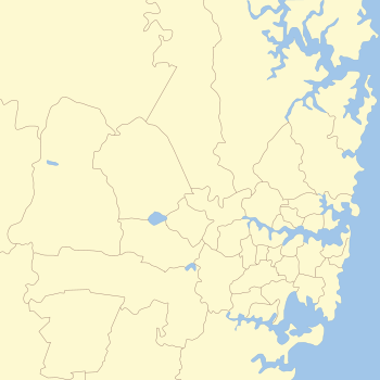
As Praias do Norte (em inglês: Northern Beaches) é uma área nos subúrbios costeiros do norte de Sydney, no estado de Nova Gales do Sul, Austrália, perto da costa do Pacífico. Esta área se estende para o sul até a entrada de Port Jackson (Porto de Sydney), a oeste até Middle Harbor e ao norte até a entrada de Broken Bay. A área foi anteriormente habitada pelos povos Garigal ou Caregal em uma região conhecida como país de Guringai.[2]
O distrito de Praias do Norte é governado no nível local pelo Conselho de Praias do Nortel, que foi formado em maio de 2016 do Conselho de Warringah (est. 1906), Conselho de Manly (est. 1877), e Conselho de Pittwater (est. 1992). O censo australiano de 2011 encontrou as Praias do Norte como o distrito mais branco e mono-étnico na Austrália, contrastando com seus vizinhos mais diversos: o North Shore e o Central Coast.[3]
Equipes notáveis de esportes incluem o Manly-Warringah Sea Eagles (Liga de Rugby), North Harbour Rays, Manly RUFC, Warringah Rugby Club (rugby union) e Manly United FC (futebol). Os Sea Eagles que jogam no National Rugby League, e Rays jogar no Brookvale Oval.
Subúrbios
Os subúrbios do distrito de Praias do Norte são - [4]
- Allambie Heights
- Beacon Hill
- Belrose
- Brookvale
- Collaroy
- Collaroy Plateau
- Cottage Point
- Cromer
- Curl Curl
- Davidson
- Dee Why
- Frenchs Forest
- Freshwater
- Forestville
- Ingleside
- Killarney Heights
- Manly
- Manly Vale
- Narrabeen
- Narraweena
- North Balgowlah
- North Curl Curl
- North Manly
- Oxford Falls
- Queenscliff
- Wheeler Heights
- Avalon
- Bayview
- Bilgola
- Bilgola Plateau
- Church Point
- Clareville
- Duffys Forest
- Elanora Heights
- Elvina Bay
- Ingleside
- Lovett Bay
- Mona Vale
- Narrabeen North
- Newport
- Palm Beach
- Terrey Hills
- Scotland Island
- Warriewood
- Whale Beach
- Balgowlah
- Balgowlah Heights
- Clontarf
- Fairlight
- Manly
- North Manly
- Seaforth
Localidades
- Austlink
- Bantry Bay
- Careel Bay
- Coasters Retreat
- Mackerel Beach
- Morning Bay (Towlers Bay)

[5][6]
Escolas
As seguintes escolas primárias, altas e K-12 estão localizadas nas Praias do Norte:
Primária
- Allambie Heights Public School
- Beacon Hill Public School
- Belrose Public School
- Wakehurst Public School
- Kamaroi Rudolf Steiner School
- John Colet School
- Yanginanook School
- Collaroy Plateau Public School
- St Rose Catholic Primary School
- Cromer Public School
- Kambora Public School
- St Martin De Porres Catholic Primary School
- Dee Why Public School
- St Kevin's Catholic Primary School
- AGBU Alexander Primary School
- Forestville Public School
- Our Lady of Good Counsel Catholic Primary School
- Forestville Montessori School
- Frenchs Forest Public School
- Mimosa Public School
- Harbord Public School
- St John The Baptist Catholic Primary School
- Killarney Heights Public School
- Manly Vale Public School
- St Kieran's Catholic Primary School
- Narrabeen Lakes Public School
- Narrabeen North Public School
- St Joseph's Catholic Primary School
- Narraweena Public School
- St John's Catholic Primary School
- Terrey Hills Public School
- Kinma School
- Wheeler Heights Public School
- Avalon Public School
- Maria Regina Catholic Primary School
- St Luke's Grammar School (Bayview Campus)
- Bilgola Plateau Public School
- Elanora Heights Public School
- Mona Vale Public School
- Sacred Heart Catholic Primary School
- Newport Public School
- Balgowlah North Public School
- Balgowlah Heights Public School
- St Cecilia's Catholic Primary School
- Manly Village Public School
- Manly West Public School
- Seaforth Public School
Alta
- Barrenjoey High School
- Balgowlah Boys Campus
- St Augustine's College (New South Wales) ( Years 5-12)
- Cromer Campus
- Davidson High School
- Forest High School
- Freshwater Senior Campus
- Killarney Heights High School
- Stella Maris College (Manly)
- St Paul's College, Manly
- Mackellar Girls Campus
- Pittwater High School
- Narrabeen Sports High School
- Manly Selective Campus
- Mater Maria Catholic College
K-12
- Covenant Christian School
- The Pittwater House Schools
- St Luke's Grammar School (Dee Why Campus)
- Oxford Falls Grammar School
- Northern Beaches Christian School
- Galstaun College
Escolas internacionais
- German International School Sydney
- Sydney Japanese International School
Escolas fechadas
- Beacon Hill High School (New South Wales)
- Forestville Montessori High School - Terry Hills
- Oxford Falls Public School
Referências
- ↑ «censusdata». censusdata.abs.gov.au. Consultado em 14 de abril de 2016
- ↑ «Aborigines». Pittwater Library. Consultado em 9 de outubro de 2014
- ↑ National Regional Profile: Northern Beaches Sydney[ligação inativa]
- ↑ Place name search - Geographical Names Board of NSW. Gnb.nsw.gov.au. Visitado em 12 de abril de 2014.
- ↑ Pittwater Council Website-Wards & Suburbs. Pittwater.nsw.gov.au. Retrieved on 2014-04-12.
- ↑ Place name search - Geographical Names Board of NSW. Gnb.nsw.gov.au. Visitado em 12 de abril de 2014.


