Zion Gate
Zion Gate (Hebrew: שער ציון, Sha'ar Zion, Arabic: باب صهيون, Bab Sahyun), also known in Arabic as Bab Harat al-Yahud ("Jewish Quarter Gate")[1] or Bab an-Nabi Dawud ("Prophet David Gate"), is one of the seven historic Gates of the Old City of Jerusalem.
History
Zion Gate was built in July 1540, west of the location of the medieval gate, which was a direct continuation of the Street of the Jews (also known as the Cardo). Six sentry towers were erected in the southern segment of the wall, four of them situated in the Mount Zion section.
In the second half of the nineteenth century, a leper colony, slaughter house and livestock market were situated in the vicinity of Zion Gate. Towards the end of the nineteenth century, shops were built along the length of the southern wall which were torn down during the British Mandate.[2]
On May 13, 1948, as the British Army withdrew from Jerusalem, a major from the Suffolk Regiment presented Mordechai Weingarten with the key for the Zion Gate.[3][4]
In 2008, restoration work was carried out on the gate, marking its 468th birthday.[5]
-
 Zion Gate, 1865
 -
 Zion Gate 1930
 -
 Zion Gate 1948
See also
- Gates of the Old City of Jerusalem
- Walls of Jerusalem
- Battle for Jerusalem
- Suleiman the Magnificent
References
- ^ Johannes Pahlitzsch; Lorenz Korn (2004). Governing the Holy City: the interaction of social groups in Jerusalem between the Fatimid and the Ottoman period. Reichert. p. 122. ISBN 978-3-89500-404-9. Retrieved 24 May 2011.
- ^ The Conservation of Jerusalem's City Walls
- ^ Joseph, p.69: 'and a sten gun and ammunition'. Collins/Lapierre, p.10: 'a bar of rusted iron about a foot long.'
- ^ This story was repeated by President George W. Bush in his address to the Knesset on the 60th-year anniversary of the creation of the State of Israel.[1] 'a short iron bar'
- ^ Preservation project marks 468th birthday of Jerusalem's Zion Gate
External links
- Photos of the Zion Gate at the Manar al-Athar photo archive
31°46′22.3″N 35°13′45.7″E / 31.772861°N 35.229361°E / 31.772861; 35.229361
- v
- t
- e
- World Heritage Site by UNESCO since 1981
- Sorted by religions
| "Status Quo" |
| ||||||||||||
|---|---|---|---|---|---|---|---|---|---|---|---|---|---|
| Catholic |
| ||||||||||||
| Eastern Orthodox |
| ||||||||||||
| Oriental Orthodox |
| ||||||||||||
| Protestant |
|
Gates
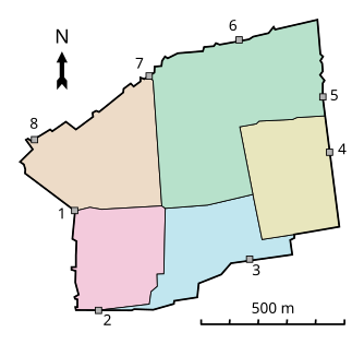
1. Jaffa 2. Zion 3. Dung 4. Golden 5. Lions 6. Herod
7. Damascus 8. New (Double, Single, Tanners')
Al-Mawazin
- Highway 60
- Jaffa Road
- Jericho
Ma'ale HaShalom - Ofel
- Sultan Suleiman
(Sunni Islamic
Grand Mufti)
| Al-Aqsa (Waqf) | |
|---|---|
| Other mosques |
|
(Sephardic/Ashkenazi
Chief Rabbis)
| General | |||
|---|---|---|---|
| Orthodox Jewish |
|
- Remnants or rebuilt buildings in italic
 Israel portal
 Palestine portal
 Christianity portal
 Islam portal
 Judaism portal


