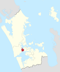
Whau ward
Ward of Auckland in New Zealand
Whau Ward | |
|---|---|
 | |
| Country | New Zealand |
| Island | North Island |
| Region | Auckland Region |
| Area | |
| • Land | 26.82 km2 (10.36 sq mi) |
| Population (June 2023)[2] | |
| • Total | 86,300 |
Whau Ward is an Auckland Council ward which elects one councillor and covers the Whau local board area. The current councillor is Kerrin Leoni.
Demographics
Whau ward covers 26.82 km2 (10.36 sq mi)[1] and had an estimated population of 86,300 as of June 2023,[2] with a population density of 3,218 people per km2.
| Year | Pop. | ±% p.a. |
|---|---|---|
| 2006 | 69,171 | — |
| 2013 | 72,594 | +0.69% |
| 2018 | 79,356 | +1.80% |
| 2023 | 81,273 | +0.48% |
| Source: [3][4] | ||
| Ethnicity | Population |
|---|---|
| New Zealand European | 30,522 |
| Māori | 8,913 |
| Pasifika | 16,050 |
| Asian | 34,332 |
| MELAA | 2,832 |
| Other | 603 |
Whau had a population of 81,273 in the 2023 New Zealand census, an increase of 1,917 people (2.4%) since the 2018 census, and an increase of 8,679 people (12.0%) since the 2013 census. There were 28,800 dwellings. The median age was 35.9 years (compared with 38.1 years nationally). There were 15,255 people (18.8%) aged under 15 years, 16,605 (20.4%) aged 15 to 29, 38,811 (47.8%) aged 30 to 64, and 10,605 (13.0%) aged 65 or older.[4]
Ethnicities were 37.6% European/Pākehā, 11.0% Māori, 19.7% Pasifika, 42.2% Asian, 3.5% Middle Eastern, Latin American and African New Zealanders, and 0.7% other. People may identify with more than one ethnicity.[4]
Whau ward had a population of 79,356 at the 2018 New Zealand census. There were 24,675 households, comprising 39,639 males and 39,717 females, giving a sex ratio of 1.0 males per female.
The percentage of people born overseas was 47.1, compared with 27.1% nationally.
Although some people chose not to answer the census's question about religious affiliation, 36.5% had no religion, 36.5% were Christian, 0.6% had Māori religious beliefs, 10.7% were Hindu, 5.6% were Muslim, 2.3% were Buddhist and 2.6% had other religions.
Of those at least 15 years old, 18,240 (28.3%) people had a bachelor's or higher degree, and 9,210 (14.3%) people had no formal qualifications. The median income was $29,600, compared with $31,800 nationally. 9,174 people (14.3%) earned over $70,000 compared to 17.2% nationally. The employment status of those at least 15 was that 32,553 (50.6%) people were employed full-time, 8,247 (12.8%) were part-time, and 2,871 (4.5%) were unemployed.[3]
Councillors
| Whau Ward councillor of Auckland | |
|---|---|
Incumbent Kerrin Leoni since 2022 | |
| Term length | Three years |
| Inaugural holder | Noelene Raffills |
| Formation | 1 November 2010 |
| Website | www.aucklandcouncil.govt.nz |
| Election | Councillors elected | Affiliation | Votes | Notes |
|---|---|---|---|---|
| 2010 | Noelene Raffills | Citizens & Ratepayers | 7518 | |
| 2013 | Ross Clow | Labour | 6227 | |
| 2016[5] | Ross Clow | Labour | 6895[6] | |
| 2019 | Tracy Mulholland | Communities and Residents | 5853[7] | |
| 2022 | Kerrin Leoni | Labour | 5853[8] |
Election Results
Election Results for the Whau Ward:
2022 Election Results
| Name | Affiliation | Votes | |
|---|---|---|---|
| 1 | Kerrin Leoni | Labour | 8373 |
| Tracy Mulholland | Communities and Residents | 8011 | |
| Blank | 1552 | ||
| Informal | 7 | ||
2019 Election Results
| Name | Affiliation | Votes | |
|---|---|---|---|
| 1 | Tracy Mulholland | Communities and Residents | 5853 |
| Ross Clow | Labour | 5663 | |
| Jessamine Fraser | Green | 2241 | |
| Paul Davie | Community Independents | 1774 | |
| Anna Degia-Pala | Independent | 1336 | |
| Blank | 1168 | ||
| Informal | 66 | ||
References
- ^ a b "ArcGIS Web Application". statsnz.maps.arcgis.com. Retrieved 24 February 2022.
- ^ a b "Subnational population estimates (RC, SA2), by age and sex, at 30 June 1996-2023 (2023 boundaries)". Statistics New Zealand. Retrieved 25 October 2023. (regional councils); "Subnational population estimates (TA, SA2), by age and sex, at 30 June 1996-2023 (2023 boundaries)". Statistics New Zealand. Retrieved 25 October 2023. (territorial authorities); "Subnational population estimates (urban rural), by age and sex, at 30 June 1996-2023 (2023 boundaries)". Statistics New Zealand. Retrieved 25 October 2023. (urban areas)
- ^ a b "Statistical area 1 dataset for 2018 Census". Statistics New Zealand. March 2020. Whau Ward (07606).
- ^ a b c "2023 Census national and subnational usually resident population counts and dwelling counts" (Microsoft Excel). Stats NZ - Tatauranga Aotearoa. Retrieved 29 May 2024.
- ^ "Local body election nominations close". Radio New Zealand. 12 August 2016. Retrieved 8 December 2017.
- ^ "Ward councillors – Whau Ward confirmed" (PDF). Auckland Council. 2016. Retrieved 8 December 2017.
- ^ a b "Local board members" (PDF). Auckland Council. 18 October 2019. Retrieved 21 October 2019.
- ^ a b "Local Elections 2022 - Official Results" (PDF). Auckland Council. 15 October 2022. Archived (PDF) from the original on 17 October 2022. Retrieved 17 October 2022.
- v
- t
- e
Local Boards
Local Subdivisions
| Albany Ward |
| ||||||
|---|---|---|---|---|---|---|---|
| Albert-Eden-Puketāpapa Ward |
| ||||||
| Franklin Ward |
| ||||||
| Howick Ward |
| ||||||
| Manukau Ward |
| ||||||
| Manurewa-Papakura Ward |
| ||||||
| Maungakiekie-Tāmaki Ward |
| ||||||
| North Shore Ward |
| ||||||
| Ōrākei Ward |
| ||||||
| Rodney Ward |
| ||||||
| Waitākere Ward |
| ||||||
| Waitematā and Gulf Ward |
| ||||||
| Whau Ward |
|
- Ambury
- Ātiu Creek
- Auckland Botanic Gardens
- Āwhitu
- Duder
- Glenfern Sanctuary
- Hunua Ranges
- Long Bay
- Mahurangi
- Motukorea Browns Island
- Muriwai
- Mutukaroa / Hamlins Hill
- Ōmana
- Orere Point
- Pākiri
- Scandrett
- Shakespear
- Tāpapakanga
- Tāwharanui
- Tawhitokino
- Te Ārai
- Te Muri
- Te Rau Pūriri
- Waharau
- Waitākere Ranges
- Waitawa
- Wenderholm
- Whakanewha
- Whakatīwai


