Werndorf
Place in Styria, Austria

Coat of arms
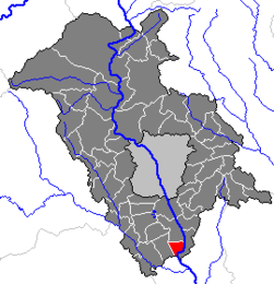
Location within Graz-Umgebung district
(2018-01-01)[2]
8402
steiermark.at
Werndorf is a municipality in the district of Graz-Umgebung in the Austrian state of Styria.
Population
| Year | Pop. | ±% |
|---|---|---|
| 1869 | 336 | — |
| 1880 | 356 | +6.0% |
| 1890 | 340 | −4.5% |
| 1900 | 357 | +5.0% |
| 1910 | 381 | +6.7% |
| 1923 | 556 | +45.9% |
| 1934 | 598 | +7.6% |
| 1939 | 624 | +4.3% |
| 1951 | 738 | +18.3% |
| 1961 | 1,021 | +38.3% |
| 1971 | 1,446 | +41.6% |
| 1981 | 1,555 | +7.5% |
| 1991 | 1,632 | +5.0% |
| 2001 | 2,007 | +23.0% |
| 2008 | 2,116 | +5.4% |
References
- v
- t
- e
Municipalities in the district of Graz-Umgebung
- Deutschfeistritz
- Dobl-Zwaring
- Eggersdorf bei Graz
- Feldkirchen bei Graz
- Fernitz-Mellach
- Frohnleiten
- Gössendorf
- Gratkorn
- Gratwein-Straßengel
- Hart bei Graz
- Haselsdorf-Tobelbad
- Hausmannstätten
- Hitzendorf
- Kainbach bei Graz
- Kalsdorf bei Graz
- Kumberg
- Laßnitzhöhe
- Lieboch
- Nestelbach bei Graz
- Peggau
- Premstätten
- Raaba-Grambach
- Sankt Bartholomä
- Sankt Marein bei Graz
- Sankt Oswald bei Plankenwarth
- Sankt Radegund bei Graz
- Seiersberg-Pirka
- Semriach
- Stattegg
- Stiwoll
- Thal
- Übelbach
- Vasoldsberg
- Weinitzen
- Werndorf
- Wundschuh
Authority control databases | |
|---|---|
| International |
|
| National |
|
 | This Styria location article is a stub. You can help Wikipedia by expanding it. |
- v
- t
- e


