Ward of Auckland in New Zealand
Waitākere Ward |
|---|
|
 |
| Country | New Zealand |
|---|
| Island | North Island |
|---|
| Region | Auckland Region |
|---|
| Area |
|---|
| • Land | 358.95 km2 (138.59 sq mi) |
|---|
| Population |
|---|
| • Total | 187,000 |
|---|
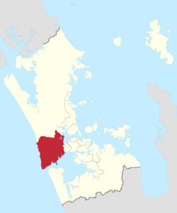
Waitākere Ward is a district of Auckland Council in New Zealand. It consists of the part of the old Waitakere City lying west of a line from Te Atatū Peninsula to Titirangi.
The ward elects two councillors, currently Shane Henderson and Ken Turner, who have oversight of its two local boards, Henderson-Massey and Waitākere Ranges.
Demographics
Waitākere ward covers 358.95 km2 (138.59 sq mi)[1] and had an estimated population of 187,000 as of June 2023, with a population density of 521 people per km2.
Historical population| Year | Pop. | ±% p.a. |
|---|
| 2006 | 144,288 | — |
|---|
| 2013 | 156,081 | +1.13% |
|---|
| 2018 | 170,514 | +1.78% |
|---|
| Source: [3] |
Waitākere ward had a population of 170,514 at the 2018 New Zealand census, an increase of 14,433 people (9.2%) since the 2013 census, and an increase of 26,226 people (18.2%) since the 2006 census. There were 52,704 households, comprising 84,312 males and 86,205 females, giving a sex ratio of 0.98 males per female. The median age was 34.1 years (compared with 37.4 years nationally), with 38,010 people (22.3%) aged under 15 years, 36,177 (21.2%) aged 15 to 29, 78,606 (46.1%) aged 30 to 64, and 17,724 (10.4%) aged 65 or older.
Ethnicities were 56.6% European/Pākehā, 15.8% Māori, 18.1% Pacific peoples, 23.3% Asian, and 3.6% other ethnicities. People may identify with more than one ethnicity.
The percentage of people born overseas was 35.2, compared with 27.1% nationally.
Although some people chose not to answer the census's question about religious affiliation, 44.9% had no religion, 37.6% were Christian, 1.0% had Māori religious beliefs, 4.3% were Hindu, 2.4% were Muslim, 1.6% were Buddhist and 2.2% had other religions.
Of those at least 15 years old, 31,212 (23.6%) people had a bachelor's or higher degree, and 21,096 (15.9%) people had no formal qualifications. The median income was $33,600, compared with $31,800 nationally. 22,464 people (17.0%) earned over $70,000 compared to 17.2% nationally. The employment status of those at least 15 was that 70,071 (52.9%) people were employed full-time, 17,391 (13.1%) were part-time, and 6,114 (4.6%) were unemployed.[3]
Councillors
Election Results
Election Results for the Waitākere Ward:
2022 election results
| | Name | Affiliation | Votes |
| 1 | Shane Henderson | Labour | 16545 |
| 2 | Ken Turner | WestWards | 14654 |
| | Linda Cooper | Independent | 13995 |
| | Shawn Blanchfield | WestWards | 8472 |
| | Peter Chan | Independent | 8199 |
| | Tua Schuster | Independent | 3278 |
| | Aimela Hansen | Independent | 2648 |
| | Michael Coote | Independent | 2550 |
| Blank | 1528 |
| Informal | 61 |
[8]
References
- ^ a b "ArcGIS Web Application". statsnz.maps.arcgis.com. Retrieved 24 February 2022.
- ^ "Subnational population estimates (RC, SA2), by age and sex, at 30 June 1996-2023 (2023 boundaries)". Statistics New Zealand. Retrieved 25 October 2023. (regional councils); "Subnational population estimates (TA, SA2), by age and sex, at 30 June 1996-2023 (2023 boundaries)". Statistics New Zealand. Retrieved 25 October 2023. (territorial authorities); "Subnational population estimates (urban rural), by age and sex, at 30 June 1996-2023 (2023 boundaries)". Statistics New Zealand. Retrieved 25 October 2023. (urban areas)
- ^ a b "Statistical area 1 dataset for 2018 Census". Statistics New Zealand. March 2020. Waitākere Ward (07604).
- ^ "Local body election nominations close". Radio New Zealand. 12 August 2016. Retrieved 3 January 2017.
- ^ a b "Ward councillors – Waitākere Ward confirmed" (PDF). Auckland Council. 2016. Retrieved 9 December 2017.
- ^ "Penny Hulse farewells council life". Our Auckland. Auckland Council. 26 September 2019. Retrieved 21 October 2019.
- ^ a b "Local board members" (PDF). Auckland Council. 18 October 2019. Retrieved 21 October 2019.
- ^ a b c "Local Elections 2022 - Official Results" (PDF). Auckland Council. 15 October 2022. Archived (PDF) from the original on 17 October 2022. Retrieved 17 October 2022.
External links
- Waitākere ward, Auckland Council


