Wabasca 166B
Indian reserve in Bigstone Cree
Wabasca 166B | |
|---|---|
Indian reserve | |
| Wabasca Indian Reserve No. 166B | |
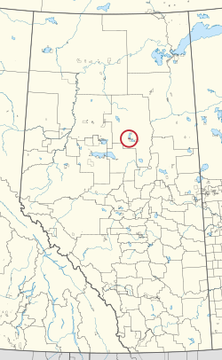 Location in Alberta | |
| First Nation | Bigstone Cree |
| Treaty | 8 |
| Country | Canada |
| Province | Alberta |
| Municipal district | Opportunity |
| Area | |
| • Total | 2,413.4 ha (5,963.6 acres) |
| Population (2016)[2] | |
| • Total | 190 |
| • Density | 7.9/km2 (20/sq mi) |
Wabasca 166B is an Indian reserve of the Bigstone Cree Nation in Alberta, located within the Municipal District of Opportunity No. 17.[3][1] In the 2016 Canadian Census, it recorded a population of 190 living in 43 of its 52 total private dwellings.[2] The community is located on the southern shore of North Wabasca Lake and to the west of the hamlet of Wabasca.[4]
References
- ^ a b "Reserve/Settlement/Village Detail". Crown–Indigenous Relations and Northern Affairs Canada. Government of Canada. Retrieved August 12, 2019.
- ^ a b "Census Profile, 2016 Census". Statistics Canada. February 8, 2017. Retrieved 2019-08-10.
- ^ Government of Alberta (May 25, 2019). Municipal Boundaries (Map). AltaLIS.
- ^ "Google Maps". Google Maps. Retrieved 2021-04-19.
- v
- t
- e

Cultural areas: Plains, Subarctic
- Algic / Algonquian
- Athapascan / Dene
- Siouan
- Nakoda
band governments
| Athabasca Tribal Council (Fort McMurray) | |
|---|---|
| Blackfoot Confederacy (Standoff) | |
| Confederacy of Treaty 6 First Nations (Enoch) | |
| Kee Tas Kee Now Tribal Council (Atikameg) | |
| Lesser Slave Lake Indian Regional Council (Slave Lake) | |
| North Peace Tribal Council (High Level) | |
| Stoney Nakoda - Tsuut'ina Tribal Council (Tsuut'ina) | |
| Tribal Chiefs Ventures (Beaver Lake Cree) | |
| Western Cree Tribal Council (Valleyview) | |
| Yellowhead Tribal Council (Morinville) | |
| Unaffiliated | |
| Not federally recognized |
|
| Not headquartered in Alberta |
|
| Terminated |
|


55°57′31″N 113°57′17″W / 55.9586°N 113.9548°W / 55.9586; -113.9548 (Wabasca 166B)
 | This Northern Alberta location article is a stub. You can help Wikipedia by expanding it. |
- v
- t
- e
 | This article about an Indian reserve in Alberta is a stub. You can help Wikipedia by expanding it. |
- v
- t
- e


