Videira
Place in South, Brazil

Flag

Seal
Capital do Vinho (the Wine Capital)
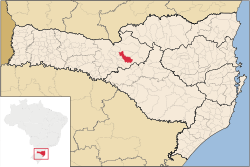
Location of Videira
(2020 [1])
Videira is a city in the state of Santa Catarina in Brazil. The estimated population in 2020 was 53,610 inhabitants. The city is called "Capital do Vinho" (The Wine Capital) in reference to the production of this alcoholic drink. In the past, Videira was one of the major producers of grapes in Brazil. Perdigão Agroindustrial S.A., one of the major food industry conglomerates of Brazil, originated in Videira.
Ângelo Ponzoni Airport serves the city.
Climate
| Climate data for Videira, elevation 779 m (2,556 ft), (1976–2005) | |||||||||||||
|---|---|---|---|---|---|---|---|---|---|---|---|---|---|
| Month | Jan | Feb | Mar | Apr | May | Jun | Jul | Aug | Sep | Oct | Nov | Dec | Year |
| Record high °C (°F) | 34.2 (93.6) | 34.6 (94.3) | 35.0 (95.0) | 32.4 (90.3) | 30.5 (86.9) | 28.4 (83.1) | 30.0 (86.0) | 33.4 (92.1) | 35.1 (95.2) | 34.8 (94.6) | 38.0 (100.4) | 38.8 (101.8) | 38.8 (101.8) |
| Mean daily maximum °C (°F) | 27.8 (82.0) | 27.6 (81.7) | 26.7 (80.1) | 24.2 (75.6) | 21.3 (70.3) | 19.7 (67.5) | 19.9 (67.8) | 21.5 (70.7) | 22.2 (72.0) | 24.3 (75.7) | 26.2 (79.2) | 27.6 (81.7) | 24.1 (75.4) |
| Daily mean °C (°F) | 21.8 (71.2) | 21.6 (70.9) | 20.2 (68.4) | 17.0 (62.6) | 13.7 (56.7) | 12.2 (54.0) | 12.3 (54.1) | 13.6 (56.5) | 15.5 (59.9) | 17.7 (63.9) | 19.4 (66.9) | 21.2 (70.2) | 17.2 (62.9) |
| Mean daily minimum °C (°F) | 16.8 (62.2) | 16.8 (62.2) | 15.3 (59.5) | 11.9 (53.4) | 8.5 (47.3) | 6.9 (44.4) | 6.5 (43.7) | 8.0 (46.4) | 10.0 (50.0) | 12.5 (54.5) | 13.8 (56.8) | 15.8 (60.4) | 11.9 (53.4) |
| Record low °C (°F) | 4.8 (40.6) | 5.2 (41.4) | −3.6 (25.5) | −2.8 (27.0) | −5.4 (22.3) | −8.6 (16.5) | −7.3 (18.9) | −7.2 (19.0) | −3.6 (25.5) | 8.0 (46.4) | 4.0 (39.2) | 2.6 (36.7) | −8.6 (16.5) |
| Average precipitation mm (inches) | 210.0 (8.27) | 188.0 (7.40) | 139.0 (5.47) | 104.0 (4.09) | 128.0 (5.04) | 126.0 (4.96) | 110.0 (4.33) | 102.0 (4.02) | 175.0 (6.89) | 198.0 (7.80) | 148.0 (5.83) | 178.0 (7.01) | 1,806 (71.11) |
| Average relative humidity (%) | 76 | 79 | 80 | 81 | 81 | 81 | 80 | 76 | 75 | 75 | 73 | 74 | 78 |
| Mean monthly sunshine hours | 201 | 167 | 186 | 158 | 157 | 140 | 159 | 165 | 154 | 172 | 203 | 222 | 2,084 |
| Source 1: Empresa Brasileira de Pesquisa Agropecuária (EMBRAPA)[2] | |||||||||||||
| Source 2: Climatempo (precipitation)[3] | |||||||||||||
References
External links
- Official Videira website
- Videira info on official Santa Catarina website
- v
- t
- e


- mesoregions of Santa Catarina
- Grande Florianópolis
- Norte Catarinense
- Oeste Catarinense
- Serrana
- Sul Catarinense
- Vale do Itajaí
- Águas de Chapecó
- Águas Frias
- Bom Jesus do Oeste
- Caibi
- Campo Erê
- Caxambu do Sul
- Chapecó
- Cordilheira Alta
- Coronel Freitas
- Cunha Porã
- Cunhataí
- Flor do Sertão
- Formosa do Sul
- Guatambú
- Iraceminha
- Irati
- Jardinópolis
- Maravilha
- Modelo
- Nova Erechim
- Nova Itaberaba
- Novo Horizonte
- Palmitos
- Pinhalzinho
- Planalto Alegre
- Quilombo
- Saltinho
- Santa Terezinha do Progresso
- Santiago do Sul
- São Bernardino
- São Carlos
- São Lourenço do Oeste
- São Miguel da Boa Vista
- Saudades
- Serra Alta
- Sul Brasil
- Tigrinhos
- União do Oeste
 | This Santa Catarina, Brazil location article is a stub. You can help Wikipedia by expanding it. |
- v
- t
- e


