Trasaghis
Comune in Friuli-Venezia Giulia, Italy
Trasaghis Trasagas (Friulian) | |
|---|---|
Comune | |
| Comune di Trasaghis | |
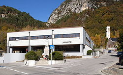 Municipal office | |
Location of Trasaghis  | |
46°17′N 13°5′E / 46.283°N 13.083°E / 46.283; 13.083 | |
| Country | Italy |
| Region | Friuli-Venezia Giulia |
| Province | Udine (UD) |
| Government | |
| • Mayor | Augusto Picco |
| Area | |
| • Total | 77.8 km2 (30.0 sq mi) |
| Elevation | 217 m (712 ft) |
| Population (31 December 2015)[2] | |
| • Total | 2,227 |
| • Density | 29/km2 (74/sq mi) |
| Demonym | Trasaghesi or Trasagani |
| Time zone | UTC+1 (CET) |
| • Summer (DST) | UTC+2 (CEST) |
| Postal code | 33010 |
| Dialing code | 0432 |
| Website | Official website |

Trasaghis (local Friulian: Trasagas) is a comune (municipality) in the Regional decentralization entity of Udine in the Italian region of Friuli-Venezia Giulia, located about 90 kilometres (56 mi) northwest of Trieste and about 25 kilometres (16 mi) northwest of Udine.
Trasaghis borders the following municipalities: Bordano, Cavazzo Carnico, Forgaria nel Friuli, Gemona del Friuli, Osoppo, Vito d'Asio.
References
External links
- Official website
- v
- t
- e
- Aiello del Friuli
- Amaro
- Ampezzo
- Aquileia
- Arta Terme
- Artegna
- Attimis
- Bagnaria Arsa
- Basiliano
- Bertiolo
- Bicinicco
- Bordano
- Buja
- Buttrio
- Camino al Tagliamento
- Campoformido
- Campolongo Tapogliano
- Carlino
- Cassacco
- Castions di Strada
- Cavazzo Carnico
- Cercivento
- Cervignano del Friuli
- Chiopris-Viscone
- Chiusaforte
- Cividale del Friuli
- Codroipo
- Colloredo di Monte Albano
- Comeglians
- Corno di Rosazzo
- Coseano
- Dignano
- Dogna
- Drenchia
- Enemonzo
- Faedis
- Fagagna
- Fiumicello Villa Vicentina
- Flaibano
- Forgaria nel Friuli
- Forni Avoltri
- Forni di Sopra
- Forni di Sotto
- Gemona del Friuli
- Gonars
- Grimacco
- Latisana
- Lauco
- Lestizza
- Lignano Sabbiadoro
- Lusevera
- Magnano in Riviera
- Majano
- Malborghetto Valbruna
- Manzano
- Marano Lagunare
- Martignacco
- Mereto di Tomba
- Moggio Udinese
- Moimacco
- Montenars
- Mortegliano
- Moruzzo
- Muzzana del Turgnano
- Nimis
- Osoppo
- Ovaro
- Pagnacco
- Palazzolo dello Stella
- Palmanova
- Paluzza
- Pasian di Prato
- Paularo
- Pavia di Udine
- Pocenia
- Pontebba
- Porpetto
- Povoletto
- Pozzuolo del Friuli
- Pradamano
- Prato Carnico
- Precenicco
- Premariacco
- Preone
- Prepotto
- Pulfero
- Ragogna
- Ravascletto
- Raveo
- Reana del Rojale
- Remanzacco
- Resia
- Resiutta
- Rigolato
- Rive d'Arcano
- Rivignano Teor
- Ronchis
- Ruda
- San Daniele del Friuli
- San Giorgio di Nogaro
- San Giovanni al Natisone
- San Leonardo
- San Pietro al Natisone
- San Vito al Torre
- San Vito di Fagagna
- Santa Maria la Longa
- Sauris
- Savogna di Cividale
- Sedegliano
- Socchieve
- Stregna
- Sutrio
- Taipana
- Talmassons
- Tarcento
- Tarvisio
- Tavagnacco
- Terzo d'Aquileia
- Tolmezzo
- Torreano
- Torviscosa
- Trasaghis
- Treppo Grande
- Treppo Ligosullo
- Tricesimo
- Trivignano Udinese
- Udine
- Varmo
- Venzone
- Verzegnis
- Villa Santina
- Visco
- Zuglio

| Authority control databases |
|
|---|
 | This article on a location in Friuli-Venezia Giulia is a stub. You can help Wikipedia by expanding it. |
- v
- t
- e


