Tooktocaugee, Alabama
Unincorporated community in Alabama, United States
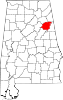
33°41′35″N 85°41′55″W / 33.69306°N 85.69861°W / 33.69306; -85.69861Tooktocaugee was an unincorporated community in Calhoun County, Alabama, United States. Tooktocaugee was formerly the site of a Creek Indian village.[2]
References
- ^ "Tooktocaugee". Geographic Names Information System. United States Geological Survey, United States Department of the Interior.
- ^ "Indian Villages and Forts of the Coosa-Tallapoosa River Region" (PDF). University of Alabama. Retrieved December 29, 2014.
- v
- t
- e
Municipalities and communities of Calhoun County, Alabama, United States
County seat: Anniston
communities
- Minden
- Tooktocaugee
‡This populated place also has portions in an adjacent county or counties
- Alabama portal
- United States portal
 | This Calhoun County, Alabama state location article is a stub. You can help Wikipedia by expanding it. |
- v
- t
- e


