Tianhui 1B
Chinese Earth observation satellite
 Tianhui I-02 | |
| Mission type | Earth observation |
|---|---|
| Operator | CASC |
| COSPAR ID | 2012-020A |
| SATCAT no. | 38256 |
| Start of mission | |
| Launch date | 6 May 2012, 07:10:05 (2012-05-06UTC07:10:05Z) UTC |
| Rocket | Chang Zheng 2D |
| Launch site | Jiuquan LA-4/SLS-2 |
| Orbital parameters | |
| Reference system | Geocentric |
| Regime | Low Earth |
| Perigee altitude | 492 kilometres (306 mi)[1][2] |
| Apogee altitude | 504 kilometres (313 mi)[1][2] |
| Inclination | 97.35 degrees[2] |
| Period | 94.57 minutes[3] |
| Epoch | 6 May 2012[3] |
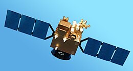
Tian Hui-1 (also known as Mapping Satellite I) is a Chinese Earth observation satellite built by Dong Feng Hong, a China Aerospace Science and Technology Corporation (CASC). Tian Hui-1 was launched on 6 May 2012 at 9:10 UTC on a Long March 2D rocket into a Sun-synchronous, polar orbit with an perigee of 490 km (300 mi) and apogee of 505 km (314 mi).[4]
According to the Chinese Ministry of Defense the new satellite carries scientific experiments and is to be used for the evaluation of ground resources and mapping.[5]
Tian Hui 1 is equipped with two different camera systems in the visible and infrared range. The visible light camera is able to produce three-dimensional pictures in the spectral region between 510 and 690 nanometers with a dissolution of approximately 5 meters and a field of view of approximately 25 degrees. The infrared camera reaches a dissolution of approximately 10 meters and covers four wavelengths (430 - 520 Nm, 520 - 610 Nm, 610 - 690 Nm and 760 - 900 Nm).[5]
References
- ^ a b "TH 1". Gunters Space Page. Retrieved 8 March 2013.
- ^ a b c "TianHui 1B". Space New Feed. Space News Feed.
- ^ a b McDowell, Jonathan. "Satellite Catalog". Jonathan's Space Page. Retrieved 3 May 2018.
- ^ "Chinese Mapping Satellite Successfully Launched to Orbit". Space.com. 8 May 2012. Retrieved 8 March 2013.
- ^ a b "China launches Tianhui-1B via Long March 2D". NASA spaceflight. 6 May 2012. Retrieved 8 March 2013.
 Spaceflight portal
 China portal


- v
- t
- e
- Edoardo Amaldi ATV
- Intelsat 22
- Kosmos 2479
- Apstar 7
- USA-234
- Kwangmyŏngsŏng-3
- Progress M-15M
- YahSat-1B
- RISAT-1
- Compass-M3, Compass-M4
- USA-235
- Tianhui 1B
- Yaogan 14, Tiantuo 1
- Soyuz TMA-04M
- JCSAT-13, Vinasat-2
- Kosmos 2480
- Shizuku, Kompsat 3, SDS-4, Horyu 2
- Nimiq 6
- SpaceX COTS Demo Flight 2, New Frontier
- Fajr
- ChinaSat 2A
- Yaogan 15
- Intelsat 19
- NuSTAR
- Shenzhou 9
- USA-236 / Quasar 18
- USA-237 / Orion 8
- EchoStar XVII, MSG-3
- SES-5
- Soyuz TMA-05M
- Kounotori 3 (Raiko, We-Wish, Niwaka, TechEdSat, F-1)
- Kanopus-V1, BelKA-2, Zond-PP, TET-1, exactView-1
- Tianlian I-03
- Gonets-M No.3, Gonets-M No.4, Kosmos 2481, MiR
- Progress M-16M (Sfera-53)
- Intelsat 20, HYLAS 2
- Telkom-3, Ekspress-MD2
- Intelsat 21
- RBSP-A, RBSP-B
- USA-239
- SpaceX CRS-1, Orbcomm-2
- David, Sif
- Shijian 9-01, Shijian 9-02
- Intelsat 23
- Soyuz TMA-06M
- Compass G6
- Progress M-17M
Launches are separated by dots ( • ), payloads by commas ( , ), multiple names for the same satellite by slashes ( / ).
Crewed flights are underlined. Launch failures are marked with the † sign. Payloads deployed from other spacecraft are (enclosed in parentheses).
Crewed flights are underlined. Launch failures are marked with the † sign. Payloads deployed from other spacecraft are (enclosed in parentheses).


