Stickleyville, Virginia
Unincorporated community in Virginia, United States
Census-designated place in Virginia, United States
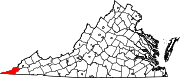
36°42′25″N 82°54′26″W / 36.70694°N 82.90722°W / 36.70694; -82.90722Stickleyville is an unincorporated community and census-designated place (CDP) in Lee County, Virginia, United States. It has also been known as Stickleysville. The community was first listed as a CDP for the 2020 census.
The community is concentrated along U.S. Route 421 near the Lee County/Scott County line in the Wallen Creek Valley. Duffield lies across Powell Mountain to the east, and Pennington Gap lies across Wallen Ridge to the northwest.
A post office was established as Stickleysville in 1850.[3] The community was named for Vastine Stickley, a pioneer settler.[4]
References
- ^ "2020 U.S. Gazetteer Files –Virginia". United States Census Bureau. Retrieved February 17, 2021.
- ^ U.S. Geological Survey Geographic Names Information System: Stickleyville, Virginia
- ^ "Lee County". Jim Forte Postal History. Retrieved September 30, 2014.
- ^ Tennis, Joe (2004). Southwest Virginia Crossroads: An Almanac of Place Names and Places to See. The Overmountain Press. p. 17. ISBN 978-1-57072-256-1.
- v
- t
- e
Municipalities and communities of Lee County, Virginia, United States
County seat: Jonesville
- Jonesville
- Pennington Gap
- Dryden
- Ewing
- Keokee
- Rose Hill
- St. Charles
- Stickleyville
communities
- Benedict-Leona Mines
- Ben Hur
- Blackwater
- Bonny Blue
- Boons Path
- Buckles
- Bundy
- Calvin
- Caylor
- Darbyville
- Darnell Town
- Ely
- Fleenortown
- Gibson Station
- Goodloe
- Hagan
- Hubbard Springs
- Imperial
- Jasper
- Leona Mines
- Maness
- Mayflower
- Mohawk
- Monarch
- Ocoonita
- Olinger
- Penn Lee
- Rawhide
- Seminary
- Shepherd Hill
- Sigma
- Smiley
- Stone Creek
- Turners Siding
- Van
- Wheeler
- Woodway
- Virginia portal
- United States portal
 | This Lee County, Virginia state location article is a stub. You can help Wikipedia by expanding it. |
- v
- t
- e


