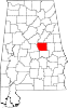
Stewartville, Coosa County, Alabama
Census-designated place in Alabama, United States
33°04′45″N 86°14′40″W / 33.07917°N 86.24444°W / 33.07917; -86.24444 (2020)
Stewartville is a census-designated place and unincorporated community in Coosa County, Alabama, United States. Its population was 1,662 as of the 2020 census.
Demographics
| Census | Pop. | Note | %± |
|---|---|---|---|
| 2020 | 1,662 | — | |
| U.S. Decennial Census[3] | |||
2020 census
| Race | Num. | Perc. |
|---|---|---|
| White (non-Hispanic) | 1,533 | 92.24% |
| Black or African American (non-Hispanic) | 60 | 3.61% |
| Native American | 5 | 0.3% |
| Other/Mixed | 49 | 2.95% |
| Hispanic or Latino | 15 | 0.9% |
As of the 2020 United States census, there were 1,662 people, 605 households, and 449 families residing in the CDP.
References
- ^ "2020 U.S. Gazetteer Files". United States Census Bureau. Retrieved October 29, 2021.
- ^ "Stewartville". Geographic Names Information System. United States Geological Survey, United States Department of the Interior.
- ^ "Census of Population and Housing". Census.gov. Retrieved June 4, 2016.
- ^ "Explore Census Data". data.census.gov. Retrieved December 18, 2021.
- v
- t
- e
Municipalities and communities of Coosa County, Alabama, United States
County seat: Rockford
communities
‡This populated place also has portions in an adjacent county or counties
- Alabama portal
- United States portal
 | This Coosa County, Alabama state location article is a stub. You can help Wikipedia by expanding it. |
- v
- t
- e


