State Square
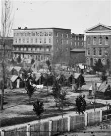

State Square was the central square of antebellum Atlanta, Georgia. The original Atlanta Union Depot designed by Edward A. Vincent stood in the middle of the square. The square was bounded by Marietta Street (now Decatur Street) on the northeast, Pryor Street on the northwest, Loyd Street (now Central Avenue) on the southeast, and Alabama Street on the south. The square was surrounded by Atlanta's most important buildings including the hotels Atlanta, Trout House, and Washington Hall, the Atlanta Bank, retail stores, and warehouses.The area is now almost entirely taken up by parking lots and parking garages, with a portion occupied by the Georgia State University College of Education, MARTA rail line, and retail and office space lining the north side of Alabama Street.[1]
References
- ^ Google Maps
- Robert Scott Davis, Civil War Atlanta, p.20
- M. Thomas Inge, High Times and Hard Times, p.86
- Seignious v. Metropolitan Atlanta Rapid Transit Authority and Cotter et al. v. Metropolitan Atlanta Rapid Transit Authority, Georgia caselaw
- ATLhistory.com
- v
- t
- e
History of Atlanta
- Standing Peachtree
- Historic districts
- Buildings listed on National Register: (Atlanta in Fulton Co.)
- (Atlanta in DeKalb Co.)
- Demolished buildings
- Demolished public housing projects
- Atlanta Campaign
- Atlanta in the Civil War
- Battle of Atlanta
- Battle of Ezra Church
- Battle of Jonesborough
- Battle of Kennesaw Mountain
- Battle of Peachtree Creek
- Battle of Utoy Creek
- Burning of Atlanta
- Stone Mountain
- Race massacre (1906)
- Ripper (1911)
- Leo Frank lynching (1915)
- Temple bombing (1958)
- Peyton Road affair (1962–1963)
- Child murders (1979–1981)
- Prison riots (1987)
- Centennial Olympic Park bombing (1996)
- Otherside Lounge bombing (1997)
- Day trading firm shootings (1999)
- Shooting of Kathryn Johnston (2006)
- Public schools cheating scandal (2009–2015)
- Shooting of Scout Schultz (2017)
- Ransomware attack (2018)
- Killing of Rayshard Brooks (2020)
- Spa shootings (2021)
- Northside Hospital shooting (2023)
- Great Atlanta Fire (1917)
- Winecoff Hotel fire (1946)
- Air France Flight 007 crash (1962)
- Bluffton University bus crash (2007)
- Tornado strikes downtown (2008)
- Interstate 85 bridge collapse (2017)
- Timeline
- International Cotton Exposition (1881)
- Piedmont Exposition (1887)
- Cotton States and International Exposition (1895)
- Gone with the Wind premiere (1939)
- Funeral of Martin Luther King Jr. (1968)
- Atlanta International Pop Festival (1969, 1970)
- Democratic National Convention (1988)
- Super Bowl XXVIII (1994)
- World Series (1991, 1992, 1995, 1996, 1999, 2021)
- Summer Olympics (1996)
- WrestleMania XXVII (2011)
- Super Bowl LIII (2019)
- Washerwomen strike (1881)
- Fulton Bag and Cotton Mills strike (1914–1915)
- Streetcar strike (1916)
- Transit strike (1950)
- Scripto strike (1964–1965)
- Sanitation strike (1977)
- Sanitation strike (2018)
- School bus drivers' strike (2018)
- Library perversion case (1953)
- Lonesome Cowboys police raid (1969)
- Atlanta Pride (1971)
- Atlanta Eagle police raid (2009)
- History by neighborhood
- Former neighborhoods and settlements
- Annexations and city wards
- Street names
- History of Georgia Tech
- Historic mills
- Zero Mile Post
- Atlanta sit-ins (1960-1961)
- Freeway revolts
- Occupy Atlanta (2011–2012)
- George Floyd protests (2020)
- Stop Cop City (2021–present)
- History of Atlanta
- Timeline of Atlanta history
33°45′10″N 84°23′20″W / 33.7529138°N 84.388902°W / 33.7529138; -84.388902
 | This U.S. state of Georgia road or road transport-related article is a stub. You can help Wikipedia by expanding it. |
- v
- t
- e


