Shinozaki Station
Metro station in Tokyo, Japan
 Bus terminal

| Preceding station |  Toei Subway Toei Subway | Following station | ||
|---|---|---|---|---|
| Mizue S19 towards Shinjuku | Shinjuku Line Local | Motoyawata S21 Terminus | ||
Location | |
|---|---|
  Shinozaki Station Location within Special wards of Tokyo Show map of Special wards of Tokyo Shinozaki Station Shinozaki Station (Tokyo Bay and Bōsō Peninsula) Show map of Tokyo Bay and Bōsō Peninsula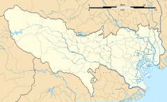 Shinozaki Station Shinozaki Station (Tokyo) Show map of Tokyo Shinozaki Station Shinozaki Station (Japan) Show map of Japan |
Shinozaki Station (Japanese: 篠崎駅, Hepburn: Shinozaki-eki) is a railway station in Edogawa, Tokyo, Japan. Its station number is S-20. The station is the easternmost station in Tokyo. The station opened on 14 September 1986.
Lines
Shinozaki Station is served by the Toei Shinjuku Line and is 20.7 km from the terminus at Shinjuku. Only local services stop at this station, except on the first Saturday in August, where express trains stop at this station to provide service to the Edogawa fireworks festival.
Platforms
Shinozaki Station consists of a single island platform served by two tracks.
| 1 | S Shinjuku Line | for Bakuro-yokoyama, Shinjuku KO Keio Line for Sasazuka, Hashimoto and Takaosanguchi |
| 2 | S Shinjuku Line | for Motoyawata |
-
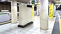 Platforms

History
Shinozaki Station opened on 14 September 1986 as the terminus of the Toei Shinjuku Line. It became an intermediate station on 19 March 1989 when the extension to Motoyawata opened. The west gate (Twin Place side) of the station opened on 20 May 2008. Platform screen doors were brought into service on 19 May 2018.
Surrounding area
The station is located underground just north of National Route 14 (Keiyō Road) and the Shuto Expressway's No. 7 Komatsugawa Line. Commercial and shopping facilities are clustered around the station, but the remainder is primarily residential. The Edogawa River is approximately 1 kilometer northeast. Other points of interest include:
- Edogawa Grounds
- Tokyo Metropolitan Shinozaki High School
- Edogawa Municipal Shinozaki Junior High School
- Edogawa Municipal Shinozaki 2nd Junior High School
- Edogawa Municipal Shinozaki Elementary School
- Kōtsu Kaikan Shinozaki Building
- Shinozaki Twin Place
Connecting bus service
Keisei Bus: Shinozaki-Eki
- Shino 01: for Edogawa City Hall
- Shinko 71: for Shin-Koiwa Station, Mizue Station
- Ko 72: for Edogawa Sports Land, Koiwa Station
Toei Bus: Shinozaki-Ekimae
- Funa 28: for Funabori Station
References
- ^ "Shinozaki Station information" (in Japanese). Tokyo Metropolitan Bureau of Transportation. Archived from the original on 2010-02-03. Retrieved February 24, 2010.
External links
- Tokyo Metropolitan Bureau of Transportation: Shinozaki Station (in Japanese)
 Media related to Shinozaki Station at Wikimedia Commons
- v
- t
- e

| Komatsugawa Area |
|
|---|---|
| Matsue Area |
|
| Mizue Area |
|
| Kasai Area |
|
| Kamoto Area |
|
| Shinozaki Area |
|
| Koiwa Area |
|

- Edogawa
- Funabori
- Hirai
- Ichinoe
- Kasai
- Kasai-Rinkai Park
- Keisei Koiwa
- Koiwa
- Mizue
- Nishi-Kasai
- Shinozaki
This list is incomplete.
35°42′22″N 139°54′13″E / 35.705979°N 139.903741°E / 35.705979; 139.903741


