Sant'Erasmo
Island in Northern Italy
Italy
Sant'Erasmo is an island in the Venetian Lagoon lying north-east of the Lido island and east of Venice, Italy.
History
The island was a port attached to Murano in the 8th century, but is now known for market gardening. Ruined fortifications, including the so-called Torre Massimiliana (Tower of Maximilian), ring the isle. Forts existed in the island as early as the 16th century. After the fall of the Republic of Venice, the French built here a stronghold in 1811–1814. After Napoleon's defeat, the Austrian Archduke Maximilian of Austria-Este had a tower built here in 1843–1844, and also found here refuge during a revolt. The tower has a polygonal base of 25 m and is surrounded by a ditch. On the upper floor up to 13 cannons could be housed. It was used by the Italian Army as late as World War I.
Today
An annual boat race takes place during the summer. Sant'Erasmo is also known for the waders on sand banks in the lagoon surrounding it. The beach on the island's Southernmost point, the Spiaggia del Bacan, is a popular summer destination with local Venetians. The island is accessed on Actv waterbus line 13 (Fondamente Nove-Murano-Vignole-Lazzaretto Nuovo-Sant'Erasmo-Treporti) and is also served by a night service.
Gallery
-
 Church
 -
 Fort
Fort -
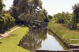 Brown and narrow canals of the island
 -
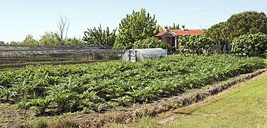 Artichoke plantations.
 -
 Beach, south end of the island of Sant'Erasmo.


See also
Wikivoyage has a travel guide for Sant'Erasmo.
References
Portals:
 Geography
 Islands
 Italy
Italy


- v
- t
- e
Islands of the Venetian Lagoon
- Buel del Lovo
- Burano
- Crevan
- Cason Montiron
- Isola dei Laghi
- La Certosa
- La Cura
- Madonna del Monte
- Mazzorbo
- Mazzorbetto
- Monte dell'Oro
- Motta dei Cunicci
- Motta di San Lorenzo
- Murano
- Salina
- San Francesco del Deserto
- San Giàcomo in Paludo
- San Michele
- Lazzaretto Nuovo
- Santa Cristina
- Sant'Andrea
- Sant'Ariano
- Sant'Erasmo
- Torcello
- Vignole
- Giudecca
- Sacca Fisola
- Sacca San Biagio
- San Giorgio Maggiore
- San Pietro di Castello
- San Secondo
- Sant'Elena
- Tronchetto
- Venice
Authority control databases | |
|---|---|
| International |
|
| National |
|


