Sandau
Town in Saxony-Anhalt, Germany

Coat of arms
Location of Sandau within Stendal district

(2021–28) Claudia Lange[1]
(2022-12-31)[2]
39524
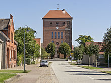
Sandau is a town in the district of Stendal, in Sachsen-Anhalt, Germany. It is situated on the right bank of the Elbe, approx. 5 km (3.1 mi) south of Havelberg. It is part of the Verbandsgemeinde ("collective municipality") Elbe-Havel-Land.
The Sandau Ferry, a cable ferry across the Elbe, connects Sandau to Büttnershof.

References
- v
- t
- e
Towns and municipalities in the district of Stendal
- Aland
- Altmärkische Höhe
- Altmärkische Wische
- Arneburg
- Bismark
- Eichstedt
- Goldbeck
- Hassel
- Havelberg
- Hohenberg-Krusemark
- Iden
- Kamern
- Klietz
- Osterburg
- Rochau
- Sandau
- Schollene
- Schönhausen
- Seehausen
- Stendal
- Tangerhütte
- Tangermünde
- Werben (Elbe)
- Wust-Fischbeck
- Zehrental

Authority control databases | |
|---|---|
| International |
|
| National |
|
 | This Stendal district location article is a stub. You can help Wikipedia by expanding it. |
- v
- t
- e


