Rooiberg
Place in Limpopo, South Africa
24°46′34″S 27°44′17″E / 24.776°S 27.738°E / -24.776; 27.738 (2011)[1]
0500
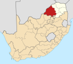
Rooiberg is a town in Waterberg District Municipality in the Limpopo province of South Africa.
Town, archaeological site and tin-mining area, 50 km west-north-west of Warmbad, at the conjunction of the Springbok Flats with the Waterberg Plateau. The name is Afrikaans for ‘red mountain’.[2]
References
- ^ a b c d "Sub Place Rooiberg". Census 2011.
- ^ "Dictionary of Southern African Place Names (Public Domain)". Human Science Research Council. p. 391.
- v
- t
- e
Municipalities and communities of Waterberg District Municipality, Limpopo
District seat: Nylstroom (Modimolle)
- Amandelbult
- Middeldrift
- Northam
- Rooiberg
- Swartklip
- Thabazimbi
- Abbotspoort
- Ellisras (Lephalale)
- Onverwacht
- Villa Nora
- Alma
- Nylstroom (Modimolle)
- Naboomspruit (Mookgophong)
- Roedtan
- Vaalwater
- Warmbaths (Bela-Bela)
- Pienaarsrivier
- Eseldrift
- Lyden
- Ga-Tshipana
- Mahwelereng
- Wisconcin (Matsitsileng)
- Potgietersrus (Mokopane)
- Mosesetjane
- Sterkwater
- Tshamahansi
- Jakkalskuil
- Kabeane
- Bakenberg
| Authority control databases |
|
|---|
 | This Limpopo location article is a stub. You can help Wikipedia by expanding it. |
- v
- t
- e


