Rico, Colorado
Town in Colorado, United States
Town in State of Colorado, United States
37°41′32″N 108°1′51″W / 37.69222°N 108.03083°W / 37.69222; -108.03083 United States
 State of Colorado
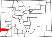
 (2020)[7]
81332
Rico is a town in Dolores County, Colorado, United States. It was settled in 1879 as a silver mining center in the Pioneer Mining District; today it functions as a historic and tourism site. The population was 288 at the 2020 census.[7] Its current form of government is that of a home rule municipality.
Rico is a name derived from Spanish meaning "rich".[9]
Geography
Rico is located in eastern Dolores County at 37°41′32″N 108°1′51″W / 37.69222°N 108.03083°W / 37.69222; -108.03083 (37.692095, -108.030839),[10] in the valley of the Dolores River. Colorado State Highway 145 passes through the town as it follows the river, leading southwest 48 miles (77 km) to Cortez and northeast over Lizard Head Pass 27 miles (43 km) to Telluride.
According to the U.S. Census Bureau, the town of Rico has an area of 0.8 square miles (2.0 km2), all of it land.[11]
Climate
Rico experiences an alpine subarctic climate (Köppen climate classification Dfc) with long, cold, very snowy winters and short, cool summers due to the high altitude and high precipitation year-round due to orographic lift.[citation needed]
| Climate data for RICO, COLORADO | |||||||||||||
|---|---|---|---|---|---|---|---|---|---|---|---|---|---|
| Month | Jan | Feb | Mar | Apr | May | Jun | Jul | Aug | Sep | Oct | Nov | Dec | Year |
| Mean daily maximum °F (°C) | 38.2 (3.4) | 39.9 (4.4) | 43.4 (6.3) | 50.5 (10.3) | 60.7 (15.9) | 70.6 (21.4) | 75.4 (24.1) | 73.2 (22.9) | 66.6 (19.2) | 58.2 (14.6) | 45.8 (7.7) | 39.5 (4.2) | 55.2 (12.9) |
| Mean daily minimum °F (°C) | 5.2 (−14.9) | 7.6 (−13.6) | 13.4 (−10.3) | 20.9 (−6.2) | 28.2 (−2.1) | 33.7 (0.9) | 40.3 (4.6) | 39.6 (4.2) | 32.7 (0.4) | 24.8 (−4.0) | 14.8 (−9.6) | 7.2 (−13.8) | 22.4 (−5.4) |
| Average precipitation inches (mm) | 2.48 (63) | 2.15 (55) | 2.44 (62) | 1.81 (46) | 1.65 (42) | 1.31 (33) | 2.78 (71) | 2.91 (74) | 2.31 (59) | 2.13 (54) | 2.01 (51) | 2.27 (58) | 26.27 (667) |
| Average snowfall inches (cm) | 32.1 (82) | 26.5 (67) | 30.8 (78) | 18.5 (47) | 6.0 (15) | 0.1 (0.25) | 0 (0) | 0 (0) | 0.5 (1.3) | 7.6 (19) | 21.5 (55) | 26.2 (67) | 171 (430) |
| Source: The Western Regional Climate Center [12] | |||||||||||||
Demographics
| Census | Pop. | Note | %± |
|---|---|---|---|
| 1880 | 894 | — | |
| 1890 | 1,134 | 26.8% | |
| 1900 | 811 | −28.5% | |
| 1910 | 368 | −54.6% | |
| 1920 | 326 | −11.4% | |
| 1930 | 447 | 37.1% | |
| 1940 | 388 | −13.2% | |
| 1950 | 212 | −45.4% | |
| 1960 | 353 | 66.5% | |
| 1970 | 275 | −22.1% | |
| 1980 | 76 | −72.4% | |
| 1990 | 92 | 21.1% | |
| 2000 | 205 | 122.8% | |
| 2010 | 265 | 29.3% | |
| 2020 | 288 | 8.7% |

Transportation
Rico is part of Colorado's Bustang network. It is on the Durango-Grand Junction Outrider line.[13] Rico was a water stop on the Rio Grande Southern Railroad, the storied narrow gauge line running from Ridgway to Durango until the railroad was abandoned in 1952. The water tank used to refill the tenders of the steam locomotives still stands on the west side of the former grade, 73 years since it was last used.
See also
 Geography portal
 North America portal
 United States portal
 Colorado portal
 Mountains portal


References
- ^ a b "Active Colorado Municipalities". State of Colorado, Department of Local Affairs. Archived from the original on February 2, 2007. Retrieved September 1, 2007.
- ^ "Colorado Municipal Incorporations". State of Colorado, Department of Personnel & Administration, Colorado State Archives. December 1, 2004. Retrieved September 2, 2007.
- ^ "Town Hall". Rico Colorado. Retrieved December 12, 2018.
- ^ "State Representative". State of Colorado. Retrieved January 3, 2024.
- ^ "2019 U.S. Gazetteer Files". United States Census Bureau. Retrieved July 1, 2020.
- ^ "US Board on Geographic Names". United States Geological Survey. October 25, 2007. Retrieved January 31, 2008.
- ^ a b United States Census Bureau. "Rico town, Colorado". Retrieved April 5, 2023.
- ^ "ZIP Code Lookup". United States Postal Service. Archived from the original (JavaScript/HTML) on December 14, 2006. Retrieved December 24, 2007.
- ^ Dawson, John Frank. Place names in Colorado: why 700 communities were so named, 150 of Spanish or Indian origin. Denver, CO: The J. Frank Dawson Publishing Co. p. 43.
- ^ "US Gazetteer files: 2010, 2000, and 1990". United States Census Bureau. February 12, 2011. Retrieved April 23, 2011.
- ^ "Geographic Identifiers: 2010 Demographic Profile Data (G001): Rico town, Colorado". U.S. Census Bureau, American Factfinder. Retrieved October 15, 2015.[dead link]
- ^ "RICO, COLORADO (057017)". Retrieved December 18, 2015.
- ^ "Bustang Schedule". RideBustang. CDOT.
External links
Wikimedia Commons has media related to Rico, Colorado.
- Town of Rico official website
- CDOT map of the Town of Rico
- Marty Durlin, "A Rico Renaissance", High Country News, February 18, 2008
- v
- t
- e
Municipalities and communities of Dolores County, Colorado, United States
County seat: Dove Creek
- Dove Creek
- Rico
communities
- Colorado portal
- United States portal
Authority control databases | |
|---|---|
| International |
|
| National |
|
| Other |
|


