Rhosnesni
Area of Wrexham, Wales
Human settlement in Wales
- Acton
- Wrexham
- Wrexham
- Wrexham
Rhosnesni (Welsh pronunciationⓘ) is an area and electoral ward in the community of Acton in Wrexham, Wrexham County Borough, Wales.[1] The population of the ward at the 2011 census was 3,683.[2] The settlement developed around the toll gate on Holt Road (the cottage of which still stands) and was expanded in the late 19th century by the addition of estate houses for the Acton Park estate. Following the breakup of the Acton estate in the 20th century much of the local land was bought up by private developers and Rhosnesni became an urban area.[3]

Rhosnesni High School is situated in the area.[4]
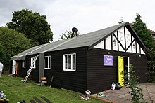
1st Rhosnesni Scout Group and K2 Explorer Scout Unit meet in the Scout hut which dates from the 1920s.[5]
References
- ^ "Wrexham County Borough Electoral Divisions Map". wrexham.gov.uk.
- ^ "Ward population 2011". neighbourhood.statistics.gov.uk. Retrieved 19 November 2015.
- ^ The Encyclopedia of Wrexham, W. Alister Williams, 2001, Bridge Books
- ^ "Ysgol Rhosnesni, Wrexham". Ysgol Rhosnesni.
- ^ "1st Rhosnesni Scout Group". clwydscouts.org.uk.
External links
Wikimedia Commons has media related to Rhosnesni.
- Wrexham County Borough Electoral Divisions Map - WCBC
- v
- t
- e
- Acton and Maesydre
- Borras Park
- Brynyffynnon
- Cartrefle
- Erddig
- Garden Village
- Grosvenor
- Gwenfro
- Hermitage
- Little Acton
- Offa
- Queensway
- Rhosnesni
- Smithfield
- Stansty
- Whitegate
 Wales
Wales


