Queens Pound River
River in New South Wales, Australia
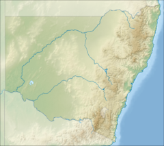

Location of mouth in New South Wales
• location
• elevation
Queens Pound River, a partly perennial river of the Tuross River catchment, is located in the upper ranges of the South Coast region of New South Wales, Australia.
Course and features
Queens Pound River rises on the northern slopes of the Kybeyan Range within Wadbilliga National Park, southwest of the locality of Yowrie and flows generally north and northwest, before reaching its confluence with the Wadbilliga River near the locality of Wadbilliga. The river descends 887 metres (2,910 ft) over its 14 kilometres (8.7 mi) course.[2]
See also
 New South Wales portal

- Rivers of New South Wales
- List of rivers of New South Wales (L–Z)
- List of rivers of Australia
References
- ^ "Queens Pound River". Geographical Names Register (GNR) of NSW. Geographical Names Board of New South Wales. Retrieved 31 May 2013.

- ^ a b "Map of Queens Pound River, NSW". Bonzle Digital Atlas of Australia. Retrieved 31 May 2013.
External links
- "Tuross River catchment" (map). Office of Environment and Heritage. Government of New South Wales.
- v
- t
- e
Rivers of the Southern Rivers catchment, New South Wales, Australia
- Lake Illawarra
- Minnamurra
- Port Kembla
- Corang
- Endrick
- Jerrabattgulla
- Kangaroo
- Mongarlowe
- Shoalhaven
- St Georges Basin
- Crooked
- Araluen
- Back
- Bettowynd
- Bimberamala
- Buckenbowra
- Clyde
- Deua
- Moruya
- Queens Pound
- Tomaga
- Tuross
- Wadbilliga
- Yadboro
- Yowaka
- Yowrie
 Category

| |
|---|---|
| Cities | |
| Towns & Townships |
|
| Local government areas | |
| National parks | |
| Rivers and other waterbodies |
|

36°19′S 149°38′E / 36.317°S 149.633°E / -36.317; 149.633
This New South Wales river or creek related article is a stub. You can help Wikipedia by expanding it. |
- v
- t
- e


