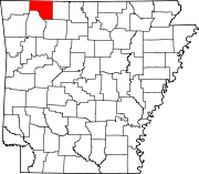
Prairie Township, Carroll County, Arkansas
Township in Arkansas, United States
36°20′27.79″N 93°35′6.28″W / 36.3410528°N 93.5850778°W / 36.3410528; -93.5850778 United States
 Arkansas
 (2010)
72616 (Berryville)
Prairie Township is one of twenty-one current townships in Carroll County, Arkansas, USA.[1] As of the 2010 census, its total population was 7,555.
Prairie Township was formed prior to 1870; the exact date is unknown since county records were lost.[2]
Geography
According to the United States Census Bureau, Prairie Township covers an area of 70.850 square miles (183.50 km2); 70.706 square miles (183.13 km2) of land and 0.144 square miles (0.37 km2) of water.
Cities, towns, villages, and CDPs
- Berryville (part)
References
- United States Census Bureau 2008 TIGER/Line Shapefiles
- United States Board on Geographic Names (GNIS)
- United States National Atlas
- Census 2010 U.S. Gazetteer Files: County Subdivisions in Arkansas
External links
- US-Counties.com
- City-Data.com
- v
- t
- e
Municipalities and communities of Carroll County, Arkansas, United States
County seats: Berryville and Eureka Springs
communities
‡This populated place also has portions in an adjacent county or counties
- Arkansas portal
- United States portal
 | This Arkansas state location article is a stub. You can help Wikipedia by expanding it. |
- v
- t
- e


