Pottsville, Kentucky
Unincorporated community in Kentucky, United States
Unincorporated community in Kentucky, United States
36°51′18″N 88°43′45″W / 36.85500°N 88.72917°W / 36.85500; -88.72917 United States
 Kentucky
42051
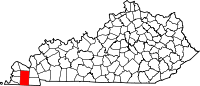
Pottsville is an unincorporated community in Graves County, Kentucky, United States.[1]
References
- ^ "Feature Detail Report for: Pottsville, Kentucky." USGS. U.S. Geological Survey Geographic Names Information System: Pottsville, Kentucky Retrieved May 11, 2011.
- v
- t
- e
Municipalities and communities of Graves County, Kentucky, United States
County seat: Mayfield
- Mayfield
- Wingo
communities
‡This populated place also has portions in an adjacent county or counties
- Kentucky portal
- United States portal
 | This Graves County, Kentucky state location article is a stub. You can help Wikipedia by expanding it. |
- v
- t
- e


