Plano, Missouri
Unincorporated community in Missouri
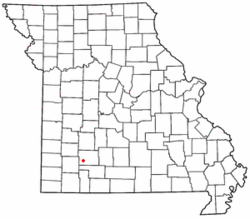
Plano is an unincorporated community on former U.S. Route 66, now Route 266 in Greene County, Missouri, United States. The community is part of the Springfield, Missouri Metropolitan Statistical Area.
A post office called Plano was established in 1895, and remained in operation until 1903.[1] The name most likely is a transfer from Plano, Texas.[2] Little remains of the original community.[3]
References
- ^ "Post Offices". Jim Forte Postal History. Retrieved October 3, 2016.
- ^ "Greene County Place Names, 1928–1945 (archived)". The State Historical Society of Missouri. Archived from the original on June 24, 2016. Retrieved October 3, 2016.
{{cite web}}: CS1 maint: bot: original URL status unknown (link) - ^ "The true story about the ruins at Plano, Mo". December 5, 2013.
37°11′34″N 93°33′03″W / 37.1928°N 93.5508°W / 37.1928; -93.5508
- v
- t
- e
Municipalities and communities of Greene County, Missouri, United States
County seat: Springfield
- Ash Grove
- Battlefield
- Fair Grove
- Republic‡
- Rogersville‡
- Springfield‡
- Strafford
- Walnut Grove
- Willard

- Brookline
- Cass
- Clay
- East Republic
- Murray
- Pond Creek
- Springfield
- Taylor
- Walnut Grove
- Washington
- West Republic
- Wilson
communities
‡This populated place also has portions in an adjacent county or counties
- Missouri portal
- United States portal
 | This Greene County, Missouri state location article is a stub. You can help Wikipedia by expanding it. |
- v
- t
- e


