Petaluma River
River in California, United States
38°18′18″N 122°43′3″W / 38.30500°N 122.71750°W / 38.30500; -122.71750[1] • location
• coordinates
• elevation
The Petaluma River is a river in the California counties of Sonoma and Marin[1] that becomes a tidal slough for most of its length. The headwaters are in the area southwest of Cotati. The flow is generally southward through Petaluma's old town, where the waterway becomes navigable, and then flows another 10 mi (16 km) through tidal marshes before emptying into the northwest corner of San Pablo Bay.
History

The word Petaluma may derive from the Miwok words pe’ta, flat, and luma, back. The Miwok people lived in Sonoma County for more than 2500 years. Petaluma was the name of a village on a low hill east of Petaluma creek and north east of the present day town of Petaluma. The first recorded exploration of the Petaluma River was by Captain Fernando Quiros in October, 1776. While other members of his Spanish expedition collected adobe and timber for the new Presidio of San Francisco and for the Mission San Francisco de Asís (Mission Dolores), Quiros and his sailors tried unsuccessfully to sail from San Pablo Bay to Bodega Bay.[2] Petaluma River was named Petaluma Creek until the early 1960s.[3]
Petaluma River Watershed
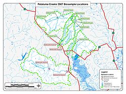
Located in southern Sonoma County, California, and a portion of northeastern Marin, the Petaluma River Watershed drains 146 square miles (380 km2).[4] The watershed is approximately 19 miles (31 km) long and 13 miles (21 km) wide with the City of Petaluma near its center. At 2,295 feet (700 m), Sonoma Mountain is the highest point in the watershed, and its western slopes drain to the Petaluma River by way of tributaries such as Lichau Creek, Lynch Creek, Washington Creek, and Adobe Creek. The lower 12 miles (19 km) of the Petaluma River flow through the Petaluma Marsh, the largest remaining salt marsh in San Pablo Bay. The marsh covers 5,000 acres (20 km2) and is surrounded by approximately 7,000 acres (28 km2) of reclaimed wetlands.[4] In the marshes west of Lakeville, the river is joined by San Antonio Creek, at which point it becomes the boundary between Marin County and Sonoma County. The river flows under State Route 37 at Green Point and enters northwest San Pablo Bay just north of Petaluma Point.
While the river's source lies over 300 ft (100 m) above sea level, it descends to 50 ft (15 m) within about 0.4 mi (600 m). The river is fully tidal 11 mi (18 km) from its mouth, indicating its slight gradient through the marshes below Petaluma. The United States Army Corps of Engineers dredges this section to keep it navigable by gravel barges and pleasure craft.
Ecology
The Petaluma River Watershed hosts several federally endangered animals including the salt marsh harvest mouse (Reithrodontomys raviventris), the North American river otter (Lontra canadensis), and Ridgway's rail (Rallus obsoletus). Endangered flora include soft bird’s-beak (Cordylanthus mollis ssp. mollis), Baker’s stickyseed (Blennosperma bakeri), Burke’s goldfields (Lasthenia burkei), showy Indian clover (Trifolium amoenum), and Sebastopol meadowfoam (Limnanthes vinculans).[4]
Steelhead (Oncorhyncus mykiss) that spawn and rear in the Petaluma River watershed are wild, not hatchery, stock.[5] Chinook salmon (Oncorhynchus tshawytscha) are seen in the main stem of the Petaluma River and The United Anglers of Casa Grande High School have seen chinook at the turning basin, near the Lynch Creek confluence. The high school students constructed a salmonid hatchery in 1993[6] and in 2002 74 Chinook salmon returned to spawn in the Adobe Creek tributary.[7]
Habitat and pollution

The marshes provide an important wildlife habitat and fish hatchery. However, since the onset of intensive immigration in the mid-1850s, the water quality has diminished, partly due to overgrazing and other agricultural uses. Pollutants present in the river include nitrates, phosphates, petroleum hydrocarbons, pesticides and sediment.[8] Urban runoff, particularly from the City of Petaluma, adds heavy metals and hydrocarbons to the river.[9] Starting about 1990, material steps were taken to mitigate the pollution.
Because the Petaluma River is relatively well-protected, most of the pollution comes from nearby storm drains. It is up to the people of Petaluma to keep the river clean.
Because most of the length of the waterway is tidal and urban/suburban, there is a significant collection of tidally deposited debris along the banks. Despite the poor aesthetics including turbidity, the water quality is not particularly poor.[10]
It has been alleged that the greatest threat to the Petaluma River is the planned Dutra asphalt plant. The reported concerns involve the "loud noises it will create" that will scare away the birds and "throw off the entire ecosystem".[11]
Bridges
The following bridges span the Petaluma River moving upstream from San Pablo Bay through Petaluma: the Black Point Railroad Bridge (NWP), California State Route 37, Haystack Landing Bridge (NWP), U.S. 101, D Street, Washington Street, Lakeville Street, NWP, Payran Street, NWP, Oak Drive, Corona Road, Petaluma Boulevard North, and Rainsville Road.[12] The longest highway span, the 4-lane Route 37 bridge, is 2,183 ft (665 m) long and was built in 1958. The oldest public bridge, built in 1925, is a 114 ft (35 m) concrete triple span carrying two lanes of Petaluma Boulevard North.[13]
Removal and replacement of the U.S. Route 101 highway bridge over the river began in 2013. The existing bridge was an 866 feet long, twin reinforced concrete box girder bridge (with a pre-cast I girder span over the river) that was built in 1955. It had two lanes of traffic in each direction, limited sight lines, and no shoulders. The new bridge is a 907 feet long, precast, post-tensioned spliced concrete girder design with three lanes of traffic in each direction and standard shoulders.[14] Construction completed in mid-2016.[15]
See also
- Endangered species
- List of rivers in California
- List of watercourses in the San Francisco Bay Area
- Wetland
References
- ^ a b c d U.S. Geological Survey Geographic Names Information System: Petaluma River
- ^ Adair Heig (1982). History of Petaluma, A California River Town. San Francisco, California: Scottwall Associates.
- ^ "PETALUMA RIVER, CA | USGS Store". store.usgs.gov. Retrieved May 2, 2024.
- ^ a b c The Southern Sonoma County Resource Conservation District (July 1999). Petaluma Watershed Enhancement Plan (Report). The State Water Resources Control Board. Retrieved June 24, 2010.
- ^ Prunuske Chatham, Inc. (February 1999). Fisheries Enhancement Opportunities in the Petaluma River Watershed (PDF) (Report). Southern Sonoma County Resource Conservation District. Retrieved June 24, 2010.
- ^ Malcolm MacConnell (1999). "Miracle at Adobe Creek". Reader's Digest. Archived from the original on July 5, 2010. Retrieved June 24, 2010.
- ^ "Project Highlights". United Anglers of Casa Grande High School. 2001. Archived from the original on July 5, 2010. Retrieved June 24, 2010.
- ^ "Petaluma River Water Quality Profile" (PDF). ca.gov. Retrieved April 10, 2018.
- ^ Kay Ransom, C. Michael Hogan, Ballard George et al., Environmental Impact Report for the Petaluma General Plan, prepared by Earth Metrics Inc. for the city of Petaluma (1986)
- ^ California, City of Petaluma IT Division, State of. "Petaluma". cityofpetaluma.net. Retrieved April 10, 2018.
{{cite web}}: CS1 maint: multiple names: authors list (link) - ^ "Stop the New Dutra Asphalt Plant in Petaluma". nopetalumaasphaltplant.com. Retrieved April 10, 2018.
- ^ Sonoma County Street Guide and Directory. Irvine, California: Thomas Brothers Maps. 1994. pp. 176, 183, 184, 191, 192, 196, 197&199. ISBN 0-88130-738-6.
- ^ "National Bridge Inventory Database".
- ^ "Caltrans District 4 | MSN 101 Petaluma Blvd South Interchange and Petaluma Bridge Project Interstate 116 Interchange Project". June 9, 2013. Archived from the original on June 9, 2013. Retrieved June 7, 2023.
- ^ "Birders hopeful for return of swallows to Petaluma bridge". Petaluma Argus-Courier. March 25, 2016. Retrieved June 7, 2023.
External links
- Petaluma Wetlands Alliance
- real-time measurements
- LIVE Blue Heron Nesting Camera Petaluma River, Petaluma, CA
- PRBO Conservation Science (based in Petaluma)
- v
- t
- e

- Major
- San Francisco Bay
- Suisun Bay
- San Pablo Bay
- Minor
- Golden Gate
- Grizzly Bay
- Richardson Bay
- San Rafael Bay
- Richmond Inner Harbor
- San Leandro Bay
- Former
- Yerba Buena Cove
- Mission Bay
- Rivers
- San Joaquin
- Sacramento
- Napa
- Guadalupe
- Petaluma
- Creeks (discharging into the Bay)
- Alameda
- Baxter
- Cerrito
- Codornices
- Coyote (Santa Clara)
- Coyote (Marin)
- San Leandro
- San Lorenzo
- Schoolhouse
- Temescal
- Sausal
- Redwood
- San Mateo
- Sonoma
- Corte Madera
- Arroyo Corte Madera del Presidio
- San Rafael
- Miller
- Novato
- Tolay
- San Francisquito
- Pacheco
- Alhambra
- Adobe
- Rodeo
- Refugio
- Pinole
- Garrity
- Rheem
- Karlson
- San Pablo
- Castro
- Wildcat
- Fluvius Innominatus
- Marin (Alameda County)
- Strawberry
- Easton
- Mission Creek
- Reservoirs
- Calaveras Reservoir
- Lafayette Reservoir
- Straits and estuaries
- Clifton Court Forebay
- Carquinez Strait
- Oakland Estuary
- Raccoon Strait
- Sacramento–San Joaquin River Delta
- Stockton Deepwater Shipping Channel
- Watersheds
- Laguna Creek Watershed
- Guadalupe watershed
protected areas
- Don Edwards National Wildlife Refuge
- San Pablo Bay National Wildlife Refuge
- Eden Landing Ecological Reserve
- Hayward Regional Shoreline
- Hayward Shoreline Interpretive Center
- Crown Memorial State Beach
- McLaughlin Eastshore State Park
- Emeryville Crescent State Marine Reserve
- Point Isabel Regional Shoreline
- César Chávez Park
- Brooks Island Regional Preserve
- Point Pinole Regional Shoreline
- Antioch Dunes National Wildlife Refuge
- Coyote Point Recreation Area
- Middle Harbor Shoreline Park
- National Estuarine Research Reserve
- China Camp State Park
- San Francisco Maritime National Historical Park
- SF Bay Trail
- Oyster Bay Regional Shoreline
- Big Break Regional Shoreline
- Palo Alto Baylands Nature Preserve
peninsulas
- Major islands
- Alameda
- Alcatraz
- Angel
- Treasure Island
- Yerba Buena
- Minor
- Brooks
- Bair
- Bay Farm
- Belvedere
- Brother
- Castro Rocks
- Coast Guard
- Greco
- Hooks Island
- Mare
- Red Rock
- The Sisters
- Marin Islands
- Roe
- Ryer
- Seal Islands
- Peninsulas/infill
- Albany Bulb
- Brisbane Baylands
- Point Isabel
- Foster City
- Fleming Point
- Hunters Point
- Sierra Point
- Steamboat Point
and tubes
marinas
- History
- Delta and Dawn
- Discovery Site
- Humphrey the Whale
- San Leandro Oyster Beds
- Richmond Shipyards
- U.S. Army Corps of Engineers Bay Model
- Harold Gilliam
- Marincello
- Ecology
- Golden Gate Biosphere Reserve
- Cosco Busan oil spill
- Thicktail chub
- Delta smelt
- Conservation and Development Commission
- The Watershed Project
- Save The Bay
- Citizens for East Shore Parks
- Friends of Five Creeks
- Urban Creeks Council
- 1971 oil spill
- Greenbelt Alliance
- The Bay Institute
- Reber Plan
- San Francisco Baykeeper
- San Francisco Estuary and Watershed Science
- Estuary Partnership
- Transportation
- Water Trail
- Transportation in the San Francisco Bay Area
 Portal
 Category


| Authority control databases: National |
|
|---|


