Parker River National Wildlife Refuge
42°44′43″N 70°48′28″W / 42.74528°N 70.80778°W / 42.74528; -70.80778Area4,662 acres (18.87 km2)Established1942Governing bodyU.S. Fish and Wildlife ServiceWebsiteParker River National Wildlife Refuge
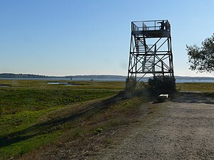
Observation tower
The Great Marsh

Parker River National Wildlife Refuge is a wildlife sanctuary encompassing the majority of Plum Island in northeastern Essex County, Massachusetts, 5 miles southeast of Newburyport. It was established in 1942 primarily to provide feeding, resting, and nesting habitats for migratory birds. Located along the Atlantic Flyway, the refuge is of vital stopover significance to waterfowl, shorebirds, and songbirds during migratory periods.

In 1985, The Trust for Public Land added 12 acres to the refuge. Besides providing habitat for birds and wildlife, the pristine coastal habitat is enjoyed by visitors who come to swim, hike, surf, fish, and birdwatch.[1]

Features and location

The refuge includes the mouth of the Parker River, which drains the mainland on the other side of Plum Island Sound. The refuge also includes the southern three-quarters of Plum Island, an 8-mile (13 km) long barrier island off the coast of mainland Essex County. The southern tip of the island, however, belongs to Sandy Point State Reservation. Trails and observation stations are scattered throughout the refuge. Included in the refuge is Plum Island Sound and all the smaller islands within it, and the mouth of the Plum Island River on the Plum Island Sound side only. The marsh in and around the winding channels of the rivers is known as Great Marsh, which has a much greater area than the refuge.

Hiking, jogging and cycling along Plum Island Drive only is permitted any time the refuge is open. Photography is permitted from any location open to the public. Beach locations may be visited over boardwalks out of nesting season. Trailers and licensed fishing are permitted on the beach in the autumn. Access is via roads through the dunes. Licensed deer hunting is permitted for one day of the year up to a maximum limit of kills. The process is controlled by the park employees and volunteers. Seasonal licensed commercial shellfishing is permitted at one location where a stream through the marsh bends close to the island. Licensed seasonal wildfowl hunting is permitted in a special area on the right bank of the Parker River. It must be accessed from the mainland side. New visitor facilities offering exhibits and programs are located on the mainland bordering Plum Island Airport. Any other activities within the refuge are strictly forbidden; the brochure presents a long list.

The refuge consists of 4,662 acres (18.87 km2) of diverse habitats including sandy beach and dune, shrub/thicket, bog, swamp, freshwater marsh, saltwater marsh and associated creek, river, mudflat, and newly created salt pannes. These and other refuge habitats support varied and abundant populations of resident and migratory wildlife including more than 300 species of birds and additional species of mammals, reptiles, amphibians, insects, and plants.

The ecology of the island, however, is not in its original state, due to earlier draining of Great Marsh by parallel channels and destabilization of the dunes by overuse. Much of the inland side of the island was cleared for farming. The farmers also used the marsh grass for haying and pasturing animals. In the waters, the chemical pollution of the Merrimack River and the damming of its stream at a number of locations totally changed the character of the fish and the bird species that fed on them. Even today coastal currents from the Merrimack in flood deposit unacceptable levels of debris on the beach, which are typically removed in public campaigns.

The creation of the reservation involved the purchase and evacuation of the farmland, the stabilization of the dunes by planting Black Pine, an intrusive Alpine species, and the enhancement of biodiversity by the creation of artificial fresh-water pools on the inland side. More recently heavy equipment was used to replace the parallel channels with unconnected pools in some places, recreating the original marsh. Since the prohibition of the public from the beach in the summer, seals from the Atlantic have been basking there.

See also

Attribution

Public Domain This article incorporates public domain material from websites or documents of the United States Fish and Wildlife Service.

References

  1. ^ "Plum Island, Parker River National Wildlife Refuge".

External links

Wikimedia Commons has media related to:
Parker River National Wildlife Refuge (category)
  • Official page at the U.S. Fish and Wildlife Service
  • The short film Parker River National Wildlife Refuge (2006) is available for free viewing and download at the Internet Archive.
  • v
  • t
  • e
National Historical Parks
National Historic Sites
Other National Park Service Units
National Wildlife Refuges
Wild and Scenic Rivers
Other Protected Areas
Parks
Reservations
Other
Wildlife
Management Areas
  • Agawam Lake
  • Agawam Mill Pond
  • Ashby
  • Ashfield Hawley
  • Attitash
  • Ayer Game Farm
  • Baddacook Pond
  • Bakers Pond
  • Bay Circuit Trail
  • Bearse Pond
  • Becket
  • Bennett
  • Birch Hill
  • Black Brook
  • Blackstone / West River
  • Bolton Flats
  • Boxboro Station
  • Brayton Point Salt Marsh
  • Breakneck Brook
  • Brewer Brook
  • Bullock Ledge
  • Burrage Pond
  • Canoe River
  • Catamount
  • Chalet
  • Chase Garden Creek Salt Marsh
  • Childs River
  • Chockalog Swamp
  • Church Homestead
  • Clapps Pond
  • Clinton Bluff
  • Concord River
  • Connecticut River
  • Cook Pond
  • Copicut
  • Coy Hill
  • Crane Pond
  • Cummington
  • Cusky Pond
  • Dartmoor Farm
  • Darwin Scott Memorial
  • Day Mountain
  • Deerfield River
  • Dogfish Bar Beach Coastal
  • Dolomite Ledges
  • Dunstable Brook
  • E. Kent Swift
  • Eagle Island
  • East Mountain
  • Eastham Salt Marsh
  • Elbow Meadow
  • English Salt Marsh
  • Eugene D. Moran
  • Facing Rock
  • Fairfield Brook
  • Farmington River
  • Fish Brook
  • Fisherville Pond
  • Fisk Forestdale Lot
  • Fisk Meadows
  • Five Mile River
  • Flagg Swamp
  • Flint Pond
  • Four Chimneys
  • Fox Den
  • Fox Island Salt Marsh
  • Frances A. Crane
  • George L. Darey Housatonic Valley
  • Glen Echo Lake
  • Gosnold
  • Grassy Pond (Dennis)
  • Grassy Pond (Plymouth)
  • Green River Access (Franklin County)
  • Green River (Berkshire County)
  • Greenfield River
  • Halfway Pond
  • Hamilton
  • Hancock
  • Harlow / Cooks Pond
  • Haskell Swamp
  • Hauk Swamp
  • Hawksnest State Park
  • Hawley
  • Head Of The Plains
  • Herman Covey
  • High Ridge
  • Hinsdale Flats
  • Hiram H. Fox
  • Hockomock Swamp
  • Hog Pond Lot
  • Honey Pot
  • Hoosatonic River
  • Hoosic River
  • Hop Brook
  • Housatonic River
  • Hubbard Brook
  • Hunting Hills
  • Hyannis Ponds
  • Ipswich River
  • John J. Kelly
  • Joint Base Cape Cod
  • Jug End
  • Jug End Fen
  • Kampoosa Fen
  • Katama Plains
  • Knops Pond
  • Konkapot River
  • Lackey Pond
  • Lake Lorraine
  • Lake Rohunta
  • Lake Snipatuit
  • Lake Warner
  • Lanesboro
  • Lawrence Brook
  • Lawrence Pond Lot
  • Leadmine
  • Leyden
  • Lilly Pond
  • Little Alum Pond
  • Long Sought For Pond
  • Maple Hill
  • Maple Springs
  • Martha Deering
  • Martin H. Burns
  • Mascuppic Lake
  • Mashpee Pine Barrens
  • Mashpee Pond Lot
  • Mashpee River
  • Mckinstry Brook
  • Meetinghouse Swamp
  • Merrill Pond
  • Miacomet Heath
  • Mill Brook Bogs
  • Mill River
  • Millers River
  • Mine Brook
  • Montague
  • Montague Plains
  • Moose Brook Access
  • Moose Brook
  • Moose Hill
  • Mossy Pond
  • Mount Watatic Reservation
  • Mt. Esther
  • Mt. Toby Highlands
  • Mt. Toby
  • Mt. Tom
  • Muddy Brook
  • Muddy Pond
  • Mulpus Brook
  • Nashua River
  • Natty Brook
  • Nemasket River
  • Nissitissit River
  • Noquochoke
  • Nordeen Marsh
  • North Brookfield
  • North Shore Salt Marsh
  • Northboro
  • Oakham
  • Olivers Pond
  • Orange
  • Otis
  • Packard Pond
  • Palmer
  • Pantry Brook
  • Pauchaug Brook
  • Peru
  • Peterson Swamp
  • Phillipston
  • Podunk Marsh
  • Poland Brook
  • Popple Camp
  • Popponesset Spit
  • Poutwater Pond
  • Powell Brook
  • Prince River
  • Provincetown Route 6 Corridor
  • Purchade Brook
  • Quaboag
  • Quacumquasit
  • Quag Pond Bog
  • Quashnet River
  • Quashnet Woods State Reservation
  • Quinapoxet River
  • Quinsigamond Marsh
  • Quisset
  • Raccoon Hill
  • Rainbow Beach
  • Red Brook
  • Richardson
  • Robbins Pond
  • Rochester
  • Rocky Gutter
  • Rowe
  • Salisbury Salt Marsh
  • Salisbury Salt Marsh WMA
  • Sandwich Game Farm
  • Sandy Pond
  • Satan's Kingdom
  • Savage Hill
  • Savoy
  • Sawmill River
  • Scorton Creek Coastal
  • SE Mass Bioreserve
  • Sevenmile River
  • Shattuck Brook
  • Sheperds Island
  • Shubael Pond
  • Sibley Brook
  • Sly Pond
  • South Barrier Beach
  • South Meadow Pond
  • South Shore Salt Marsh
  • South Triangle Pond
  • Southampton
  • Southwick
  • Spectacle Pond
  • Springhill Lot
  • Sputtermill Pond
  • Squannacook River
  • Stafford Hill
  • Sudbury River
  • Sunderland Islands
  • Taconic Mountain
  • Taunton River Access
  • Taunton River
  • Tekoa Mountain
  • Thad Ellis
  • Thayer Pond
  • Three Mile Pond
  • Townsend
  • Townsend Hill
  • Trapfall Brook
  • Triangle Pond
  • Tully Brook
  • Tully Mountain
  • Tully River
  • Wakeby Pond
  • Wales
  • Walnut Hill
  • Ware River
  • Warwick
  • Wendell
  • West Meadows
  • Westboro
  • Westfield River
  • Westfield
  • Weymouth Back River
  • Whately Great Swamp
  • Whately Ponds
  • Whately
  • Wilbraham Game Farm
  • William Forward
  • Williams River
  • Williamsburg
  • Winimusset
  • Wolf Swamp
Wildlife
Sanctuaries
  • Billingsgate Island
  • Carr Island
  • E. Howe Forbush
  • Egg Rock
  • Grace A. Robson
  • J.C. Phillips
  • Knight
  • Penikese Island
  • Ram Island (Mattapoisett)
  • Ram Island (Salisbury)
  • Susan B. Minns
  • Tarpaulin Cove
  • Watatic Mountain
  • Black Pond Bog
  • Boat Meadow
  • Francis Newhall Woods
  • Grassy Pond
  • Greene Swamp
  • Halfway Pond Island
  • Hawley Bog
  • Hockomock Swamp
  • Hoft Farm
  • Homer-Watcha
  • Katama Plains
  • McElwain-Olsen
  • Miacomet Moors
  • Reed Brook
  • Roger and Virginia Drury
  • Sandy Neck
  • David H. Smith Preserve and Fire Trail
  • Stacy Mountain
  • Tatkon
Other
  • v
  • t
  • e
Authority control databases Edit this at Wikidata
International
  • VIAF
National
  • Israel
  • United States