Pallasca Province
Province in Ancash, Peru

Flag
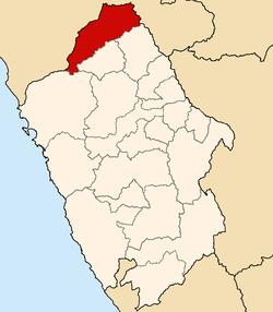
Location of Pallasca in the Ancash Region
The Pallasca Province (from Quechua Pallasqa) is one of 20 provinces of the Ancash Region in Peru.
Geography
One of the highest peaks of the province is Utkhu Qucha at approximately 4,600 m (15,100 ft). Other mountains are listed below:[1]
- Allqu Maka
- Amaru
- Chawpi Qucha
- Chunta
- Hatun Hirka
- Kiswar
- Lasu
- Llama
- Mankha Qutu
- Minas Urqu
- Parya Chuku
- Parya Qucha
- Puma Sallqa
- P'iti Qucha
- Sapallu
- Sinqa
- Tawlli
- Tuku Wayin
- Tullu Kancha
- Urqun
- Wachu Mach'ay
- Wamani
- Wanaku
- Wawra
- Wiqu Runtu
- Wira Wira
- Yuraq Yaku
Some of the lakes of the district are Challwaqucha, Kinwaqucha, Llamaqucha, Paryaqucha, Pusaqqucha, P'itiqucha, T'uruqucha and Wayq'uqucha.
Political division
Pallasca is divided into eleven districts, which are:
- Bolognesi
- Cabana
- Conchucos
- Huacaschuque
- Huandoval
- Lacabamba
- Llapo
- Pallasca
- Pampas
- Santa Rosa
- Tauca
References
- ^ http://escale.minedu.gob.pe/ UGEL map Pallasca Province (AncashRegion)

Authority control databases | |
|---|---|
| International |
|
| National |
|
8°24′00″S 78°01′59″W / 8.40000°S 78.03306°W / -8.40000; -78.03306
 | This Ancash Region geography article is a stub. You can help Wikipedia by expanding it. |
- v
- t
- e


