Oswego, Montana
Unincorporated community in Montana, United States
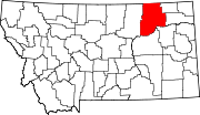
48°3′31″N 105°52′52″W / 48.05861°N 105.88111°W / 48.05861; -105.88111Oswego /ɒsˈwiːɡoʊ/ is an unincorporated community in Valley County, Montana, United States.[1] It is located along U.S. Route 2 between the cities of Frazer and Wolf Point. Oswego is located on the Fort Peck Indian Reservation.
History

Settled sometime in the 1890s, the village was named after Oswego, New York, the hometown of some early-day settlers.[2] A post office was located there from 1896 until 1971.[citation needed] On September 11,1971 one of the worst prairie fires in northeastern Montana destroyed much of Oswego, leaving only 4 homes untouched. The entire population of Oswego was forced to evacuate, and of those 75 residents only about 40 of them returned to live and rebuild.[citation needed]Recently a day ago Wildfires started again but more farther south
Transportation
Amtrak’s Empire Builder, which operates between Seattle/Portland and Chicago, passes through the small town on BNSF tracks, but makes no stop. The nearest station is located in Wolf Point, 12 miles (19 km) to the east.Its located on US Route 2
References
- ^ a b c U.S. Geological Survey Geographic Names Information System: Oswego, Montana
- ^ Compiled and Written by the Federal Writers' Project of the Work Projects Administration for the State of Montana (1939). "Oswego, Montana". Montana: A State Guide Book. Retrieved January 27, 2007.
External links
- MTLinks - Oswego, Montana
- v
- t
- e
Municipalities and communities of Valley County, Montana, United States
County seat: Glasgow
communities
‡This populated place also has portions in an adjacent county or counties
- Montana portal
- United States portal
 | This Valley County, Montana state location article is a stub. You can help Wikipedia by expanding it. |
- v
- t
- e


