North Hampton, St. Louis
Neighborhood of St. Louis in Missouri, United States
North Hampton | |
|---|---|
Neighborhood of St. Louis | |
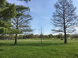 Tilles Park in the North Hampton neighborhood of St. Louis in May 2018 | |
 Location (red) of North Hampton within St. Louis | |
| Country | United States |
| State | Missouri |
| City | St. Louis |
| Wards | 10, 23, 24 |
| Area | |
| • Total | 0.92 sq mi (2.4 km2) |
| Population (2020)[1] | |
| • Total | 7,489 |
| • Density | 8,100/sq mi (3,100/km2) |
| ZIP code(s) | Parts of 63109, 63139 |
| Area code(s) | 314 |
| Website | stlouis-mo.gov |
North Hampton is a neighborhood of St. Louis, Missouri. Located in St. Louis, North Hampton is bounded by Scanlan and Connecticut to the north, South Kingshighway Boulevard to the east, Chippewa Street to the south, and Hampton Avenue to the west.
Two smaller neighborhoods make up North Hampton. The Tilles Park neighborhood occupies the area from Hampton Avenue to Macklind Avenue, and the Kingshighway Hills neighborhood occupies the area from Macklind Avenue to South Kingshighway Boulevard.
Tilles Park
The 29-acre (120,000 m2) Tilles Park was created by city ordinance 48569 in 1956. It was named after Andrew Tilles, a wealthy business man of the early 20th century. There is also a Tilles Park in St. Louis County.[2]
Demographics
| Census | Pop. | Note | %± |
|---|---|---|---|
| 1990 | 7,708 | — | |
| 2000 | 8,097 | 5.0% | |
| 2010 | 7,892 | −2.5% | |
| 2020 | 7,489 | −5.1% | |
| Sources:[3][4] | |||
In 2020, Northampton's racial makeup was 71.4% White, 15.9% Black, 0.3% Native American, 4.2% Asian, 6.8% Two Or More Races, and 1.5% Some Other Race. 4.6% of the population was of Hispanic or Latino origin.[5]
References
External links
- Kingshighway Hills Neighborhood Association
- Tilles Park Neighborhood Association
- v
- t
- e
- Academy
- Baden
- Benton Park
- Benton Park West
- Bevo Mill
- Botanical Heights
- Boulevard Heights
- Carondelet
- Carr Square
- Central West End
- Cheltenham
- Chinatown (defunct since 1966)
- Clayton/Tamm
- Clifton Heights
- College Hill
- Columbus Square
- Compton Heights
- Covenant Blu Grand Center
- DeBaliviere Place
- "Dogtown"
- Downtown
- Downtown West
- Dutchtown
- Ellendale
- Fairground
- Forest Park Southeast
- Fountain Park
- Fox Park
- Franz Park
- Gate District
- Gravois Park
- Greater Ville
- Hamilton Heights
- The Hill
- Hi-Pointe
- Holly Hills
- Hyde Park
- JeffVanderLou
- Kings Oak
- Kingsway East
- Kingsway West
- Kosciusko
- Lafayette Square
- LaSalle Park
- Lewis Place
- Lindenwood Park
- Marine Villa
- Mark Twain
- Mark Twain/I-70 Industrial
- McKinley Heights
- Midtown
- Mill Creek Valley (defunct since 1960s)
- Mount Pleasant
- Near North Riverfront
- Northampton
- North Point
- North Riverfront
- O'Fallon
- Old North St. Louis
- Patch
- Peabody–Darst–Webbe
- Penrose
- Princeton Heights
- Riverview
- Shaw
- Skinker DeBaliviere
- Soulard
- Southampton
- Southwest Garden
- St. Louis Hills
- St. Louis Place
- Tiffany
- Tower Grove East
- Tower Grove South
- Vandeventer
- The Ville
- Visitation Park
- Walnut Park East
- Walnut Park West
- Wells/Goodfellow
- West End
- Wydown/Skinker
38°35′55″N 90°16′51″W / 38.5986°N 90.2808°W / 38.5986; -90.2808
 | This St. Louis location article is a stub. You can help Wikipedia by expanding it. |
- v
- t
- e


