Ngqeleni
Place in Eastern Cape, South Africa
31°40′12″S 29°01′41″E / 31.670°S 29.028°E / -31.670; 29.028 (2011)[1]
5140
5140
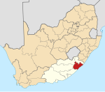
Ngqeleni is a town in OR Tambo District Municipality in the Eastern Cape province of South Africa.
Village in West Pondoland, 32 km southeast of Umtata and about 40 km north-north-west of Coffee Bay. The name is derived from the Xhosa ngqele, ‘cold’ or ‘frost’. Coldstream, which flows past it, may have a name translated from Ngqeleni, ‘at the cold’."[2]
References
- ^ a b c d "Main Place Ngqeleni". Census 2011.
- ^ "Dictionary of Southern African Place Names (Public Domain)". Human Science Research Council. p. 335.
- v
- t
- e
Municipalities and communities of OR Tambo District Municipality, Eastern Cape
District seat: Mthatha
- Buntingville
- Canzibe
- Libode
- Ngqeleni
- Nomcamba
 | This Eastern Cape location article is a stub. You can help Wikipedia by expanding it. |
- v
- t
- e


