National Register of Historic Places listings in St. Francis County, Arkansas

This is a list of the National Register of Historic Places listings in St. Francis County, Arkansas.
This is intended to be a complete list of the properties on the National Register of Historic Places in St. Francis County, Arkansas, United States. The locations of National Register properties for which the latitude and longitude coordinates are included below, may be seen in a map.[1]
There are 15 properties listed on the National Register in the county.
This National Park Service list is complete through NPS recent listings posted May 10, 2024.[2]
Map all coordinates using OpenStreetMap
Download coordinates as:
- KML
- GPX (all coordinates)
- GPX (primary coordinates)
- GPX (secondary coordinates)
Current listings
| [3] | Name on the Register[4] | Image | Date listed[5] | Location | City or town | Description |
|---|---|---|---|---|---|---|
| 1 | Blackfish Lake Ferry Site | Upload image | April 10, 2003 (#03000195) | Address Restricted | New Shady Grove | A Trail of Tears site[6] |
| 2 | Scott Bond Family Plot | Upload image | June 6, 2002 (#02000603) | 0.3 miles west of 5th St. on Highway 70, W. 35°00′45″N 90°43′53″W / 35.0125°N 90.731389°W / 35.0125; -90.731389 (Scott Bond Family Plot) | Madison | |
| 3 | Campbell House |  | December 21, 2006 (#06000841) | 305 N. Forrest St. 35°00′49″N 90°47′03″W / 35.013611°N 90.784167°W / 35.013611; -90.784167 (Campbell House) | Forrest City | |
| 4 | First United Methodist Church |  | May 19, 1994 (#94000467) | 101 S. Izard St. 35°00′33″N 90°47′01″W / 35.009167°N 90.783611°W / 35.009167; -90.783611 (First United Methodist Church) | Forrest City | |
| 5 | Forrest City City Hall | Upload image | May 11, 2022 (#100007718) | 224 North Rosser St. 35°00′38″N 90°47′13″W / 35.0105°N 90.7870°W / 35.0105; -90.7870 (Forrest City City Hall) | Forrest City | |
| 6 | Forrest City Colored Cemetery | Upload image | September 21, 2021 (#100007000) | SFC Rd. 702, south of U.S. Route 70, west of Margaret Dr., east of Union Pacific RR 35°00′32″N 90°46′16″W / 35.0089°N 90.7712°W / 35.0089; -90.7712 (Forrest City Colored Cemetery) | Forrest City | |
| 7 | Forrest City High School | Upload image | October 8, 1992 (#92001341) | Rosser St. 35°00′59″N 90°47′21″W / 35.016389°N 90.789167°W / 35.016389; -90.789167 (Forrest City High School) | Forrest City | |
| 8 | Forrest City Public Library | Upload image | January 7, 2022 (#100007321) | 421 South Washington St. 35°00′22″N 90°47′02″W / 35.0062°N 90.7839°W / 35.0062; -90.7839 (Forrest City Public Library) | Forrest City | |
| 9 | Highway B-1, Little Telico Creek Bridge | Upload image | May 20, 2009 (#09000316) | SFC 213 Rd. over Little Telico Creek 35°03′57″N 90°48′57″W / 35.065756°N 90.815922°W / 35.065756; -90.815922 (Highway B-1, Little Telico Creek Bridge) | Caldwell | |
| 10 | Hughes Water Tower |  | October 5, 2006 (#06000905) | Church St. 34°57′03″N 90°28′21″W / 34.950833°N 90.4725°W / 34.950833; -90.4725 (Hughes Water Tower) | Hughes | |
| 11 | Mann House | Upload image | December 22, 1982 (#82000937) | 422 Forest St. 35°00′17″N 90°46′13″W / 35.004722°N 90.770278°W / 35.004722; -90.770278 (Mann House) | Forrest City | |
| 12 | St. Francis River Bridge |  | April 9, 1990 (#90000516) | U.S. Route 70, over the St. Francis River 35°02′07″N 90°42′46″W / 35.035278°N 90.712778°W / 35.035278; -90.712778 (St. Francis River Bridge) | Madison | |
| 13 | Smith House | Upload image | December 22, 1982 (#82000938) | Memphis Ave. 34°54′40″N 91°06′33″W / 34.911111°N 91.109167°W / 34.911111; -91.109167 (Smith House) | Wheatley | |
| 14 | William Stone House | Upload image | October 8, 1992 (#92001346) | Southeastern corner of the junction of Highway 306 and Doris Ln. 35°07′53″N 90°48′38″W / 35.1315°N 90.8105°W / 35.1315; -90.8105 (William Stone House) | Colt | |
| 15 | Stuart Springs | Upload image | August 3, 1977 (#77001502) | Stuart St. 35°01′07″N 90°46′45″W / 35.018611°N 90.779167°W / 35.018611; -90.779167 (Stuart Springs) | Forrest City |
See also
Wikimedia Commons has media related to National Register of Historic Places in St. Francis County, Arkansas.
- List of National Historic Landmarks in Arkansas
- National Register of Historic Places listings in Arkansas
References
- ^ The latitude and longitude information provided in this table was derived originally from the National Register Information System, which has been found to be fairly accurate for about 99% of listings. Some locations in this table may have been corrected to current GPS standards.
- ^ National Park Service, United States Department of the Interior, "National Register of Historic Places: Weekly List Actions", retrieved May 10, 2024.
- ^ Numbers represent an alphabetical ordering by significant words. Various colorings, defined here, differentiate National Historic Landmarks and historic districts from other NRHP buildings, structures, sites or objects.
- ^ "National Register Information System". National Register of Historic Places. National Park Service. March 13, 2009.
- ^ The eight-digit number below each date is the number assigned to each location in the National Register Information System database, which can be viewed by clicking the number.
- ^ "Trail Of Tears National Historic Trail: National Register Research". National Park Service. Retrieved January 22, 2013.
- v
- t
- e
- List of U.S. National Historic Landmarks by state:
- Alabama
- Alaska
- Arizona
- Arkansas
- California
- Colorado
- Connecticut
- Delaware
- Florida
- Georgia
- Hawaii
- Idaho
- Illinois
- Indiana
- Iowa
- Kansas
- Kentucky
- Louisiana
- Maine
- Maryland
- Massachusetts
- Michigan
- Minnesota
- Mississippi
- Missouri
- Montana
- Nebraska
- Nevada
- New Hampshire
- New Jersey
- New Mexico
- New York
- North Carolina
- North Dakota
- Ohio
- Oklahoma
- Oregon
- Pennsylvania
- Rhode Island
- South Carolina
- South Dakota
- Tennessee
- Texas
- Utah
- Vermont
- Virginia
- Washington
- West Virginia
- Wisconsin
- Wyoming
 National Register of Historic Places portal
 Category


Municipalities and communities of St. Francis County, Arkansas, United States | ||
|---|---|---|
County seat: Forrest City | ||
| Cities | 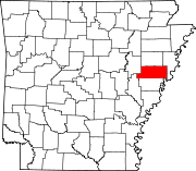 | |
| Towns | ||
| CDP | ||
| Other unincorporated communities | ||
| Footnotes | ‡This populated place also has portions in an adjacent county or counties | |
| ||


