Mexican Federal Highway 12
Highway in Mexico
 | ||||
|---|---|---|---|---|
| Carretera federal 12 | ||||
| Route information | ||||
| Maintained by Secretariat of Communications and Transportation | ||||
| Length | 68.00 km[1][better source needed] (42.25 mi) | |||
| Major junctions | ||||
| West end |  Fed. 1 at Parador Punta Prieta Fed. 1 at Parador Punta Prieta | |||
| East end | Bahía de los Ángeles | |||
| Location | ||||
| Country | Mexico | |||
| State | Baja California | |||
| Highway system | ||||
| ||||
| ||||


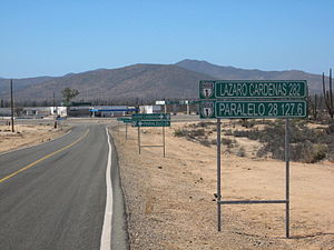
Federal Highway 12 (Spanish: Carretera Federal 12, Fed. 12) is a free part of the federal highways corridors (Spanish: los corredores carreteros federales) of Mexico.[2][better source needed] Fed. 12 is set from Fed. 1 in central Baja California to Bahía de los Ángeles and its total length is 68 km (42.25 mi).[3]
References
- ^ "Datos Viales de Baja California" (PDF) (in Spanish). Dirección General de Servicios Técnicos, Secretaría de Comunicaciones y Transportes. 2011. p. 6. Archived from the original (PDF) on 2012-03-16. Retrieved 2011-08-21.
- ^ "Mapa Nacional de Comunicaciones y Transportes" (PDF). Secretaría de Comunicaciones y Transportes de Mexico. Archived from the original (PDF) on January 26, 2009. Retrieved December 11, 2008.
- ^ "On the Road In (Mexico) - Distancias de Baja". Bell and Bell. Archived from the original on April 13, 2010. Retrieved June 30, 2010.
- v
- t
- e

- 1
- 2
- 3
- 5
- 8
- 9
- 10
- 11
- 12
- 14
- 15
- 16
- 17
- 19
- 22
- 23
- 24
- 25
- 29
- 30
- 34
- 35
- 36
- 37
- 39 (Legal only)
- 40
- 41
- 43
- 44
- 45
- 49
- 51
- 53
- 54
- 55
- 57
- 58
- 61
- 62
- 63
- 66 (Legal only)
- 68
- 69
- 70
- 71
- 72
- 74
- 76
- 80
- 81
- 83
- 84
- 85
- 87
- 90
- 93
- 95
- 97
- 98
- 101
- 102
- 103
- 105
- 106
- 107
- 110
- 111
- 113
- 114
- 115
- 117
- 119
- 120
- 121
- 123
- 125
- 126
- 127
- 129
- 130
- 131
- 132
- 134
- 135
- 136
- 138
- 140
- 142
- 144
- 145
- 147
- 150
- 160
- 162
- 166
- 172
- 175
- 176
- 178
- 179
- 180
- 182
- 184
- 185
- 186
- 187
- 188
- 190
- 193
- 195
- 196
- 198
- 199
- 200
- 203
- 211
- 221
- 225
- 259
- 261
- 281
- 293
- 295
- 305
- 307
  | This article about the roads and road transport of Mexico is a stub. You can help Wikipedia by expanding it. |
- v
- t
- e


