Matalai Rural LLG
Local-level government in Papua New Guinea
Place in New Ireland Province, Papua New Guinea
Matalai Rural LLG | |
|---|---|
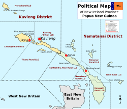 District map of New Ireland Province | |
| Country | Papua New Guinea |
| Province | New Ireland Province |
| Time zone | UTC+10 (AEST) |
Matalai Rural LLG was created from Wards 15–21 in the Namatanai Rural LLG and Wards 1-2 of Konoagil Rural LLG in the Namatanai district of New Ireland.[1][2] It is located in the South East Coast of New Ireland Province. It has a population of 12,393 as of the 2011 PNG National Census. The current LLG President is Augustine Topi. Languages spoken here are Sursurunga language, Tanglamet and Konomala language.
- Sursurunga at Ethnologue (18th ed., 2015)
References

 | This New Ireland Province geography article is a stub. You can help Wikipedia by expanding it. |
- v
- t
- e


