Müllrose
Town in Brandenburg, Germany

Coat of arms
Location of Müllrose within Oder-Spree district

(2019–24) Thomas Kühl[1]
(2022-12-31)[2]
15299
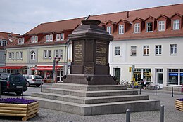
Müllrose (Lower Sorbian: Miłoraz) is a town in the Oder-Spree district, in Brandenburg, Germany. It is situated on the Oder-Spree Canal, 15 km southwest of Frankfurt (Oder). A part of the city is located in the Schlaube Valley Nature Park, named after the Schlaube, a 20 kilometres long river.
Overview
Müllrose is also situated at the northern bank of the Großer Müllroser See, a lake between Müllrose in the north and the municipality Mixdorf in the south. The lake covers an area of 1.32 km2 (0.51 sq mi). The watermill Müllrose was first mentioned in a document in 1275 and is still in use today.[3]
History
From 1815 to 1947, Müllrose was part of the Prussian Province of Brandenburg.
After World War II, Müllrose was incorporated into the State of Brandenburg from 1947 to 1952 and the Bezirk Frankfurt of East Germany from 1952 to 1990. Since 1990 Müllrose is again part of Brandenburg.
Demography

|
|
References
- ^ Landkreis Oder-Spree Wahl der Bürgermeisterin / des Bürgermeisters, accessed 2 July 2021.
- ^ "Bevölkerungsentwicklung und Bevölkerungsstandim Land Brandenburg Dezember 2022" (PDF). Amt für Statistik Berlin-Brandenburg (in German). June 2023.
- ^ Hermann Trebbin: Müllrose - Aus den Schicksalen und Kämpfen einer märkischen Landstadt. Nachdruck der Ausgabe von 1934. Hrsg.: Stadt Müllrose, Verlag Die Furt, Jacobsdorf 2003, ISBN 3-933416-45-0.
- ^ Detailed data sources are to be found in the Wikimedia Commons.Population Projection Brandenburg at Wikimedia Commons
External links
![]() Media related to Müllrose at Wikimedia Commons
Media related to Müllrose at Wikimedia Commons
- v
- t
- e
Towns and municipalities in Oder-Spree
- Bad Saarow
- Beeskow
- Berkenbrück
- Briesen
- Brieskow-Finkenheerd
- Diensdorf-Radlow
- Eisenhüttenstadt
- Erkner
- Friedland
- Fürstenwalde
- Gosen-Neu Zittau
- Groß Lindow
- Grünheide
- Grunow-Dammendorf
- Jacobsdorf
- Langewahl
- Lawitz
- Mixdorf
- Müllrose
- Neißemünde
- Neuzelle
- Ragow-Merz
- Rauen
- Reichenwalde
- Rietz-Neuendorf
- Schlaubetal
- Schöneiche
- Siehdichum
- Spreenhagen
- Steinhöfel
- Storkow
- Tauche
- Vogelsang
- Wendisch Rietz
- Wiesenau
- Woltersdorf
- Ziltendorf

Wikimedia Commons has media related to Müllrose.
Authority control databases | |
|---|---|
| International |
|
| National |
|
 | This Brandenburg location article is a stub. You can help Wikipedia by expanding it. |
- v
- t
- e


