List of crossings of the River Trent
This is a list of crossings of the River Trent, a major river flowing through the Midlands of England.
The table lists crossings that have been identified downstream from the River Sow confluence, the first major tributary on the river. Starting at Essex Bridge it includes ferries; road, rail, foot and pipe bridges found along the river to Trent Falls. Fords are only indicated where they predate a known crossing point. In Downstream (2008), author Tom Fort notes that over eighty historic crossings have been identified, most of which were fords or ferries.[1] In The River Trent (2005), author Richard Stone stated that "there are around seventy bridges across the Trent".[2] Each crossing has been marked with its river mileage with mile zero at Essex Bridge, reaching 140 miles (230 km) at Trent Falls.[3][4][5][6][7][8][9] Along the lower reaches, marker boards in kilometres show the distance from Nottingham.[8]
Map all coordinates using OpenStreetMap
Download coordinates as:
- KML
- GPX (all coordinates)
- GPX (primary coordinates)
- GPX (secondary coordinates)
Crossings
| River Miles (km) | Name | Image | From /To | County Coordinates | Carries | Date | Ford | Ferry | Bridge | Notes & refs |
|---|---|---|---|---|---|---|---|---|---|---|
| 0 (0) | Essex Bridge |  | Great Haywood Shugborough Hall | Staffordshire 52°48′03″N 2°00′31″W / 52.80070°N 2.00860°W / 52.80070; -2.00860 (Essex Bridge) | Bridleway | Ford | Packhorse | Grade I Scheduled monument possibly 16th century[10] | ||
| 1 (1.6) | Shugborough Viaduct |  | Shugborough Colwich | Staffordshire 52°47′15″N 2°00′10″W / 52.78758°N 2.00281°W / 52.78758; -2.00281 (Shugborough Viaduct) | Trent Valley line | Railway | [11][12] | |||
| 1.3 (2.1) | Weetman's Bridge |  | Little Haywood Cannock Chase | Staffordshire 52°47′04″N 1°59′45″W / 52.78449°N 1.99578°W / 52.78449; -1.99578 (Weetman's Bridge) | Meadow Lane | 1888 | Ford | Road | Replaced earlier wooden bridge built in 1830.[12] | |
| 2.3 (3.7) | Wolseley Bridge | 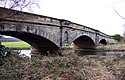 | Wolseley Colwich | Staffordshire 52°46′52″N 1°58′16″W / 52.781046°N 1.971018°W / 52.781046; -1.971018 (Wolseley Bridge) | A51 | 1799 | Road | Grade II[12] | ||
| 4.1 (6.6) | Rugeley Bypass bridge (north) |  | Rugeley Rugeley | Staffordshire 52°46′32″N 1°56′42″W / 52.7755°N 1.9451°W / 52.7755; -1.9451 (Rugeley Bypass bridge (north)) | A51 | 2007 | Road | Rugeley bypass.[13] | ||
| 4.3 (6.9) | Brindley Bank Aqueduct |  | Rugeley Rugeley | Staffordshire 52°46′25″N 1°56′35″W / 52.77350°N 1.94318°W / 52.77350; -1.94318 (Brindley Bank Aqueduct) | Trent and Mersey Canal | Canal Aqueduct | [12] | |||
| 5.2 (8.4) | Rugeley Bypass bridge (east) |  | Colton Rugeley | Staffordshire 52°46′03″N 1°55′54″W / 52.76760°N 1.93168°W / 52.76760; -1.93168 (Rugeley Bypass bridge (east)) | A51 | 2007 | Road | Rugeley bypass.[13] | ||
| 5.3 (8.5) | Colton Mill Bridge | 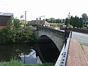 | Colton Rugeley | Staffordshire 52°46′04″N 1°55′46″W / 52.767778°N 1.929365°W / 52.767778; -1.929365 (Colton Mill Bridge) | Colton Rd | 1800s | Road | Grade II bridge.[12] | ||
| 5.8 (9.3) | Rugeley railway bridge |  | Colton Rugeley | Staffordshire 52°45′50″N 1°55′32″W / 52.76378°N 1.92556°W / 52.76378; -1.92556 (Rugeley railway bridge) | Chase Line | Railway | [12] | |||
| 7.2 (11.6) | Mavesyn Ridware railway bridge |  | Mavesyn Ridware Armitage | Staffordshire 52°45′02″N 1°53′36″W / 52.75062°N 1.89326°W / 52.75062; -1.89326 (Mavesyn Ridware railway bridge) | Trent Valley line | Railway | [12] | |||
| 7.7 (12.4) | Mavesyn Ridware footbridge | 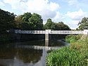 | Mavesyn Ridware Armitage | Staffordshire 52°44′48″N 1°53′06″W / 52.74668°N 1.88487°W / 52.74668; -1.88487 (Mavesyn Ridware footbridge) | Footpath | 1866 | Pedestrian | [14] | ||
| 8.5 (13.7) | High Bridge (new) |  | Mavesyn Ridware Armitage | Staffordshire 52°44′54″N 1°51′54″W / 52.74824°N 1.86513°W / 52.74824; -1.86513 (High Bridge (new)) | B5014 | Road | Modern span.[14] | |||
| 8.5 (13.7) | High Bridge | 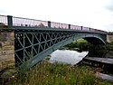 | Mavesyn Ridware Handsacre | Staffordshire 52°44′54″N 1°51′55″W / 52.7484°N 1.86516°W / 52.7484; -1.86516 (High Bridge) | Footpath | 1830 | Pedestrian | Grade II*, modern span adjacent.[14] | ||
| 9.2 (14.8) | Nethertown pipe bridge (north) |  | Nethertown Kings Bromley | Staffordshire 52°45′19″N 1°50′26″W / 52.755402°N 1.840655°W / 52.755402; -1.840655 (Nethertown pipe bridge (north)) | Pipeline | Pipe | [3] | |||
| 9.7 (15.6) | Nethertown footbridge |  | Nethertown Kings Bromley | Staffordshire 52°45′14″N 1°50′23″W / 52.75401°N 1.83968°W / 52.75401; -1.83968 (Nethertown footbridge) | Footpath | Pedestrian | [14] | |||
| 9.8 (15.8) | Nethertown pipe bridge (south) |  | Nethertown Kings Bromley | Staffordshire 52°45′14″N 1°50′21″W / 52.75376°N 1.83908°W / 52.75376; -1.83908 (Nethertown pipe bridge (south)) | Pipeline | Pipe | [3] | |||
| 11.2 (18.0) | Kings Bromley footbridge |  | Kings Bromley | Staffordshire 52°45′08″N 1°49′21″W / 52.752101°N 1.822489°W / 52.752101; -1.822489 (Kings Bromley footbridge) | Footpath | Pedestrian | [3] | |||
| 12.8 (20.6) | Yoxall Bridge |  | Yoxall Kings Bromley | Staffordshire 52°45′26″N 1°48′26″W / 52.757305°N 1.807311°W / 52.757305; -1.807311 (Yoxall Bridge) | Minor road | Road | Grade II, modern span adjacent.[14] | |||
| 12.8 (20.6) | Yoxall Bridge (new) |  | Yoxall Kings Bromley | Staffordshire 52°45′26″N 1°48′25″W / 52.75723°N 1.80703°W / 52.75723; -1.80703 (Yoxall Bridge (new)) | A515 | 1998 | Road | Modern span.[14] | ||
| 16.8 (27.0) | Cotton Close mill bridge |  | Alrewas | Staffordshire 52°44′11″N 1°45′10″W / 52.73627°N 1.75285°W / 52.73627; -1.75285 (Cotton Close mill bridge) | Access road | Road | Alrewas Mill.[3] | |||
| 16.9 (27.2) | Statfold Lane millstream bridge |  | Wychnor Alrewas | Staffordshire 52°44′06″N 1°45′02″W / 52.73500°N 1.75049°W / 52.73500; -1.75049 (Statfold Lane millstream) | Farm track | Road | Bailey bridge, built by Transco in 1969.[15] | |||
| 16.9 (27.2) | Statfold Lane river bridge | 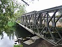 | Wychnor Alrewas | Staffordshire 52°44′14″N 1°45′02″W / 52.73727°N 1.75057°W / 52.73727; -1.75057 (Statfold Lane river) | Farm track | Road | Bailey bridge, also built by Transco in 1969.[15] | |||
| 17 (27) | Alrewas footbridge | 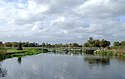 | Wychnor Alrewas | Staffordshire 52°44′16″N 1°44′49″W / 52.73771°N 1.74708°W / 52.73771; -1.74708 (Alrewas footbridge) | Towpath | Pedestrian | Trent and Mersey Canal towpath.[16] | |||
| 17.9 (28.8) | Wychnor Bridges |  | Wychnor Alrewas | Staffordshire 52°44′23″N 1°43′49″W / 52.73968°N 1.73019°W / 52.73968; -1.73019 (Wychnor Bridges) | A38 road | Ford | Road | Dual carriageway bridges replaced earlier bridges.[17] | ||
| 18.6 (29.9) | Catholme viaduct |  | Wychnor Alrewas | Staffordshire 52°44′06″N 1°43′13″W / 52.73495°N 1.72030°W / 52.73495; -1.72030 (Catholme viaduct) | South Staffordshire line | Railway | [17] | |||
| 18.7 (30.1) | Wichnor Viaduct |  | Wychnor Alrewas | Staffordshire 52°44′02″N 1°43′05″W / 52.7339°N 1.71818°W / 52.7339; -1.71818 (Wichnor Viaduct) | Cross Country Route | 1839 | Railway | [17] | ||
| 18.8 (30.3) | Mythaholme Bridge |  | Wychnor Alrewas | Staffordshire 52°44′01″N 1°43′04″W / 52.73363°N 1.71776°W / 52.73363; -1.71776 (Mythaholme Bridge) | Footpath | 2004 | Pedestrian | Near National Memorial Arboretum.[17] | ||
| 21.3 (34.3) | Walton Bridge |  | Barton Walton | Staffordshire Derbyshire 52°45′41″N 1°41′03″W / 52.7613°N 1.6843°W / 52.7613; -1.6843 (Walton Bridge) | Station Lane | 1974 | Ford | Ferry | Road | Bailey bridge.[18] |
| 24.7 (39.8) | Drakelow Viaduct |  | Branston Drakelow | Staffordshire Derbyshire 52°47′12″N 1°38′18″W / 52.78668°N 1.63835°W / 52.78668; -1.63835 (Drakelow Viaduct) | Leicester line | Railway | Leicester Line bridge.[19] | |||
| 25.5 (41.0) | Ferry Bridge | 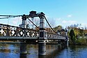 | Burton upon Trent Stapenhill | Staffordshire 52°47′40″N 1°37′34″W / 52.79457°N 1.626021°W / 52.79457; -1.626021 (Ferry Bridge) | Footpath | Ford | Ferry | Pedestrian | Grade II.[20] | |
| 25.6 (41.2) | St Peter's Bridge |  | Burton upon Trent Stapenhill | Staffordshire 52°47′44″N 1°37′29″W / 52.79546°N 1.62485°W / 52.79546; -1.62485 (St Peter's Bridge) | A5189 | 1985 | Road | [20] | ||
| 26.1 (42.0) | Andresey Bridge | 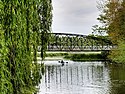 | Burton upon Trent Andressey Island | Staffordshire 52°48′08″N 1°37′37″W / 52.802111°N 1.627034°W / 52.802111; -1.627034 (Andresey Bridge) | Footpath | Pedestrian | Grade II bridge across Peel's Cut.[21] | |||
| 26.2 (42.2) | Cattle Bridge |  | Burton upon Trent Andressey Island | Staffordshire 52°48′09″N 1°37′31″W / 52.80259°N 1.62531°W / 52.80259; -1.62531 (Cattle Bridge) | Footpath | Pedestrian | Spans Peel's Cut.[22] | |||
| 26.5 (42.6) | Burton Bridge |  | Burton upon Trent Winshill | Staffordshire 52°48′24″N 1°37′23″W / 52.80661°N 1.62309°W / 52.80661; -1.62309 (Burton Bridge) | A511 | Road | Left Channel.[21] | |||
| 27 (43) | Wetmore footbridge (south) | Burton upon Trent | Staffordshire 52°48′37″N 1°37′27″W / 52.810289°N 1.624164°W / 52.810289; -1.624164 (Wetmore footbridge (south)) | Footpath | Pedestrian | Left Channel.[4] | ||||
| 27.3 (43.9) | Wetmore pipe bridge |  | Burton upon Trent | Staffordshire 52°48′51″N 1°37′24″W / 52.81411°N 1.62320°W / 52.81411; -1.62320 (Wetmore pipe bridge) | Pipeline | Pipe | Left Channel.[4] | |||
| 27.6 (44.4) | Wetmore footbridge (north) |  | Burton upon Trent | Staffordshire 52°49′02″N 1°37′18″W / 52.81716°N 1.62153°W / 52.81716; -1.62153 (Wetmore footbridge (north)) | Footpath | Pedestrian | Left Channel.[4] Accessible via Electric Street or Wetmore Lane. | |||
| 27.4 (44.1) | Burton Flour Mills bridge |  | Winshill | Staffordshire 52°48′49″N 1°36′41″W / 52.813498°N 1.611522°W / 52.813498; -1.611522 (Burton Flour Mills bridge) | Access road | Road | Millstream.[23] | |||
| 27.5 (44.3) | Winshill pipe bridge |  | Winshill | Staffordshire 52°48′57″N 1°36′37″W / 52.81581°N 1.61034°W / 52.81581; -1.61034 (Winshill pipe bridge) | Pipeline | Pipe | Right Channel.[4] | |||
| 30.4 (48.9) | Newton Solney pipe bridge |  | Egginton Newton Solney | Derbyshire 52°50′12″N 1°34′47″W / 52.83676°N 1.57961°W / 52.83676; -1.57961 (Newton Solney pipe bridge) | Pipeline | Pipe | Water pipeline.[24] | |||
| 31.9 (51.3) | Willington Bridge |  | Willington Repton | Derbyshire 52°50′53″N 1°33′41″W / 52.84794888°N 1.561398215°W / 52.84794888; -1.561398215 (Willington Bridge) | B5008 | 1839 | Ford | Ferry | Road | Previously ferry and ford.[24] |
| 34 (55) | Twyford Ferry |  | Twyford Milton | Derbyshire 52°51′09″N 1°31′00″W / 52.85257°N 1.51675°W / 52.85257; -1.51675 (Twyford Ferry) | Ford | Ferry | [24] | |||
| 38.5 (62.0) | Swarkestone Bridge |  | Swarkestone Stanton by Bridge | Derbyshire 52°51′10″N 1°27′13″W / 52.85288°N 1.45356°W / 52.85288; -1.45356 (Swarkestone Bridge) | A514 | Road | Grade I, Scheduled Monument, first mentioned in 1204.[25] | |||
| 40.2 (64.7) | Weston-on-Trent viaduct |  | Weston-on-Trent Kings Newton | Derbyshire 52°50′37″N 1°25′26″W / 52.843712°N 1.423869°W / 52.843712; -1.423869 (viaduct) | Cloud Trail | 1867 | Pedestrian | Previously a rail bridge.[26] | ||
| 40.5 (65.2) | Weston Cliff Ferry |  | Weston-on-Trent Kings Newton | Derbyshire 52°50′28″N 1°25′08″W / 52.8412°N 1.4188°W / 52.8412; -1.4188 (Weston Cliff Ferry) | Ferry | [27] | ||||
| 42.7 (68.7) | King's Mill Ferry |  | Weston-on-Trent King's Mill | Derbys Leics 52°50′40″N 1°22′58″W / 52.84455°N 1.38290°W / 52.84455; -1.38290 (Kings Mill Ferry) | Ford | Ferry | [28] | |||
| 43.6 (70.2) | Castle Donington railway viaduct |  | Weston-on-Trent Castle Donington | Derbys Leics 52°51′06″N 1°21′56″W / 52.85158°N 1.36553°W / 52.85158; -1.36553 (Castle Donington railway viaduct) | Castle Donington line | Railway | [5] | |||
| 45 (72) | A50 Trent Bridge |  | Shardlow Cavendish Bridge | Derbys Leics 52°51′40″N 1°20′52″W / 52.86101°N 1.34765°W / 52.86101; -1.34765 (A50 Trent Bridge) | A50 | 1997 | Road | [5] | ||
| 46.1 (74.2) | Cavendish Bridge | 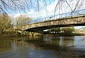 | Shardlow Cavendish Bridge | Derbys Leics 52°51′54″N 1°20′14″W / 52.86502°N 1.33722°W / 52.86502; -1.33722 (Cavendish Bridge) | B5010 | 1956 | Ford | Ferry | Road | Wilden Ferry.[26] |
| 47.3 (76.1) | Long Horse Bridge |  | Shardlow Hemington | Derbys Leics 52°52′16″N 1°19′09″W / 52.87114°N 1.31918°W / 52.87114; -1.31918 (Long Horse Bridge) | Towpath | 2011 | Pedestrian | [29] | ||
| 47.5 (76.4) | Sawley Aqueduct |  | Sawley Hemington | Derbys Leics 52°52′24″N 1°18′53″W / 52.87337°N 1.31464°W / 52.87337; -1.31464 (Sawley Aqueduct) | Derwent Valley Aqueduct | 1909 | Pipe | [29] | ||
| 47.7 (76.8) | M1 Trent viaduct |  | Sawley Hemington | Derbys Leics 52°52′24″N 1°18′33″W / 52.87342°N 1.30909°W / 52.87342; -1.30909 (M1 Trent viaduct) | M1 | 1967 | Road | [29] | ||
| 48.2 (77.6) | Harrington Bridge |  | Sawley Hemington | Derbys Leics 52°52′31″N 1°18′04″W / 52.8754°N 1.3012°W / 52.8754; -1.3012 (Harrington Bridge) | B6540 | 1790 | Ford | Ferry | Road | Grade II bridge, replaced Sawley Ferry.[30] |
| 48.6 (78.2) | Sawley railway viaduct | 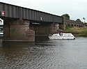 | Long Eaton Hemington | Derbys Leics 52°52′22″N 1°17′26″W / 52.87276°N 1.29065°W / 52.87276; -1.29065 (Sawley railway viaduct) | Castle Donington line | Railway | [30] | |||
| 49.4 (79.5) | Trent Lock Scout Ferry |  | Trent Lock Scout Activity Centre | Derbys Leics 52°52′32″N 1°16′31″W / 52.87557°N 1.27536°W / 52.87557; -1.27536 (Trent Lock Scout Ferry) | 1975 | Ferry | Scout Activity Centre ferry.[31] | |||
| 49.5 (79.7) | Trent Lock Ferry |  | Trent Lock Ratcliffe-on-Soar | Derbys Notts 52°52′30″N 1°16′16″W / 52.87489°N 1.27115°W / 52.87489; -1.27115 (Trent Lock Ferry) | Ferry | Horse and passenger ferry.[32] | ||||
| 49.8 (80.1) | Redhill Viaducts |  | Long Eaton Thrumpton | Derbys Notts 52°52′25″N 1°15′58″W / 52.8735°N 1.26617°W / 52.8735; -1.26617 (Redhill Viaduct) | Midland Main Line | 1893 | Railway | Trent Viaducts.[30] | ||
| 49.9 (80.3) | Thrumpton Ferry |  | Long Eaton Thrumpton | Derbys Notts 52°52′45″N 1°14′33″W / 52.87914°N 1.24255°W / 52.87914; -1.24255 (Thrumpton Ferry) | Ferry | [33] | ||||
| 52 (84) | Barton Ferry |  | Attenborough Barton in Fabis | Nottinghamshire 52°53′43″N 1°13′46″W / 52.89539°N 1.22949°W / 52.89539; -1.22949 (Barton Ferry) | Ferry | Operated until 1960s.[34] | ||||
| 56.5 (90.9) | Clifton Bridge |  | Nottingham Clifton | Nottinghamshire 52°55′30″N 1°09′57″W / 52.9251°N 1.1658°W / 52.9251; -1.1658 (Clifton Bridge) | A52 | 1958 | Road | [35] | ||
| 57.5 (92.5) | Wilford Toll Bridge |  | The Meadows Wilford | Nottinghamshire 52°56′16″N 1°09′17″W / 52.9377°N 1.1546°W / 52.9377; -1.1546 (Wilford Toll Bridge) | Nottingham Express Transit | 1870 | Ferry | Railway | Wilford Ferry.[36] | |
| 57.6 (92.7) | Great Central Railway Bridge | The Meadows Wilford | Nottinghamshire 52°56′13″N 1°09′08″W / 52.9370°N 1.15231°W / 52.9370; -1.15231 (Wilford Toll Bridge) | 1895 | Railway | Demolished in 1985. | ||||
| 58.3 (93.8) | Wilford Suspension Bridge |  | The Meadows West Bridgford | Nottinghamshire 52°56′00″N 1°08′21″W / 52.9332°N 1.1393°W / 52.9332; -1.1393 (Wilford Suspension Bridge) | Footpath | 1906 | Pedestrian | Footpath and pipelines[37] | ||
| 58.6 (94.3) | Trent Bridge, Nottingham |  | Nottingham West Bridgford | Nottinghamshire 52°56′17″N 1°08′10″W / 52.938°N 1.136°W / 52.938; -1.136 (Trent Bridge, Nottingham) | A60 | 1871 | Road | The current bridge is the last in a series of bridges at this important crossing point. A bridge was first mentioned in 924.[38] | ||
| 58.8 (94.6) | Navigation Bridge | 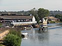 | Nottingham West Bridgford | Nottinghamshire 52°56′25″N 1°08′06″W / 52.9403°N 1.1350°W / 52.9403; -1.1350 (Navigation Bridge) | Towpath | Pedestrian | Former horse bridge - damaged by the 1875 flood and subsequently demolished.[39] | |||
| 58.9 (94.8) | Lady Bay Bridge | 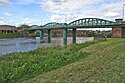 | Nottingham West Bridgford | Nottinghamshire 52°56′34″N 1°07′54″W / 52.94283°N 1.13162°W / 52.94283; -1.13162 (Lady Bay Bridge) | A6011 | 1878 | Road | Previously a rail bridge.[39] | ||
| 60.5 (97.4) | Holme Sluices |  | Colwick Holme Pierrepont | Nottinghamshire 52°56′53″N 1°05′17″W / 52.94793°N 1.08799°W / 52.94793; -1.08799 (Holme Sluices) | Access | 1952 | Sluices | Private bridge.[40] | ||
| 62.7 (100.9) | Rectory Junction Viaduct |  | Netherfield Radcliffe-on-Trent | Nottinghamshire 52°57′04″N 1°03′15″W / 52.95116°N 1.054154°W / 52.95116; -1.054154 (Rectory Junction Viaduct) | Nottingham–Grantham line | 1850 | Railway | Radcliffe Viaduct.[41] | ||
| 63.5 (102.2) | Radcliffe Ferry |  | Stoke Bardolph Radcliffe-on-Trent | Nottinghamshire 52°57′05″N 1°02′29″W / 52.95133°N 1.04139°W / 52.95133; -1.04139 (Radcliffe Ferry) | Ferry | [34] | ||||
| 64.2 (103.3) | Stoke Bardolph Ferry |  | Stoke Bardolph Shelford | Nottinghamshire 52°58′22″N 1°02′12″W / 52.97276°N 1.03664°W / 52.97276; -1.03664 (Stoke Bardolph Ferry) | Ferry | [34] | ||||
| 67.5 (108.6) | Gunthorpe Bridge |  | Gunthorpe East Bridgford | Nottinghamshire 52°59′10″N 0°59′15″W / 52.9862°N 0.9874°W / 52.9862; -0.9874 (Gunthorpe Bridge) | A6097 | 1925 | Ford | Ferry | Road | Earlier ford and ferry.[42] |
| 71 (114) | Hoveringham Ferry |  | Hoveringham Kneeton | Nottinghamshire 53°00′35″N 0°57′06″W / 53.00971°N 0.95174°W / 53.00971; -0.95174 (Hoveringham Ferry) | Ferry | [34] | ||||
| 73.2 (117.8) | Hazelford Ferry |  | Hazelford Ferry Elston | Nottinghamshire 53°01′57″N 0°55′03″W / 53.0324°N 0.9175°W / 53.0324; -0.9175 (Hazelford Ferry) | Ferry | [34] | ||||
| 75.5 (121.5) | Fiskerton Ferry |  | Fiskerton East Stoke | Nottinghamshire 53°03′05″N 0°54′05″W / 53.05152°N 0.90149°W / 53.05152; -0.90149 (Fiskerton Ferry) | Ferry | [34] | ||||
| 78.5 (126.3) | Farndon Ferry |  | Farndon Farndon | Nottinghamshire 53°03′40″N 0°51′22″W / 53.06114°N 0.85604°W / 53.06114; -0.85604 (Farndon Ferry) | Ferry | [43] | ||||
| 79.5 (127.9) | Averham Viaduct |  | Staythorpe Newark-on-Trent | Nottinghamshire 53°04′35″N 0°51′02″W / 53.07649°N 0.85048°W / 53.07649; -0.85048 (Averham Viaduct) | Nottingham–Lincoln line | Railway | Kelham Arm[43] | |||
| 80.9 (130.2) | Kelham Bridge |  | Kelham Newark-on-Trent | Nottinghamshire 53°05′33″N 0°50′34″W / 53.09244947°N 0.842654209°W / 53.09244947; -0.842654209 (Kelham Bridge) | A617 | 1857 | Road | Kelham Arm[44] | ||
| 82 (132) | Muskham Bridge |  | South Muskham Newark-on-Trent | Nottinghamshire 53°05′52″N 0°49′31″W / 53.09775°N 0.82521°W / 53.09775; -0.82521 (Muskham Bridge) | A616/Great North Road | 1922 | Road | Kelham Arm[45][46] | ||
| 82 (132) | Smeaton's Arches | 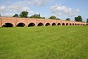 | South Muskham Newark-on-Trent | Nottinghamshire 53°05′24″N 0°49′15″W / 53.0901°N 0.82092°W / 53.0901; -0.82092 (Smeaton's Arches) | A616/Great North Road | 1772 | Road | Causeway links Muskham Bridge and Trent Bridge, Newark.[47] | ||
| 82.7 (133.1) | Muskham Viaduct |  | South Muskham Newark-on-Trent | Nottinghamshire 53°05′51″N 0°48′32″W / 53.0976°N 0.8088°W / 53.0976; -0.8088 (Muskham Viaduct) | East Coast Main Line | Railway | Kelham Arm[48] | |||
| 80.4 (129.4) | A46 Newark bypass, Farndon |  | Newark-on-Trent Farndon | Nottinghamshire 53°04′02″N 0°50′09″W / 53.06717°N 0.83584°W / 53.06717; -0.83584 (A46 Newark bypass, Farndon) | A46 road | 1992 | Road | [49] | ||
| 81.2 (130.7) | Longstone Bridge |  | Newark-on-Trent | Nottinghamshire 53°04′28″N 0°49′07″W / 53.07445°N 0.818642°W / 53.07445; -0.818642 (Longstone Bridge) | Towpath | 1819 | Pedestrian | [50] | ||
| 81.3 (130.8) | Mill Bridge |  | Newark-on-Trent | Nottinghamshire 53°04′29″N 0°49′02″W / 53.0748°N 0.81732°W / 53.0748; -0.81732 (Mill Bridge) | Mill Lane | 1952 | Road | [47] | ||
| 81.4 (131.0) | Backwater Bridge, Newark-on-Trent |  | Newark-on-Trent | Nottinghamshire 53°04′37″N 0°48′52″W / 53.07695°N 0.81458°W / 53.07695; -0.81458 (Backwater Bridge, Newark-on-Trent) | Towpath | 1952 | Pedestrian | [47] | ||
| 81.6 (131.3) | Trent Bridge, Newark |  | Newark-on-Trent | Nottinghamshire 53°04′43″N 0°48′46″W / 53.078544°N 0.812663°W / 53.078544; -0.812663 (Trent Bridge, Newark) | Great North Road | 1775 | Road | [47] | ||
| 81.8 (131.6) | Jubilee Bridge |  | Newark-on-Trent | Nottinghamshire 53°04′53″N 0°48′32″W / 53.08141°N 0.80876°W / 53.08141; -0.80876 (Jubilee Bridge) | Footpath | 2002 | Pedestrian | [47] | ||
| 82.2 (132.3) | Fiddler's Elbow Bridge |  | Newark-on-Trent | Nottinghamshire 53°05′14″N 0°48′17″W / 53.0872°N 0.804855°W / 53.0872; -0.804855 (Fiddler’s Elbow Bridge) | Towpath | 1915 | Pedestrian | [47] | ||
| 82.3 (132.4) | A46 Nether Lock Viaduct |  | Newark-on-Trent | Nottinghamshire 53°05′20″N 0°48′17″W / 53.089°N 0.80481°W / 53.089; -0.80481 (A46 Nether Lock Viaduct) | A46 road | 1992 | Road | [46] | ||
| 82.4 (132.6) | Midland Railway Viaduct |  | Newark-on-Trent | Nottinghamshire 53°05′20″N 0°48′22″W / 53.08902°N 0.80609°W / 53.08902; -0.80609 (Midland Railway Viaduct) | Nottingham–Lincoln line | 1846 | Railway | [46] | ||
| 82.6 (132.9) | Newark Dyke Bridge |  | North Muskham Newark-on-Trent | Nottinghamshire 53°05′34″N 0°48′22″W / 53.09279°N 0.80606°W / 53.09279; -0.80606 (Newark Dyke Bridge) | East Coast Main Line | 2000 | Railway | [46] | ||
| 83.1 (133.7) | Winthorpe Bridge |  | North Muskham Winthorpe | Nottinghamshire 53°06′06″N 0°47′55″W / 53.10164°N 0.7986°W / 53.10164; -0.7986 (Winthorpe Bridge) | A1 | 1964 | Road | Grade II listed.[46] | ||
| 86.2 (138.7) | Muskham Ferry |  | North Muskham Holme | Nottinghamshire 53°07′14″N 0°48′29″W / 53.12058°N 0.80803°W / 53.12058; -0.80803 (Muskham Ferry) | Ford | Ferry | Operated until the 1940s.[44] | |||
| 87 (140) | Cromwell Lock |  | Cromwell | Nottinghamshire 53°08′29″N 0°47′33″W / 53.14137°N 0.79248°W / 53.14137; -0.79248 (Cromwell Lock) | Tidal limit.[51] | |||||
| 90.6 (145.8) | Carlton on Trent Ferry |  | Carlton-on-Trent Collingham | Nottinghamshire 53°10′06″N 0°48′02″W / 53.16824°N 0.80068°W / 53.16824; -0.80068 (Carlton on Trent Ferry) | Ferry | [34] | ||||
| 92.6 (149.0) | Meering Ferry |  | Sutton-on-Trent Meering | Nottinghamshire 53°10′42″N 0°47′11″W / 53.17846°N 0.78626°W / 53.17846; -0.78626 (Meering Ferry) | Ferry | [2] | ||||
| 96.6 (155.5) | Marnham Ferry |  | High Marnham South Clifton | Nottinghamshire 53°13′27″N 0°46′59″W / 53.22416°N 0.78318°W / 53.22416; -0.78318 (Marnham Ferry) | Ferry | [34] | ||||
| 96.9 (155.9) | Fledborough Viaduct |  | Fledborough North Clifton | Nottinghamshire 53°14′07″N 0°46′44″W / 53.2353°N 0.77875°W / 53.2353; -0.77875 (Fledborough Viaduct) | Footpath | 1897 | Pedestrian | Former rail bridge.[52] | ||
| 97 (156) | Fledborough Ferry |  | Fledborough North Clifton | Nottinghamshire 53°14′28″N 0°46′41″W / 53.24108°N 0.77818°W / 53.24108; -0.77818 (Fledborough Ferry) | Ferry | [34] | ||||
| 99 (159) | Dunham Bridge |  | Dunham Newton on Trent | Nottinghamshire Lincolnshire 53°15′39″N 0°46′23″W / 53.2608°N 0.773°W / 53.2608; -0.773 (Dunham Bridge) | A57 | 1832 | Ferry | Road | Previously a ferry.[52] | |
| 99 (159) | Dunham pipe bridge |  | Dunham Newton on Trent | Nottinghamshire Lincolnshire 53°15′37″N 0°46′23″W / 53.2602°N 0.77312°W / 53.2602; -0.77312 (Dunham pipe bridge) | Pipeline | 1912 | Pipe | [52] | ||
| 101.4 (163.2) | Laneham Ferry |  | Laneham Laughterton | Nottinghamshire Lincolnshire 53°16′53″N 0°46′37″W / 53.2815°N 0.7770°W / 53.2815; -0.7770 (Laneham Ferry) | Ferry | Closed in 1922.[34] | ||||
| 103.6 (166.7) | Torksey Ferry |  | Rampton Torksey | Nottinghamshire Lincolnshire 53°18′00″N 0°44′56″W / 53.3000°N 0.7489°W / 53.3000; -0.7489 (Torksey Ferry) | Ferry | [53] | ||||
| 103.7 (166.9) | Torksey Viaduct |  | Cottam Torksey | Nottinghamshire Lincolnshire 53°18′11″N 0°44′53″W / 53.303°N 0.74819°W / 53.303; -0.74819 (Torksey Viaduct) | Footpath | 1849 | Railway | Grade II*, disused railway bridge.[54] | ||
| 107.3 (172.7) | Littleborough Ferry |  | Littleborough Marton | Nottinghamshire Lincolnshire 53°19′58″N 0°45′42″W / 53.33283°N 0.76156°W / 53.33283; -0.76156 (Littleborough Ferry) | Ford | Ferry | Probable Roman ford at Segelocum.[55] | |||
| 110.7 (178.2) | Bole Ferry |  | Bole Lea | Nottinghamshire Lincolnshire 53°22′08″N 0°47′26″W / 53.36887°N 0.79058°W / 53.36887; -0.79058 (Bole Ferry) | Ferry | [56] | ||||
| 112.2 (180.6) | Gainsborough Trent Junction railway bridge |  | Bole Gainsborough | Nottinghamshire Lincolnshire 53°23′02″N 0°47′04″W / 53.38387°N 0.78439°W / 53.38387; -0.78439 (Gainsborough Trent Junction railway bridge) | Railway | 1849 | Railway | Rebuilt with new spans in 1992.[57][8] | ||
| 113.5 (182.7) | Trent Bridge, Gainsborough |  | Beckingham Gainsborough | Nottinghamshire Lincolnshire 53°23′32″N 0°46′36″W / 53.3922°N 0.7766°W / 53.3922; -0.7766 (Trent Bridge, Gainsborough) | A631 | 1791 | Ferry | Road | Grade II, earlier ferry and ford.[56] | |
| 116.7 (187.8) | Walkerith Ferry |  | Walkeringham Walkerith | Nottinghamshire Lincolnshire 53°25′34″N 0°49′03″W / 53.4261°N 0.8175°W / 53.4261; -0.8175 (Walkerith Ferry) | Ferry | [58] | ||||
| 117.5 (189.1) | Stockwith Ferry |  | West Stockwith East Stockwith | Nottinghamshire Lincolnshire 53°26′34″N 0°48′48″W / 53.44267°N 0.81327°W / 53.44267; -0.81327 (Stockwith Ferry) | Ferry | Ceased around 1953.[59] | ||||
| 121.7 (195.9) | Owston Ferry |  | Owston Ferry East Ferry | Lincolnshire 53°29′25″N 0°46′30″W / 53.49020°N 0.77490°W / 53.49020; -0.77490 (Owston Ferry) | Ferry | Ceased around 1951.[34] | ||||
| 126.6 (203.7) | Butterwick Ferry |  | West Butterwick East Butterwick | Lincolnshire 53°32′27″N 0°44′24″W / 53.54087°N 0.73987°W / 53.54087; -0.73987 (Butterwick Ferry) | Ferry | [34] | ||||
| 127.1 (204.5) | M180 Trent Bridge |  | West Butterwick Burringham | Lincolnshire 53°33′25″N 0°44′46″W / 53.55686°N 0.74623°W / 53.55686; -0.74623 (M180 Trent Bridge) | M180 | 1979 | Road | [60] | ||
| 129 (208) | Althorpe Ferry |  | Althorpe Burringham | Lincolnshire 53°34′35″N 0°44′18″W / 53.57652°N 0.73820°W / 53.57652; -0.73820 (Althorpe Ferry) | Ferry | [34] | ||||
| 130 (210) | Keadby Bridge | 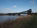 | Keadby Gunness | Lincolnshire 53°35′09″N 0°43′52″W / 53.5857°N 0.7311°W / 53.5857; -0.7311 (Keadby Bridge) | A18 South Humberside Main Line | 1916 | Road Railway | Grade II Bascule bridge King George V Bridge.[60] | ||
| 134.5 (216.5) | Amcotts Ferry |  | Amcotts Flixborough | Lincolnshire 53°37′04″N 0°42′06″W / 53.61768°N 0.70171°W / 53.61768; -0.70171 (Amcotts Ferry) | Ferry | [61] | ||||
| 136.6 (219.8) | Garthorpe Ferry |  | Garthorpe Burton upon Stather | Lincolnshire 53°39′23″N 0°41′41″W / 53.65637°N 0.69460°W / 53.65637; -0.69460 (Garthorpe Ferry) | Ferry | Also known as Burton Stather Ferry.[34] | ||||
| 140 (230) | Trent Falls | 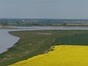 | Ousefleet Alkborough | 53°41′50″N 0°41′45″W / 53.6972°N 0.6957°W / 53.6972; -0.6957 (Trent Falls) | Mouth of the Trent.[62] |
Bibliography
- Fort, Tom (2008). Downstream. Century. ISBN 978-1-84605-169-2.
- Stone, Richard (2005). The River Trent. Phillimore. ISBN 978-1-86077-356-3.
- Taylor, Mike (2000). The River Trent Navigation. Tempus Publishing. ISBN 0-7524-1743-6.
References
- ^ Fort 2008, p. 124.
- ^ a b Stone 2005, p. 16.
- ^ a b c d e f "Great Heywood to Alrewas". iGreens. Archived from the original on 17 March 2015. Retrieved 7 January 2019.
- ^ a b c d e f "Alrewas to Kings Mills". iGreens. Archived from the original on 17 March 2015. Retrieved 7 January 2019.
- ^ a b c d "Kings Mills to Holme Lock". iGreens. Archived from the original on 17 March 2015. Retrieved 7 January 2019.
- ^ a b "Holme Lock to Cromwell Weir". iGreens. Archived from the original on 17 March 2015. Retrieved 7 January 2019.
- ^ a b Anon (1999). The Non Tidal Trent (Chart No.1) –The Trent Chart Series. Trent Boating Association.
- ^ a b c d Anon (1999). The Tidal Trent (Chart No.2) –The Trent Chart Series. Trent Boating Association.
- ^ Taylor 2000, p. 24.
- ^ Stone 2005, p. 58.
- ^ a b "Shugborough Viaduct". Attridge Scaffolding. Archived from the original on 8 January 2019. Retrieved 7 January 2019.
- ^ a b c d e f g Stone 2005, p. 59.
- ^ a b c "Relief Floods into bypass builders". Birmingham Live. Birmingham Mail. Retrieved 7 January 2019.
- ^ a b c d e f Stone 2005, p. 60.
- ^ a b c "Youths went a bridge too far". The Village Market. Staffordshire Live. August 2013. p. 10. Retrieved 7 January 2019.
- ^ Stone 2005, p. 61.
- ^ a b c d Stone 2005, p. 62.
- ^ Stone 2005, p. 63.
- ^ Stone 2005, p. 64.
- ^ a b Stone 2005, p. 65.
- ^ a b Stone 2005, p. 66.
- ^ a b "Burton's Cattle Bridge finally being repaired after seven-month closure". Staffordshire Live. Retrieved 7 January 2019.
- ^ Stone 2005, p. 67.
- ^ a b c Stone 2005, p. 69.
- ^ Stone 2005, p. 70.
- ^ a b Stone 2005, p. 73.
- ^ Stone 2005, p. 71.
- ^ Stone 2005, p. 72.
- ^ a b c Stone 2005, p. 74.
- ^ a b c Stone 2005, p. 75.
- ^ a b "History of Long Eaton Trent Lock Scout Activity Centre". trentlock.org. Trent Lock Scout Activity Centre, Long Eaton District Scouts. Archived from the original on 31 August 2018. Retrieved 7 January 2019.
- ^ Taylor 2000, p. 113.
- ^ Stone 2005, p. 77.
- ^ a b c d e f g h i j k l m n Stone 2005, p. 15.
- ^ Stone 2005, p. 79.
- ^ Stone 2005, p. 80.
- ^ Stone 2005, p. 82.
- ^ Stone 2005, p. 83.
- ^ a b Stone 2005, p. 85.
- ^ Stone 2005, p. 120.
- ^ Stone 2005, p. 87.
- ^ Stone 2005, p. 88.
- ^ a b Stone 2005, p. 92.
- ^ a b Stone 2005, p. 101.
- ^ a b "Nottinghamshire County Records: Notes and Extracts from the Nottinghamshire County Records of the 17th Century". Nottinghamshire History. Archived from the original on 10 January 2019. Retrieved 7 January 2019.
- ^ a b c d e Stone 2005, p. 99.
- ^ a b c d e f Stone 2005, p. 97.
- ^ Stone 2005.
- ^ Stone 2005, p. 93.
- ^ Stone 2005, p. 98.
- ^ Stone 2005, p. 103.
- ^ a b c Stone 2005, p. 104.
- ^ Stone 2005, p. 106.
- ^ Stone 2005, p. 107.
- ^ Stone 2005, p. 108.
- ^ a b Stone 2005, p. 109.
- ^ a b "Underbridge 213 Reconstruction - River Trent Railway Crossing, Gainsborough". Cass Hayward. Archived from the original on 19 December 2018. Retrieved 7 January 2019.
- ^ Stone 2005, p. 14.
- ^ Stone 2005, p. 113.
- ^ a b Stone 2005, p. 116.
- ^ a b "Amcotts". Axholme Info. Archived from the original on 13 September 2016. Retrieved 7 January 2019.
- ^ Stone 2005, p. 118.
External links
Wikimedia Commons has media related to Bridges across the River Trent.


