Lansing River Trail
Recreational trail in Michigan, United States
| Lansing River Trail | |
|---|---|
 Lansing River Trail near Kalamazoo St. and Cedar St. intersection. | |
| Length | 13 miles (21 km)[1] |
| Location | Lansing / East Lansing, Michigan, USA |
| Trailheads | MSU campus, Dietrich Park, North Lansing |
| Use | Hiking, Running, Biking, Roller skating |
| Difficulty | Easy |
| Season | Year Round |
| Sights | Grand River Red Cedar River |
| Hazards | Flooding, Overhead clearance |
| Website | Lansing River Trail |
Lansing River Trail is a multiple use trail approximately 13 miles (21 km) long.[1] It runs along the Grand River and the Red Cedar River between Michigan State University and Dietrich Park in northern Lansing. The first segment of trail opened in 1975.[2] It was designated a National Recreation Trail in 1981.[3]
The trail has a western extension that begins where it splits off at River Point park just south of downtown Lansing and ends in Moores Park. The River Trail South stretches along Sycamore Creek from Potter Park to Maguire Park in southeast Lansing. The stretch from Hawk Island County Park to Maguire Park was completed in 2008.
The River Trail is also home to a number of special events, including the Common Ground Music Festival, the Annual Mayor's Walk, Michigan Run, the Capital City River Run and a number of other city-sponsored activities.
The trail is currently being extended into Delhi Township to connect with an existing trail in Holt, as well as east to west across south Lansing.[4]
-
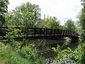 A pedestrian bridge of the Lansing River Trail at Riverpoint Park.
 -
 Lansing River Trail just south of the Kalamazoo Street Bridge in downtown Lansing.
 -
 River Trail near Kalamazoo Street.
 -
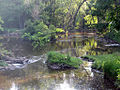 River Trail along Red Cedar River near Potter Park Zoo.
 -
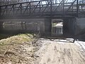 High waters along the Red Cedar render the trail impassable under Kalamazoo Rd.
 -
 River Trail in downtown Lansing with City Market in distance.


References
- ^ a b "Lansing River Trail". Retrieved May 11, 2009.
- ^ "History of the Lansing River Trail | Lansing River Trail". lansingrivertrail.org. Retrieved 2021-03-06.
- ^ "Lansing River Trail - NRT Database". www.nrtdatabase.org. Retrieved 2021-03-06.
- ^ Davis, Scott (26 March 2014). "2 new trails will 'transform' south Lansing, Delhi Twp". The Lansing State Journal. Retrieved 4 August 2014.
External links
- Lansing River Trail dot Org's Current Map - Up to date, clear and concise map.
- Map of the trail - Map of the Lansing River Trail with information about scenic spots along the trail.
- Heart of Michigan Trail - Lansing River Trail is a part of this bigger trail.
- OpenStreetMap - The Lansing River Trail on OpenStreetMap.
42°42′58″N 84°31′26″W / 42.71612°N 84.5239°W / 42.71612; -84.5239
- v
- t
- e
Hiking trails in Michigan
- Bay de Noc
- Boardman Lake
- Betsie Valley
- Dune Climb
- Fox River
- Greenstone Ridge
- High Country
- Horseshoe Bay
- Iron Belle
- Iron Ore Heritage Trail
- Jordan River
- Kal-Haven
- Kent
- Lake Superior
- Lakelands
- Lansing River
- Leelanau
- Manistee River Trail
- Marble Head
- Michigan Shore-to-Shore
- Musketawa
- North Country
- North Western State Trail
- Ogemaw Hills Pathway
- Paul Henry–Thornapple Rail
- Pere Marquette Rail
- Pere Marquette State
- Plaster Creek
- State Line
- TART
- Van Buren
- Waterloo-Pinckney
- White Pine

 | This Ingham County, Michigan location article is a stub. You can help Wikipedia by expanding it. |
- v
- t
- e
 | This United States trail or long-distance path–related article is a stub. You can help Wikipedia by expanding it. |
- v
- t
- e


